General Features
The region is characterized by long, straight and winding sandstone ridges that close back on themselves to form features such as Burke's Garden, a 3100 foot (945 m) high agricultural valley composed largely of Ordovician limestones. The major linear ridge, continuous Chestnut Ridge and Garden Mountain, consists of Undivided Silurian Formations according to Rader and Evans (1993). Where observed by us on the summit of Garden Mountain, sandstone was exposed, and it is likely that this rock dominates generally along the Ridge. Elevations range up to 4700 feet (1335 m) asl on adjacent Beartown Mountain.
Regional precipitation falls in the range of 1050 mm (40 inches) according to Hayden (1979), but local values in the vicinity of the higher elevations may be considerably more. The rather broad summit area of the Beartown Wilderness on Beartown Mountain, which has the highest elevations, is occupied by Red Spruce (Picea rubens) forest and northern hardwoods, and the latter also dominate some deep valleys such as that of Roaring Fork, which are subject to cold air drainage from the adjacent highlands. Great Rhododendron (Rhododendron maximum) is important at all elevations in these forests, indicating a general abundance of moisture. However, high, narrow-topped ridges surrounding the Wilderness area, such as Chestnut Ridge, have milder, dryer climates, although they range above 4000 feet (1200 m) asl. It is likely that cold air originating on these ridges, as a consequence of radiation cooling, is readily shed to the valleys below, as there is nothing to trap it at the higher elevations.
Source Walks: 7-19-94, 7-20-04 and 7-21-94
-
The Approach, 7-19-94
Our objective was to characterize the vegetation in the vicinity of the Federally-designated Beartown Wilderness, although access to the latter was greatly limited in the time available due to the severity of the terrain. Our approach to the general area was from the northwest on Forest Road 222, first descending into the deep valley of Laurel Creek. Here we noted rich mesic forests, with common Canada Hemlock (Tsuga canadensis), with little evidence of the Woolly Adelgid (Adelges tsugae), as well as abundant Great Rhododendron. Other species noted were Tuliptree (Liriodendron tulipifera), Black Birch (Betula lenta) and Yellow Buckeye (Aesculus octandra). Also seen was a fine large accipiter, likely a Cooper's Hawk (Accipiter cooperi), darting through among the trees.
We soon came to the junction with forest Road 631, and turning left on it, began our ascent of the mountain to near the Beartown Wilderness boundary. At near the local summit we encountered a "kelley hump" in the road, which stopped further progress, and here we established our camp at an elevation of a little over 3000 feet ( 315 m). Our night was spent listening to Whippoorwills (Caprimulus vociferus) and Barred Owls (Strix varia)
The forest here was rather xeric, developed on yellowish-red, silty- clay soils. Dominant trees were Black, Scarlet, Chestnut, Northern Red and White Oaks (Quercus velutina, Q. coccinea, Q. prinus, Q, rubra and Q. alba). Other canopy species were Red Maple (Acer rubrum), Pignut Hickory (Carya glabra and/or C. ovalis), Black Gum (Nyssa sylvatica), Black Cherry (Prunus serotina), Black Locust (Robinia pseudoacacia) and a few large Tuliptrees. Small trees and large shrubs noted were Sourwood (Oxydendrum arboreum), Flowering Dogwood (Cornus florida), American Chestnut (Castanea dentata) sprouts, Mountain Laurel (Kalmia latifolia) and a little Great Rhododendron. Also common were Deerberry (Vaccinium stamineum) and other blueberries, including likely Upland Low Blueberry (Vaccinium pallidum).
Among herbs, Wood Tickseed (Coreopsis major), blooming Indian Tobacco (Lobelia inflata) and trailing Arbutus (Epigaea repens) were common along the road. Also noted were Mountain Mint (Pycnanthemum montanum), and another similar, but unidentified mint, possibly Hoary Mountain Mint ( P. incanum ). Birds heard and/or seen during the day included American Robins (Turdus migratorius) and vireos, likely Red-eyed (Vireo olivaceus). Whippoorwills and Barred Owls were also heard again in the early morning.
7-20-94 Ascent of Chestnut Ridge.
-
We
planned to ascend the southwest end of Chestnut Ridge to the
Appalachian Trail and follow this along the Ridge to the shelter
overlooking Burke's Garden. The first leg lay along the road to the
Wilderness edge. The forest here consisted of the previously
mentioned five oaks, pignut hickory, Red Maple, Black Cherry, Black
Locust, Black Gum, with scattered Tuliptree and Cucumber Magnolia (Magnolia acuminata). There was also some Pitch Pine (Pinus
rigida). Sourwood, Flowering Dogwood, Serviceberry (likely
Amelanchier arborea) and American Chestnut sprouts formed an
understory, and Mountain Laurel, Deerberry and other blueberries
shrub layers. Herbs were Hay-scented fern (Dennstaedtia
punctilobula), Bracken Fern (Pteridium aquilinum ),
Whorled Loosestrife (Lysimachia quadrifolia), Wood Tickseed, Trailing Arbutus, Teaberry (Gaultheria procumbens), Wild
indigo (Baptisia tinctoria) and White Wood aster (Aster
divaricatus). We also flushed two Wild Turkeys (Meleagris
gallopavo), one a chick.
On the next leg we ascended from about 3100 feet to about 3690 feet (1125 m) asl., at the junction with the Appalachian Trail. Black, Scarlet and White Oaks remained common on this slope, but Chestnut Oak had begun to fade, and Northern Red Oak became more common, as did pignut hickory. There was also some Tuliptree and Cucumber Magnolia, as well as one apparently healthy Hemlock. We now encountered our first Striped Maple (Acer pensylvanicum ), although it is likely that this species occurs at lower elevations as well. Also seen at about mid-slope was an unidentified high-bush blueberry (Vaccinium sp) with dark berries, an unidentified serviceberry and Deerberry. Common in the ground cover were Galax (Galax aphylla), Pink Ladyslipper (Cypripedium acaule), Rattlesnake Plantain ( Goodyera pubescens), Spotted Wintergreen (Chimaphila maculata), Christmas Fern (Polystichum acrostichoides ) and White Wood Aster. Red Maple and Sassafras continued common, and a few small Sugar Maples ( Acer saccharum ) were seen. As in virtually ever Appalachian forest of this type, Four-leaved Yam (Dioscorea quaternata) appeared almost omnipresent.
Near the top of the leg, where the slope became less, conditions became more mesic, as is often the case, and White Ash (Fraxinus americana), May Apple (Podophyllum peltatum) and Black Cohosh (Cimicifuga racemosa) appeared. Basilbalm (Monarda clinopodia) with white blooms, and Dotted St. Johns-wort (Hypericum punctatum) also became common. Northern Red Oak increased again in frequency, and a grove consisting almost entirely of pignut hickory was encountered. Just southwest of the junction with the Appalachian Trail old fields begin, and there was much hawthorn (Crataegus sp) with dark green, glossy leaves. Black Cherry (frequently wind-broken), Black Locust, Sassafras and still scattered Tuliptrees. These fields, in addition to scattered trees, contained Timothy Grass (Phleum pratense), large patches of what appeared to be a blackberry (Rubus sp), an unidentified hazelnut (Corylus sp) and Bracken Fern. Unexpectedly, healthy looking, if rather stunted, Tuliptree occurred at 3700 feet here. However, Chestnut Oak, more characteristically, dropped out below this elevation.
As we continued climbing through the old fields, Northern Red Oak and White Ash became proportionately more common, but Tuliptree appeared to have dropped out. Red Maple remained relatively common.
The next leg began at about 4000 feet asl, where the Trail entered a forest of Northern Red and White Oaks, White Ash, Red Maple, Black Cherry and, for the first time, Yellow Birch (Betula alleghaniensis). An understory consisted of Mountain Maple (Acer spictum), an unidentified serviceberry (Amelanchier sp) , Wild Raisin (Viburnum cassinoides), unidentified high-bush blueberry (Vaccinium sp) and hawthorn (Crataegus sp), Great Rhododendron and, for the first time, Catawba Rhododendron (Rhododendron catawbiense). The Great Rhododendron was in bloom, but the Catawba Rhododendron was already forming seeds. In one place there was a small grove of American beech (Fagus grandifolia), with minor Sugar Maple. Also common were several species of unidentified berries (Rubus sp), Cinnamon Fern (Osmunda cinnamomea) and Witch Hazel (Hamamelis virginiana). Noted at 4200 feet (1280 m) were Black Birch and curiously, one Tuliptree, in the highest station for this species observed by this reporter in the Central Appalachians. Here also was one small American Mountain Ash (Sorbus americana), with seedlings of the same. Also present in the area were unidentified azaleas (deciduous rhododendrons), American Chestnut sprouts, Cucumber Magnolia, Mountain Holly, (Ilex montana), pignut hickory, Witch Hazel, Maleberry (Lyonia ligustrina), Southern Mountain Cranberry (Vaccinium erythrocarpum), Lady Fern (Athyrium filix-femina), Teaberry, Christmas Fern, Pale Jewelweed (Impatiens pallida), possible American Lovage (Ligusticum canadense ), Plume Lily (Smilacina racemosa), Fire pink (Silene virginica), Wild Geranium (Geranium maculatum), Common Speedwell (Veronica officinalis), Dotted St. Johns-wort, Canada Mayflower (Maianthemum canadense), Wild Sarsaparilla (Aralia nudicaulis), Indian Cucumber-root (Medeola virginiana) Galax, Mountain Aster (Aster acuminatus), Basilbalm, Four-leaved Yam and Wild lily-of-the-Valley (Convallaria montana). An unidentified luxuriant haircap moss (Polytrichum sp) formed an intergrowth with a number of the foregoing plants. In one place Mountain Aster, Canada Mayflower, Galax and an unidentified plant, possibly an orchid, formed an association under Beech. This plant had oval, glaberous leaves, dark green on top, grayish-green on the bottom, with some flat against the ground.. A Catbird (Dumetella carolinensis ) also called here.
It should be mentioned that many of the large oaks in this high elevation forest were found to be dead or dying, although no obvious causes, such as defoliation by insects such as the Gypsy Moth (Lymantria dispar) were evident.
From a number of viewpoints along Chestnut Ridge the dark spires of the Beartown Wilderness spruce forest are clearly distinguishable. Also, at the point of the Appalachian Trail shelter, virtually the entire Burkes Garden Valley was in view.
Roaring Fork
On 7-21-94 a traverse was made into the Beartown Wilderness, along the abandoned Forest Road 631, to Roaring Fork, which lay about a mile to the north. The traverse was essentially along the 3100 foot contour. The first part of the traverse was through xeric oak forest, as already described, and perhaps 50 years in age. Birds noted were Wild Turkeys, Scarlet Tanagers (Piranga olivacea) and unidentified vireos. Teaberry appeared unusually abundant and soon Shining Clubmoss (Lycopodium lucidulum) began to appear on the road bank with Galax. A large Chicken -of-the-Woods mushroom (Laetiporous sulphureous) had also been collected from this forest on the previous day.
This forest gradually became more mesic, Hay-scented Fern (Dennstaedtia punctilobula) appeared, with seedlings of Fraser Magnolia (Magnolia fraseri) and Northern Red Oak. The frequency of Tuliptree, many double-trunked, increased, as did Hemlock, and Striped Maple began to appear. However pignut was still common, as was Red Maple. Then Round-leaf Violet (Viola rotundifolia) with Christmas Fern became common on the shaded road bank. Large Northern Red Oak also became more common, Wild Sarsaparilla and a patch of Wild Lily-of-the-Valley were noted, and the first Mealy Bellwort (Uvularia perfoliata) was seen. The soil here appeared to be a red-brown silty loam, with a six-inch (15 cm) organic (mor) layer on top.
As we approached Roaring Fork, which here flowed over nearly flat-lying rock beds, Great Rhododendron and Hemlock became more abundant. The Hemlock here appeared unhealthy, but there was no clear sign of the Woolly Adelgid. Black and Yellow Birches, Northern Red Oak, Black Gum, Large Tuliptrees and Cucumber and Fraser Magnolias became more abundant. There were also some basswoods (likely American, or Tilia americana). Near the stream Yellow Birch assumed dominance. Shrubs, in addition to Great Rhododendron, included Mountain Holly, Hobblebush (Viburnum alnifolium) and Witch Hazel. Ground cover included Clearweed (Pilea pumila), an unidentified alum root (Heuchera sp ), Horse Balm ( Collinsonia canadensis), a trillium (likely Trillium erectum), Indian Cucumber-root, an unidentified agrimony (Agrimonia sp), White Wood Aster, Mountain Aster, violets, including Round-leaf Violet, an unidentified Meadowrue (Thalictrum sp) and a golden alexanders (likely Zizia aptera). An unidentified chantrelle ( Cantharellus sp) mushroom was also noted, and a Wood Thrush (Hylocichla mustelina) was heard singing. However, no fish were observed, although the stream is said to contain native Brook Trout (Salvelinus fontinalis).
The mesic environment, the northerly aspect and the low gradient of the valley at this point, all favor the occurrence of northern species such as Yellow Birch, Hobblebush and Mountain Aster at an elevation of little more than 3000 feet asl, compared to their apparent restriction to elevations considerably above 4000 feet on Chestnut Ridge.
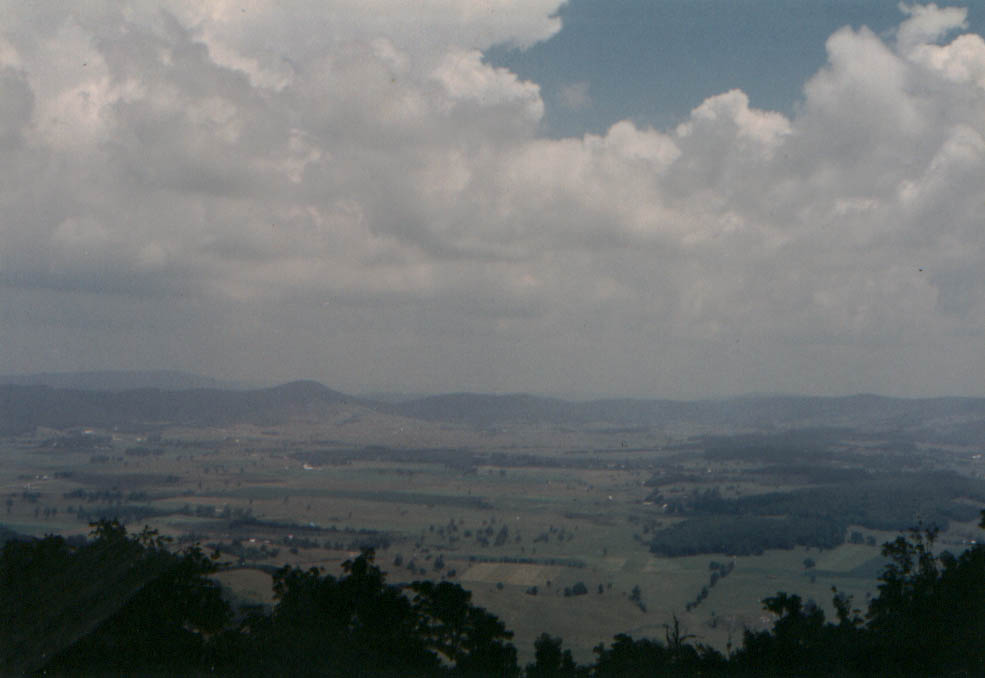
7-20-94: View of Burke's Garden from Chestnut Ridge.
Click to enlarge.
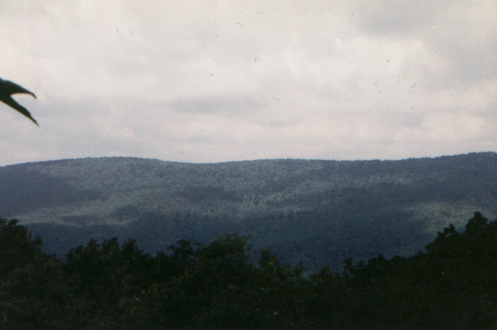
7-20-94: Chestnut Ridge, view of Beartown Wilderness.
Click to enlarge.
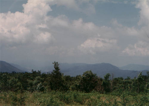
7-20-94: Chestnut Ridge. View Southwest, edge of Beartown Wilderness.
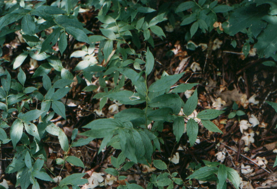
7-20-94: Chestnut Ridge, 4200 ft. asl. Southern Mountain Cranberry.
Click to enlarge.
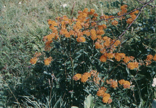
7-20-94: Chestnut Ridge, 3800 ft. asl. Asclepias tuberosa.
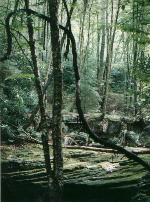
7-21-94: Yellow Birch along Roaring Fork, Beartown Wilderness. Note flat-bedded rock.
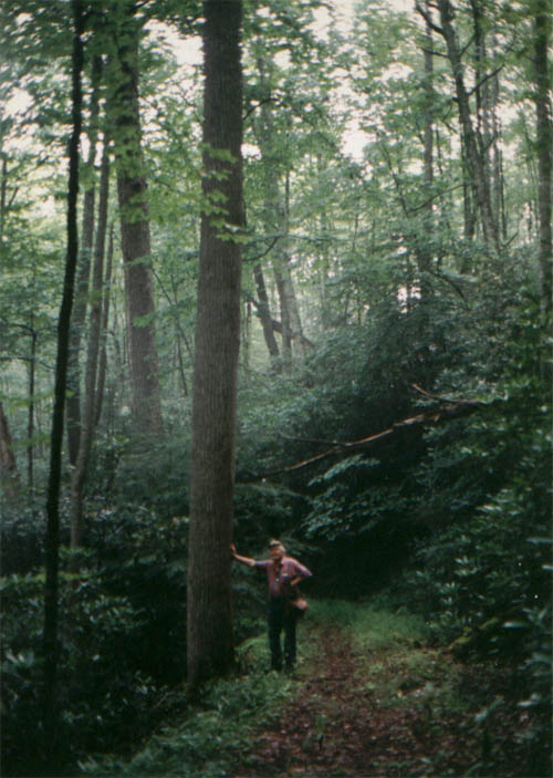
7-21-94: Trail to Roaring Fork, Beartown Wilderness.
Acknowledgements
The participation and assistance of Steve Krichbaum in these surveys is greatly appreciated.
References
Hayden, B. P. (1979) Atlas of Virginia Precipitation. Virginia University Press, Charlottesville, Virginia.
Rader, E. K. and N. H. Evans, editors (1993) Geologic Map of Virginia- expanded explanation. Virginia Div. of Mineral Resources, Charlottesville, Virginia.