Source Walk 8-4-95
The Elk Mountain/Gay Knob Area forms the southeast edge of the Allegheny Plateau and overlooks the Greenbrier Valley northwest of Marlinton, West Virginia. Attention here is directed to the more limited area lying between US Route 219 and the base of Gay Knob, specifically along Forest Road 202 of the Monongahela National Forest. Exposed rocks in this area, which lies between 3500 and 3900 ft (1070 and 1190 meters) elevation are part of the Bluefield Formation. Compositionally, this formation consists of "Red and green shale and sandstone with a few thin limestone beds" (Cardwell et al, 1968). Most of the area is rolling upland, with a few pronounced knobs rising higher. Gay Knob rises to 4545 ft (1385 meters) and is composed dominantly of Hinton Formation which is compositionally similar to the Bluefield. Aspect along most of the traverse, which extended somewhat over a mile along FR 202, is south, with the slope falling away to the Greenbrier Valley. From road cuts, where past erosion has not been too severe, soils appear deep, with the characteristically poorly-defined horizons and dark color of the mull type. Despite the high elevations the character of these soils and exposure to the sun and valley wind currents have resulted in a mesic forest quite different from those most typical of the high Alleghenies. This forest is also rather young, perhaps no more than 50 years in age, but its trees are tall and of good form, reflecting high site quality.
Near the road junction at the lowest elevations, the canopy consists of Sugar Maple (Acer saccharum), Beech (Fagus grandifolia), Shagbark Hickory (Carya ovata), Northern Red Oak (Quercus rubra), White Oak (Q. alba), Black Locust (Robinia pseudoacacia), Red Maple (Acer rubrum), Black Birch (Betula lenta), White Ash (Fraxinus americana), Black Cherry (Prunus serotina) and Cucumber Magnolia (Magnolia acuminata) roughly in order of abundance. Hawthorn (Crataegus sp) of undetermined species and abundant Hophornbeam (Ostrya virginiana) dominate the understory. A cursory examination of the herbs along the road and at the forest edge revealed very abundant Tall Bellflower (Campanula americana) and Wood Nettle (Laportea canadensis), less abundant but still common Horse-balm (Collinsonia canadensis), Starry Campion (Silene stellata), Blue Cohosh (Caulophyllum thalictroides), Mad-dog Skullcap (Scutellaria lateriflora), Wild Stonecrop (Sedum ternatum), Panicled Hawkweed (Hieracium paniculatum), Horse Gentian (Triosteum sp.), Wrinkle-leaf Goldenrod (Solidago rugosa) and American Spikenard (Aralia racemosa). However many other herbs were likely present but unidentified because of the season and limited time of observation.
Perhaps a quarter of a mile (400 meters) from the road junction, at an elevation of about 3600 ft (1100 meters), a spot inventory was conducted in the adjacent forest interior. The canopy here consists of Sugar Maple, Beech, Black Cherry, White Ash and Black Birch with large woody debris of American Chestnut (Castanea dentata) . The understory is dominated by Hophornbeam up to ten inches (25 cm) dbh, with smaller amounts of Striped Maple (Acer pensylvanicum ) and Witch Hazel (Hamamelis virginiana) . These species hold for at least one half acre (0.2 hectare) over which a quite exhaustive inventory of ground cover was also done. This was dominated by Sugar Maple seedlings with a few Bitternut Hickory (Carya cordiformis) as well. Associated herbs were Canada Mayflower (Maianthemum canadense), Wild Stonecrop, Curtis Goldenrod (Solidago curtisii), Blue Cohosh, Plume Lily (Smilacina racemosa), Sweet-scented Bedstraw (Galium triflorum ), Lance-leaf Wild Liquorice (G. lanecolatum ) , Wood Nettle, Tall Bellflower (in bloom as in the open), Indian Turnip (Arisćma triphyllum), Four-leaved Yam (Dioscorea quaternata), Gall-of-the-Earth (Prenanthes sp.), Round-leaf Violet (Viola rotundifolia), Wild Sarsaparilla ( Aralia nudicaulis) Crooked-stem Aster (Aster prenanthoides), Sessile-leaved Bellwort (Uvularia sessilifolia), the sedges Carex radiata and C. gracilescens and Beechdrops (Epifagus virginiana), the root parasite of Beech. This spot was also extraordinarily rich in ferns, with the following species observed: Southern Lady Fern (Athyrium filix -femina), Christmas Fern (Polystichum acrostichoides ), New York Fern (Thelypteris noveboracenis), Marginal Shield Fern (Dryopteris marginalis), Intermediate Shield Fern (D. intermedia), Interrupted Fern (Osmunda claytoniana) and Broad Beech Fern (Phegopteris hexagonoptera) . Present here also was a very lively Wood Frog (Rana sylvatica)
Despite the high elevation, species of wide distribution dominate, with only the presence of Canada Mayflower and Wild Sarsaparilla and the absence of certain southern species such as Tuliptree (Liriodendron tulipifera) are indicative of these elevations.
The close association here of Canada Mayflower, which normally reflects acid conditions, and species which usually occur under more alkaline conditions, raises an interesting question. Since Canada Mayflower is a boreal species that is apparently favored by both cool and acid environments, it should, by LeChâtelier’s Theorem, be able to grow under more alkaline conditions at the lower temperatures associated with high elevations. However, extensive studies would be required to confirm this.
The forest along the entire traverse of more than a mile (1.6 km) to the base of Gay Knob is of a similar character to that near the road, although there is a 400 ft (120 meter) increase in elevation. Additional canopy species noted, but which could have been present at the start, were American Basswood (Tilia americana) and Butternut (Juglans cinerea) . Also a few isolated leaves of White Basswood (T. heterophylla) that had fallen to the road were seen near the end of the traverse. However the tree from which they were blown was not seen. Additional species of shrubs and herbs tallied were Black Elderberry (Sambucus canadensis), Flowering Raspberry (Rubus odoratus), Basil Balm (Monarda clinopodia), Spotted Jewelweed (Impatiens capensis), Poke (Phytolacca americana), Virgin’s Bower (Clematis virginiana), Enchanters Nightshade (Circća quadrisulcata), Bottle-brush Grass (Hystrix patula) and Canada Bromegrass (Bromus purgans) . Many of the herbs noted at the start, such as Tall Bellflower, also maintained their abundance to the end of the traverse. Virtually all of both woody and herbaceous species observed, if not limited to, at least characterize mesic and even circumneutral conditions. This is in all likelihood a result of a carbonate component in the rock and soil.
While not abundant, and at this season largely silent, birds observed or heard were Eastern Phoebe (Sayornis phoebe), Scarlet Tanager (Piranga olivacea) and Raven (Corvus corax) . Fritillary Butterflies and other unidentified lepidoptera were also common.
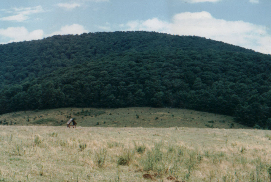
Gay Knob is somewhat unusual because, although it rises to 4545 ft (1385 meters) elevation, it appears covered by deciduous forest to the summit, at least on the southwest side, while mountains only a little higher to the west (see photos) are topped by spruce. Like the forest along FR 202, deciduous species on this knob are probably favored by both rock types, which may include substantial carbonate, and position at the plateau edge where there is maximum exposure to warm, moisture-bearing winds that sweep up the Greenbrier Valley. In any case, the entire area seems little subject to cold air drainage/accumulation since slopes are generally directed toward the Greenbrier Valley or north toward Pleasant Valley. Thus cooling would be confined to the effect of lapse rate. This provides an interesting contrast with the Tea Creek area and the Gaudineer Scenic Area, Although developed on similar bedrock, the former lies about 700 feet (214 meters) lower on average, but is subject to cold air drainage/accumulation because it is in a deep river basin not accessible to south winds.The latter lies only a little higher, but has an acidic substrate of siliceous rock at least in part, and lies above a higher and more constricted part of the Greenbrier Valley. This results in both cases in mixed forest with a Red Spruce component as well as more boreal undergrowth and herb floras (see our sections on Tea Creek and the Gaudineer Scenic Area).
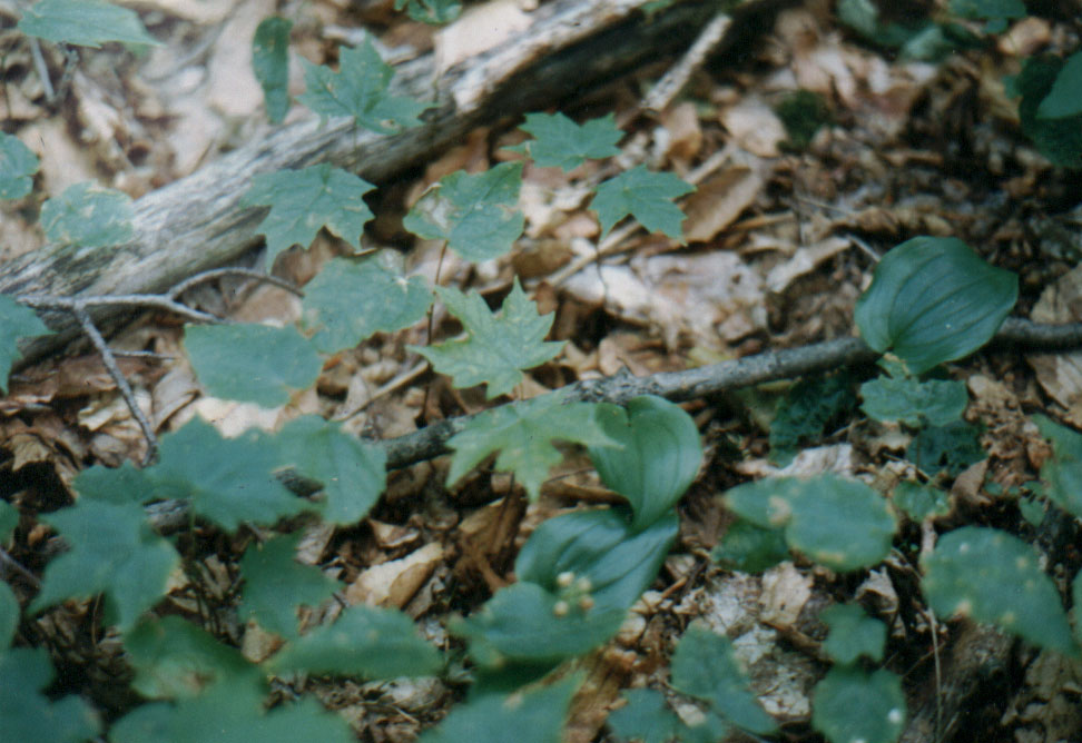
8-4-95: Elk Mtn to Gay Knob. Mesic forest floor at 3600 ft.
(Click to enlarge.)
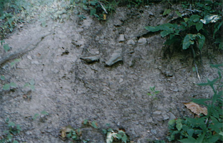
8-4-95: Elk Mtn to Gay Knob. Mull soil profile along FR 202.
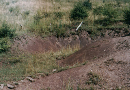
8-4-95: Elk Mtn to Gay Knob. Eroding sedimentary rock. U.S. Forest Service abuse.
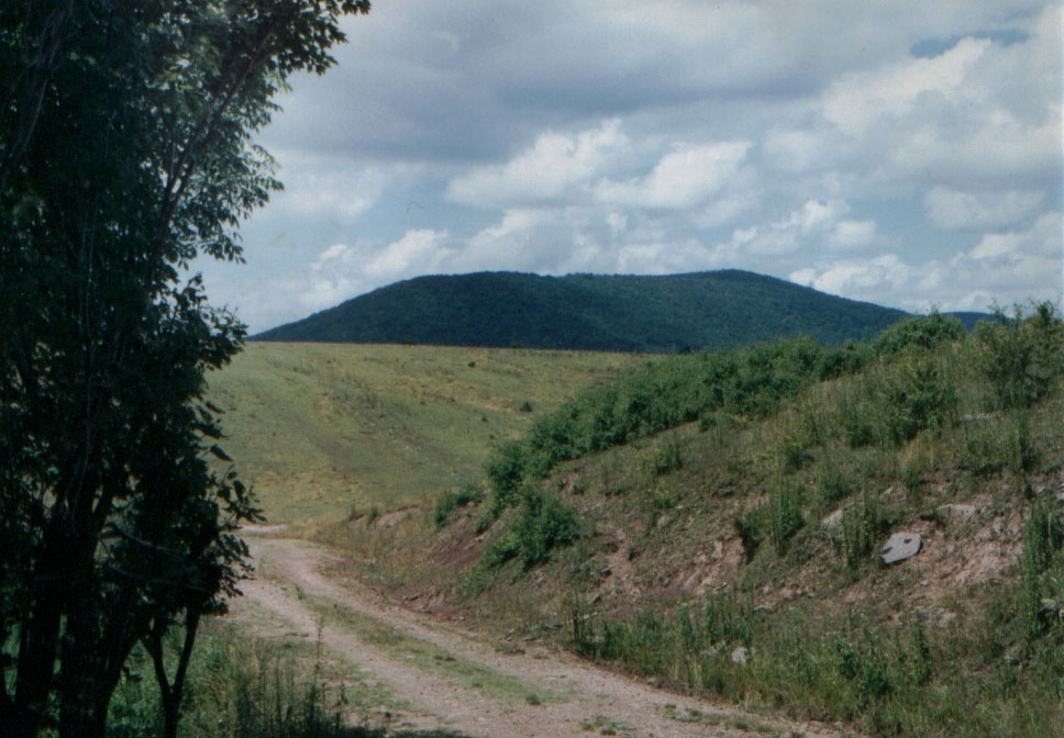
8-4-95: Gay Knob from the southwest.
(Click to enlarge.)
8-5-95: Elk Mtn to Gay Knob. View of mountain to the west. Note spruce on the summit.
(Click to enlarge.)
References
Cardwell, Dudley H., Robert B. Erwin, Herbert P. Woodward and Charles W. Lotz, compilers (1968) Geologic Map of West Virginia, slightly revised 1986. West Virginia Geologic and Economic Survey, Morgantown, West Virginia.