Back to Forests of the Central Appalachians |
Feedback
Folly Mills Watershed
Augusta County, Virginia
December 2003
Geologic Setting
The geology of the Folly Mills Watershed, a part
of the South Fork of the Shenandoah River Watershed, is dominated by
highly deformed and slightly metamorphosed rocks of Cambrian and
Ordovician ages. It is part of the Great Valley of Virginia and the
Ridge and Valley Geomorphic Province. Structural features generally
trend northeast-southwest and consist largely of erosion -
truncated folds but also include numerous faults. Rocks on the
southeast side of the upper Folly Mills mainstem are dominated by the
Cambrian Elbrook Formation dolomitic limestones and other carbonates,
whereas the northwest side consists of a variety of dolomites and
dolomitic limestones of the Ordovician Beekmantown and Chepultepec
Formations (Rader, 1967). A major structural feature here is the
Pulaski-Staunton Fault, whish extends for many miles in the Great
Valley. Associated with this fault are extensive breccias and
fracture zones in adjacent rocks. In addition to the magnesium-rich
carbonates, a highly characteristic member closely associated with
them is the siliceous rock chert. A prominent feature of this rock is
its shattered nature, presumably due to its proximity to the Pulaski
- Staunton Fault. One consequence is that no Native American
implements such as arrowheads could be fashioned from it even though
the fragments have been re-cemented with quartz. Such implements
found in the vicinity all consist of coarsely crystalline quartzite
from out of the area. Since this chert tends to be more resistant to
erosion and chemical dissolution than the carbonates, it forms the
tops of ridges and conical hills. Characteristic species and plant
and animal communities are associated with these contrasting rock
types, as well as the soils developed on them. Typically soils over
chert and even over much limestone terrain are acidic as a
consequence of vertical acid leaching by precipitation, Exceptions
are those immediately down-slope from dissolving limestone or on
limestone colluvial slopes.
The Folly Mills flood plain is the site of a rare
calcareous wetland (Hunsucker and Mueller, 1998) that, with the
associated flood plain, stream and oak-hickory ridge, constitutes a
State natural area preserve.. This wetland, fed by artesian springs,
and at an elevation of 1590 feet (480 m) asl, lies behind a natural
levee and forms an embayment in the oak-hickory ridge (Mueller's
Mountain) discussed below.
The floras of the Oak-Hickory Ridge Forest on
the northwest side of the Valley and the Mesic Slope Forest on the
southeast side present interesting and highly informative contrasts
with respect to their dependencies on elevation, aspect and
underlying soil and rock types. Elsewhere (Mueller, 2002, 2003)
treatments of their soil temperatures and general ecological
characteristics are also compared to those of a mesic valley forest
with boreal components at Ramsey's Draft in the nearby George
Washington National Forest. It will be seen that there are striking
relations between the occurrences of many species and substrate and
microclimate as expressed by pH, soil moisture and soil and water
temperatures, and that these relations bear on the fundamental
stability of the species and plant communities in which they occur..
Oak-Hickory Ridge Forest (Mueller's Mountain)
This small ridge that rises
about 120 feet (37 m) above the flood plain, is about one half mile
(0.8 km) in (somewhat arbitrary) length, and mostly trends
northeast-southwest. Several distinct forest types as well as
pasture land reverting to forest occupy the ridge. The ridge's
backbone, as exposed on its crest, consists of massive beds of
fractured chert, which also extends down both northwest and southeast
slopes as scattered outcrops and talus. This talus dominates the
forested part of the northwest slope, which has only minor outcrops
of magnesium limestone. In contrast,, the southeast slope is
dominated by calcareous colluvium and numerous magnesium limestone
outcrops. However, there are minor outcrops and substantial chert
talus on this slope as well. Reverting pastureland on the ridge's
southwest end bears few rock outcrops and appears to consist largely
of calcareous and leached residual soils. The northeast end of the
ridge turns to the east, presenting east and south aspects covered by
a mesic sapling forest of reverting pasture and, down-slope, an
open Black Walnut grove. This disposition of rock and soil types has
resulted in an ericaceous oak forest on the ridge crest and north and
northwest slopes and dry mesic calcareous forest on the southeast
slope. Where more abundant limestone outcrops occur on the southeast
slope, there is a Chinquapin Oak (Quercus muehlenbergii) -
White Ash (Fraxinus americana) variant of the calcareous
forest. The acid environment of most of the chert areas is enhanced
by vertical leaching. However, this leaching also occurs in
calcareous areas, and is even effective on outcrops of massive
limestone. Where colluvial processes dominate, as on the steep
southeast slopes, deeper soils establish contact with and incorporate
calcareous material, which is then brought to the shallow feeder root
zone by down-slope earth movements. Enhancing this effect is the
lateral movement and bathing of the root zone by subsurface
solutions that also originate in the calcareous depths. The result is
down-slope enrichment of soils.
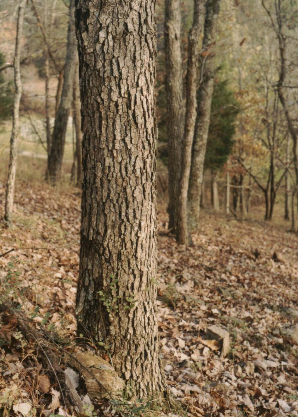
The closed canopy forest of the Ridge
is a mature remnant of recent logging (~ 30 years before the present), which took an older but probably still secondary component.
Consequently there is an un-equilibrated age distribution of trees,
although the mix of flora in general clearly reflects substrate and
aspect with fidelity. Few trees however exceed a foot (0.3 m) dbh
or 70 years in age.
The canopy of the ericaceous oak
forest of the Ridge top and north and northwest slopes is dominated
by White and Black Oaks (Quercus alba and Q. velutina), with less common pignut hickory (Carya glabra and/or
C. ovalis ), Mockernut Hickory (C. tomentosa ), Red
Maple (Acer rubrum) and Black Cherry (Prunus serotina). Minor canopy species are White Pine (Pinus strobus),
Virginia Pine (P. virginiana), Pitch Pine (P. rigida), Scarlet Oak (Quercus coccinia), Chestnut Oak (Q.
prinus) (1), Sassafras (Sassafras albidum), Tuliptree
(Liriodendron tulipifera) (1), Canada Hemlock (Tsuga
canadensis), Black Gum (Nyssa sylvatica) (1) and one
American Chestnut (Castanea dentata) sapling. Small and
understory trees are Downy Serviceberry ( Amelanchier arborea) and Flowering Dogwood (Cornus florida). Shrubs in the
most acidic, rocky areas include Upland Low Blueberry (Vaccinium
pallidum), Deer Berry (V. stamineum), Pinxter Azalea (
Rhododendron nudiforum), Black Huckleberry (Gaylussacia
baccata),, Corymbed Spiraea (Spiraea corymbosa) and
St.. Andrew's Cross (Hypericm hypericoides). Some Mountain
Laurel (Kalmia latifolia) may also have been present at one
time but was likely browsed away by goats. Shrubs that occur
throughout are Black Haw Viburnum (Viburnum prunifolium),
Maple-leaf Viburnum (V. acerifolium) and Carolina Rose (Rosa carolina). Virginia Creeper (Parthenocissus
quinquefolia), Poison Ivy (Rhus radicans), Summer
Grape (Vitis aestivalis) and Northern Dewberry (Rubus
flagellaris) are common vines, except in the most acidic areas.
A heavy leaf mat is everywhere present in this forest except around
some tree bases and on windswept ridge tops, and soils are mostly of
the mor type (Braun, 1950). Here, as in most areas of the
mountains, many Flowering Dogwood trees have been killed by
Anthracnose (Discula destructiva).
The status of Coral Berry (
Symphoricarpos orbiculatus), a somewhat calciphile shrub, in
acidic forest is unclear. While it apparently is excluded from the
interior of most acidic stands here, it may occur on their periphery
in soils with pH less than 5. However, it appears to be excluded
generally in the mountains where acid soils are of wide extent. It is
possible that this plant satisfies its stability requirements through
extended root contact with distant calcareous elements in soils.
Herbs most characteristic of the most
rocky and acidic areas are Spotted Wintergreen (Chimaphila
maculata) Pipsisewa (C. umbellata), Rattlesnake Weed (Hieracium venosum), Downy Rattlesnake Plantain (Goodyera
pubescens), Bluntlobe Hepatica (Hepatica americana) and Creeping Five-leaf (both Potentilla simple and P.
canadensis). Other species of wider distribution are Plantain -
leaf Pussytoes (Antennaria plantaginifolia), the alien
Mouse-ear Chickweed (Cerastrum viscosum), Alumroot (Heuchera americana), American Pennyroyal (Hedeoma
pulegioides) Common Speedwell (Veronica officinalis), Hairy Bedstraw (Galium pilosum), Great Chickweed (
Stellaria pubera), Hairy Hawkweed (Hiracium gronovii), White Wood Aster (Aster divaricatus), Wavy-leaf Aster
(A. undulatus), Curtis Goldenrod (Solidago curtisii), Cut-leaf Goldenrod (S. arguta ), Silverrod (S.
bicolor), Venus Looking Glass (Specularia perfoliata),
the tick-trefoil Desmodium nudiflorum, Four-leaf yam (Dioscorea quaternata), Rue Anemone (Anemonella
thalictroides), Hairy-jointed Meadowparsnip (Thaspium
barbinode), Yellow Star Grass (Hypoxis hirsuta), Spiked
Lobelia (Lobelia spicata var scaposa), Cutleaf
Grapefern (Botrychium dissectum), Marginal Shield Fern (Dryopteris marginalis), Indian Pipe (Monotropa uniflora), Pinesap (M. hypopithys ), Slender
Gerardia (Gerardia tenuifolia ), the sedges Carex
pensylvanica, C. wildenowii, C. digitalis and C. rosea
and the grasses Poverty Oat Grass (Danthonia spicata),
Nimblewill (Muhlenbergii schreberi) Autumn Bent Grass (Agrostis perennans), Nodding Fescue (Festuca obtusa )
and the alien Canada Bluegrass (Poa compressa).
Additionally, Early Saxifrage (Saxifraga virginiensis),
Common Many knees (Polygonatum biflorum) and unidentified
violets (Viola spp) are usually confined to tree bases. It
is also interesting that neither Pipsisewa, a north-ranging
species, nor Bluntlobe Hepatica ever occur on any south or southeast
slope, but are confined to the north and northwest slopes, although
Spotted Wintergreen is common on acid soils everywhere.
As might be expected, wherever
limestone outcrops occur in the dominantly ericaceous oak forest, the
area in proximity to them bears a richer, more mesic flora
characteristic of calcareous, more alkaline soils. In one place, in
the midst of an acidic area with numerous Red Maple seedlings, a
small limestone outcrop is surrounded by a meter-wide zone from
which all Red Maples are excluded, in a visual display of the
stability relations of this species.
Although the relatively dry character
of this forest does not favor bryophytes, certain species are
concentrated at tree bases and in windswept areas free of the heavy
leaf mat. Apparently the dry environment also prevents bryophytes
from ascending very high on tree trunks or to occur conspicuously on
down wood or rocks. Most apparent to the unaided eye is haircap moss,
likely Polytrichum ohioense from its macroscopic features (see below for confirmation). Other common species on soil are
Delicate Fern Moss (Thuidium delicatulum) and the false
haircap Atrichum angustatum, while Hedwigia
ciliata, as usual, is found on siliceous rock, in this case
chert, One or more species of Mnium also occur (see our later
list of mosses identified under the microscope).
In the most acidic parts of the
ericaceous oak forest pH values range from about 4.4 to 5.5, and
these values are regularly obtained in close proximity to Hepatica,
Downy Rattlesnake Plantain, Spotted Wintergreen, Pipsissewa,
Rattlesnake Weed, the blueberries, Black Huckleberry and Pinxter
Azalea. Among the lowest are those obtained from soil immediately
beneath Polytrichum mats. As we shall see in our tabulation,
obtained. pH values also are remarkably constant throughout the year
at any given site.
A large open area on the ridge crest
also has prevailingly acid soils. Common herbs there are Long -
leaved Bluets (Houstonia longifolia), Pinweed (Lechea
tenuifolia), Creeping Bush Clover (Lespedeza repens),
Whorled Milkwort (Polygala verticillata), Bird-foot
Violet (Viola pedata), Ovate-leaved Violet (Vola
fimbriata), Blue Curls (Trichostema dichotomum), Six -
week Fescue (Festuca octoflora ), Tarweed (Cuphea
petiolata), Indian Tobacco (Lobelia inflata) and
Poverty Oat Grass. Where small elevations with a substantial chert
component in the soil occur, there is dense intergrowth of mosses and
lichens as well as some of the aforementioned herbs. By far the most
common moss here is Dicranum scoparium and the most
conspicuous lichen a fruticose Cladina, possibly Cladina
subtenuis. Values of pH in these patches tend to be low, and
in the soil immediately beneath Dicranum is near 4.5.
At the southwestern edge of the ridge
forest there is a stand of Virginia Pine that is encroaching on
pasture although the interior of this stand has virtually no ground
flora, the better lit edge has a cover of Poverty Oat Grass and a
somewhat uncommon fruticose lichen Cetraria arenaria.
On the ridge, as in many areas
inventoried by us, there appears to be a correlation between the soil
pH and the abundance and diversity of fungi, with acid soils being
favored. Consequently mushrooms appear to be most abundant and in
greater variety in the ericaceous oak forest as compared to the
forest of the calcareous slope.
Although many of the canopy species of
the ericaceous oak forest are also to be found on the southeast
slope, additional species occur on the latter, particularly on
calcareous colluvium. Especially abundant on the colluvium are White
Ash (Fraxinus americana), Bitternut Hickory (Carya
cordiformis ), Black Walnut (Juglans nigra), Hackberry
(Celtis occidentalis) of stunted form, Slippery Elm (Ulmus
rubra), Northern Red Oak (Quercus rubrum) and
Chinquapin Oak (Quercus muehlenbergii). Of these Chinquapin
Oak is closely associated with limestone outcrops, and where these
are particularly abundant this oak and White Ash dominate the canopy.
Other minor canopy species are Red Mulberry (Morus rubra),
Post Oak (Quercus stellata), Persimmon (Diospyros
virginiana), Black Locust (Robinia pseudoacacia), Sycamore (Platanus occidentalis) (1), Sugar Maple (Acer
saccharum) (1) and Tuliptree (1). Red Maple and Scarlet Oak
occur in a few locations of higher acidity such as chert oucrops and
talus slopes. Virginia Juniper (Juniperus virginiana) is
scattered throughout; there are a few White Pine, and the alien Tree
of Heaven (Ailanthus altissima )occurs in open areas. As in
the ericaceous oak forest, Flowering Dogwood is a common understory
tree, but Downy Serviceberry is much less common, and Redbud (Cercis
canadensis) is an additional species here. Also, as previously
indicated, Hackberry is of stunted form and really forms the most
abundant understory in places. Other small trees and shrubs, mostly
at the edges of this forest, are Blackhaw Viburnum, Wild Plum (
Prunus americana), American Hazelnut (Corylus americana), Coral Berry, Black raspberry (Rubus occidentalis),
Allegheny Blackberry (R. allegheniensis) and Lance-leaved
Buckthorn (Rhamnus lanceolata) (1).
Japanese Honeysuckle (Lonicera
japonica) is the most common vine. Among natives, Hispid
Greenbrier (Smilax hispida), Virginia Creeper, Poison Ivy
and Winter Grape (Vitis vulpina) dominate., but Summer
Grape, Canada Moonseed (Menispermum canadense), Common
Greenbrier (Smilax rotundifolia ), Bittersweet (Celastrus
scandens ) and Northern Dewberry also occur.
Common herbs on the
calcareous slopes are Lopseed (Phryma leptostachya),
Honewort (Cryptotaenia canadensis), Starry Campion (
Silene stellata), Plume Lily (Smilacina racemosa),
Nodding Fescue, Rattlesnake Fern (Botrychium virginianum),
the tick-trefoils Desmodium glutinosum and D.
paniculatum, Bloodroot (Sanguinaria canadensis), Hispid
Buttercup (Ranunculus hispidus), Allegheny Crowfoot (R.
allegheniensis), Kidney-leaf Crowfoot (R. abortivus ),
Hooked Crowfoot ( R. recurvatus ), the alien Bulbous
Buttercup (R. bulbosa), Hog Peanut (Amphicarpa
bracteata), Thimbleweed (Anemone virginiana), Mealy
Bellwort (Uvularia perfoliata), Three-lobed Violet (
Viola triloba), Tall Agrimony (Agrimonia gryposepala), Black Cohosh (Cimicifuga racemosa), Smooth Sweet Cicely
(Osmorhiza longistylis), Wild Geranium (Geranium
maculatum), Wild Comfrey (Cynoglossum virginianum),
Pale Indian Plantain (Cacalia atriplicifolia), Pilewort (Erechtites hieracifolia), Wild Liquorice (Galium
circaezans), Cleavers (G. aperine), Sweet-scented
Bedstraw (G. triflorum), Virginia Knotweed (Polygonum
virginianum), Clearweed (Pilea pumila), Hairy Skullcap
(Scutellaria elliptica ), Wingstem (Verbesina
alternifolia), May Apple (Podophyllum peltatum),
Enchanter's Nightshade (Circaea quadrisulcata), Poverty Oat
Grass, Carex rosea, C. sparganoides, C. laxiflora, C.
cephalophora, Ebony Spleenwort (Asplenium platyneuran).
Dotted St. Johns Wort (Hypericum dentatum), Upright Yellow
Wood Sorrel (Oxalis stricta ), Adder's Tongue (Ophioglossum
vulgatum), Christmas Fern (Polystichum acrostichoides
), Common Many Knees, Stickweed (Hackelia virginiana
),Cranefly Orchid (Tipularia discolor), the panic grass
Paicum bosci and Ginseng (Panax quinquefolius). The
latter frequently exhibits leaflets with bleached edges, perhaps as a
consequence of air pollution. Of special interest is the occurrence
of Goldenseal (Hydrastis canadensis). The mode of the
latter's occurrence and associated species are discussed in our
section on Hydrastis canadensis L. Under moist conditions
Spotted Jewelweed (Impatiens capensis) seeds on the lower
slope just above the wetland where it always occurs. Additionally,
Wild Pink (Silene pensylvanica) is widely distributed in
sunny exposures-also on limestone outcrops-on the southeast
slope, as well as in ericaceous oak forest of the ridge crest, but
appears to be absent on the north and northwest slopes. Also
Yellow Stargrass and the tick-trefoil Desmodium rotundifolium,
species usually found in acidic terrain, were noted in the Chinquapin
- White Ash forest. Soil in close proximity to the former had pH=
5.8, hinting that acid leaching may enable these species to grow here
at the margins of their stability fields. A single clump of
Lady fern (Athyrium filix-femina) was observed in a chert
talus area of the southeast slope. The northeast end of the ridge,
which is occupied by the sapling forest was probably cleared several
times, based on the number of multiple sprout clumps. While it may
have served as a pasture of a sort, the present richness of the flora
seems to indicate survival of the original ground cover to a degree.
South and southeast aspects dominate and the slopes are gentle. A
number of limestone outcrops occur. The low canopy is dominated by
the four species of hickory as previously stated, with less common
Black and White Oaks, Black walnut, Slippery Elm and minor Chinquapin
Oak and Red Mulberry. Black Haw Viburnum is common and a single small
plant of Spice Bush (Lindera benzoin) was seen. Many of the
mesic herbs, which form a very dense ground cover, and which were
already listed for the calcareous slopes, occur here, but some
additions include the calciphile sedges Carex granularis and
C. frankii, Cutleaf Toothwort (Dentaria laciniata), Downy Wood Violet (Viola sororia), Tinker's weed (
Triosteum perfoliatum), Squaw Weed (Senecio
obovatus), Virginia Avens (Geum virginianum ),
Four-leaved Milkweed (Asclepias quadriflora),
Riparian Wild Rye (Elymus riparius), White Grass (Leersia
virginica) and the blue-eyed grass Sisyrinchium
angustifolium. The two sedges, which are common in the nearby
wetland (Hunsucker and Mueller, 1998), may be metastable here (
Mueller, 2000), since they could have been established in an
unusually wet year. Where this forest borders ericaceous oak forest
and at certain leached spots in the interior of the stand, one may
also find Spotted Wintergreen, Indian Pipe and Pinesap. Also,
locally, within the stand, are small, usually elevated areas on the
soil, subject to more intense leaching, and in these areas one may
find small patches of Polytrichum moss.
Down-slope from this
stand, where a pasture opening with scattered Black Walnut and
Hackberry is still reverting to forest, the following were noted:
Tree of Heaven, Oldfield Goldenrod (Solidago
nemoralis), Canada Goldenrod ( S. canadensis ), Wild
Bergamot (Monarda fistulosa ), abundant New York Ironweed,
Spanish Needles (Bidens bipinnata ), Cudweed (
Gnaphalium obtusifolium ), on limestone outcrops: Columbine (Aquilegia canadensis) and Purple Cliffbrake (Pellaea
atropurpurea ), Purpletop (Triodia flava), Kentucky
Bluegrass (Poa pratensis), Hairy Panic Grass (Panicum
lanuginosum), Few-flowered Panic Grass (P. oligosanthes
), Canada Bluegrass, Smooth Ground Cherry (Physalis
subglaberata ) and daisy Fleabane (Erigeron annuus).
The southwest end of the
Ridge consists mostly of gently southeast- sloping pasture that is
reverting to forest. The primary woody pioneer species here is Black
Cherry, but Virginia Pine, Pitch Pine, a single Table Mountain Pine (
Pinus pungens), Black Walnut, hawthorn, including
Cockspur Thorn (Crataegus crus-galli ) and Tree of Heaven
also occur. Black Haw Viburnum, Allegheny Blackberry, Black Raspberry
and Coral Berry are common shrubs, and there is some of the alien
Morrow's Honeysuckle (Lonicera morrowi). The most abundant
vine is Japanese Honeysuckle but Virgin's Bower (Clematis
virginiana )and Bittersweet are also common. Herbs include
Kentucky Bluegrass, abundant Bulbous Buttercup, Bracted Plantain (
Platago aristata), Wild Bergamot, Clearweed, Tall Agrimony.
White Vervain (Verbena urticifolia),, Bugleweed (Lycopus
virginicus), Horseweed (Erigeron canadensis, syn.
Conyza canadensis), the aliens (some in part) Indian
Strawberry (Duchesnea indica), Selfheal (Prunella
vulgaris), Field Basil (Satureja vulgaris ),
Calamint ( Satureja calamintha ), Ox-eye Daisy
(Chrysanthemum leucanthemum) and Moth Mullein (Verbascum
blattaria), Great Blue Lobelia (Lobelia siphilitica),
Wingstem and Poke (Phytolacca americana). A number of these
are characteristic of rich, moist soils, while others are typical of
dry calcareous soils. The acidity of soils in this reverting pasture
ranges widely, and, since slopes are gentle for the most part, these
soils are largely residual and thus have been subject to considerable
acid leaching. Measured pH values range from less than 5 under pine
to greater than 7 under such species as Cockspur Thorn.
A summary of the fauna of
this forest may be found in our section on Hydrastis
canadensis L.
Bryophytes and a few lichens
were collected by R. F. Mueller on the Ridge 4-21-03 to 4-23 -
03 inclusive and identified by R. Hunsucker. See also Crum and
Anderson (1981) and Hicks (1992).
The
following is a listing of habitat and habitat groups with their
observed bryophytes and lichens. Liverworts are distinguished by the
symbol (Li).
#1
magnesium limestone outcrop surface, open Black Walnut grove, east
end of Ridge, east aspect
Entodon seductrix, Anomodon attenuatus,
Anomodon minor
#2 base of
large Black Walnut sprout, mesic sapling forest, east end of Ridge,
east aspect
Anomodon attenuatus, Entodon cladorrhizans
#3 soil,
mesic sapling forest, east end of Ridge, up-slope from 2), east
aspect
Atrichum angustatum, Mnium cuspidatum
# 4 soil, mesic, sapling
forest, east end of Ridge, up-slope from 3), east aspect
Atrichum angustatum, Polytrichum ohioense
#5 tree
base, upper slope, mesic sapling forest, east aspect
Platygyrium
repens, Phaeophyscia rubropulchra (a lichen)
#6 soil,
ericaceous oak forest, north aspect
Dicranella
sp, Polytrichum ohioense, Rhynchostegium serrulatum, Atrichum
angustatum, Cladina sp (a lichen), Dicranella heteromalla,
Leucobryum albidum, Chiloscyphus profundus (= Lophocolea
heterophylla) (Li)
#7 soil,
ericaceous oak forest, northwest aspect
Rhynchostegium
serrulatum, Atrichum angustatum, Polytrichum ohioense
#8 soil
on limestone, northwest aspect, mesic inlier in ericaceous oak forest
Anomodon
attenuatus, Phaeophyscia rubropulchra (a lichen)
#9
cherty soil, crest of Ridge, xeric oak forest, flat aspect
Rhynchostegium serrulatum, Atrichum angustatum,
Polytrichum ohioense
# 10 chert and cherty soil,
crest of Ridge, xeric forest, flat aspect
Brachythecium oxycladon, Mnium cuspidatum, Dicranella
heteromalla, Dicranum scoparium, Thuidium delicatulum
#11 limestone, chert, tree
base, soil mesic slope vicinity of large Hydrastis patch,
southeast aspect
Thuidium delictulum,
Mnium cuspidatum, Atrichum angustatum, Dicranum scoparium
#12 chert gravel,
crest of Ridge, xeric oak forest
Brachythecium sp,
Mnium cuspidatum, Anomodon attenuatus, Anomodon rostratus,
Anomodon minor, Entodon seductrix
#13 soil, chert
gravel, on northwest slope
Thelia asprella,
Dicranella heteromalla, Dicranella
sp
#14 cherty soil,
summit of Ridge, flat aspect
Mnium cuspidatum,
Entodon cladorrhizans, Brachythecium oxycladon, Atrichum
angustatum, Thuididium delicatulum, Dicranum scoparium, Polytrichum
ohioense
# 15 steep
colluvial bank, soil over limestone, southeast aspect, shaded
Anomodon rostratus
# 16 low, semi -
colluvial bank, southeast aspect
Atrichum angustatum,
Anomodon attenuatus, Brachythecium oxycladon, Fissidens bryoides
The
frequencies of the bryophyte taxa in these 16 habitat groups are as
follows:
8 Atrichum angustatum
5 Anomodon attenuatus
5 Mnium cuspidatum
5 Polytrichum ohioense
5 Brachythecium oxycladon
3 Dicranella heteromala
3 Dicranum scoparium
3 Rhynchostegium serrulatum
3 Thuidium delicatulum
2 Anomodon minor
2 Anomodon rostratus
2 Dicranella sp
2 Entodon cladorrhizans
2 Entodon seductrix
1 Brachythecium sp
1 Chiloscyphus profundus (Li)
1 Fissidens bryoides
1 Leucobryum albidum
1 Platygyrium repens
1 Thelia asprella
It should be mentioned that during and
immediately after the prolonged cool rainy period, of the Spring of
2003, the bryophyte cover on the Oak-Hickory Ridge expanded
greatly.
At this point a few words are needed
regarding the precision and accuracy of pH determinations in what
follows. All determinations utilized a variety of papers (pHydrion
ULTRAFINE), which had the advantage of small samples, economy and
simplicity. In some papers precision can be as good as 0.2 pH units,
but agreement between several papers seldom approaches this. The
greatest precision is attained in the pH range below 5.0 and becomes
progressively less for some samples with increasing pH. It is also
sensitive to sample composition, with some samples yielding only of
the order a unit or less precision. These, when still usable, are
designated by the symbol ~. In some cases several papers may all
yield precise individual values, but disagree somewhat among
themselves. A subjective evaluation may then be made, based on
previous experience with these papers on various sample types, and
the "best" value is chosen. Or, in some cases, an average
value of several papers may seem warranted. Although pH
determinations of some samples may have only pH unit precision, they
may still be of great value. The reason for this is that the total pH
range in natural systems is greater than six units. Accuracy is more
difficult to define, but in its purest form would involve determining
the hydrogen ion activities as a function of concentration for the
samples involved rather than those used to calibrate the papers.
Adequate for our purposes is the recognition of the pH values
obtained as falling in ranges to be expected for the given
substrates, plant species and communities. The samples are prepared
at room temperature by adding water- usually rainwater-in a
quantity to make a wet slurry. The precise amount of water and,
within limits, its ionic content, are-as may easily be demonstrated
- unimportant, as the exchangeable ions in the sample are so much
greater in amount than those in the water. The pH is then determined
as soon as convenient. This initial determination is usually followed
by one or more later determinations, usually after the sample sets
for ~ 24 hours or longer. This allows as natural as possible
conditions to prevail, and in addition allows for slow reaction over
time to identify possible reactive particles. This routine avoids
possible errors inherent in certain standard laboratory procedures
that may involve excessive handling or particle size reduction for
certain samples. Also conventional laboratory procedures frequently
call for oven drying of samples, which may have unpredictable effects
and render these samples not directly comparable with ours.
Additionally, a number of sample sites were revisited several times
to determine possible seasonal effects. However, in most cases little
change was observed, which is in distinct contrast to the behavior of
moisture content.
The following are dated and annotated
proximity studies by R. F. Mueller of various plants and soils of the
Oak-Hickory Ridge Forest.
9-8-97, Soil sample MM-5 soil
from next to Spotted Wintergreen in chert talus, near the only
American Chestnut sapling-or other size- found on the Ridge, on
southeast slope a few meters elevation below the Ridge crest,. in
heavy leaf mat, dry sample. pH= 5.9.
9-9 -97, soil sample MM- 6, dry soil,
on surface close to trunk of Chinquapin Oak; pH~ 7.0; after a few
hours pH= 6.8; and twenty-four hours later pH= 7.2.
9-10-97, soil sample MM-7, soil,
collected after rain, just beneath Dicranum scoparium in
cherty clay soil at edge of opening on Ridge crest. pH= 4.5.
9 -11-97, soil sample MM- 8, soil,
collected from surface under only known Chestnut Oak on Ridge, on
northwest slope; soil is rich in yellow clay, with chert. pH~ 5.5,
but somewhat uncertain.
9-11-97, soil sample MM-9,soil,
from just under Polytrichum ohioense at Ridge crest; soil is
low density, dark, organic. pH= 4.5.
9-12-97, soil sample MM-10, soil,
from under Atrichum angustatum on lower trail bank, southeast
base of Ridge ; organic, with brown clay. pH= 4.7; next day pH=4.6.
9-12-97, soil sample MM-11, soil
from next to Spotted Wintergreen, just centimeters outside a patch of
Clearweed, southeast slope; highly organic, with chert fragments. pH=
5.6; next day pH = 5.3. (see also MM-21).
9-13-97, soil sample MM-12,
surface layer of organic soil within centimeters of a patch of Downy
Rattlesnake Plantain and Spotted Wintergreen on the north slope of
the Ridge in ericaceous oak forest. pH= 4.7; next day: pH= 4.5.
9-13-97, soil sample MM-13,
surface layer of clay/sand (?) soil at the base of a White Oak close
to Spotted Wintergreen, about 12 m up-slope from a Chinquapin Oak
on the southeast slope of the Ridge. pH= 4.7; the same next day.
9-14-97, soil sample MM-14,
surface layer of organic, mull-type soil 5 m closer to the
Chinquapin Oak than MM-13. pH~ 6-7; next day pH= 7.6.
9-14-97, soil sample MM- 15,
surface layer of organic mull-type soil at the base of the
Chinquapin Oak mentioned above pH~ 6-7. next day: pH= 7.6.
9-15-97, soil sample MM-16,
surface soil layer not far along contour from MM-13, very near
Spotted Wintergreen plant, about 0.3 m from a limestone
outcrop.pH~5.0; four hours later: pH= 5.5.
9-15-97, soil sample MM-17,
surface soil layer immediately adjacent to the limestone outcrop of
MM- 16.pH~ 5.8-6.0.
9-16-97, soil sample MM-18,
surface layer of soil within a few cm from Bluntlobe Hepatica on
northwest slope of the Ridge. pH= 5.5; hours later; pH= 6.4; next day
the same.
9-16-97, soil sample MM-19,
surface layer among Spotted Wintergreen and Coral Berry on Ridge
crest. pH=5.1; a few hours later: pH= 5.5; next day, the same.
9 -17-97, soil sample MM-20,
shallow, brown, sandy soil from beneath Polytrichum ohioense,
base of Black Oak, close to trunk, on NW side of Ridge. pH= 4.5; next
day pH= 4.6.
9-17-97, soil sample MM-21, dark
organic soil, from patch of Clearweed, SE slope, only a meter or less
from Spotted Wintergreen outside the patch (see MM- 11), pH= 6.2;
next day: pH= 6.7.
9-18-97, soil sample MM-22,
surface soil rich in undigested organic matter between two plants of
Spotted Wintergreen, on NW side of Ridge near summit, pH= 4.5;
contained pale tan, cm-long millipede.
9-18-97, soil sample MM- 23,
surface soil with some undigested organic matter, a few cm from
Bluntlobe Hepatica on NW side of the Ridge, down-slope from MM -
22, pH~ 5.5; contained small earthworm
9-22-97, soil sample MM-24, light
colored sandy, cherty, organic soil sample within a few cm from
Bluntlobe Hepatica NW side of Ridge; pH= 5.4.
9-22-97, soil sample MM-25, soil
much as MM- 24, within a few cm of Spotted Wintergreen and Potentilla
simplex at base of Ridge near wetland; pH= 5.1.
9-23-97, soil sample MM-26, very
close to Goldenseal (large patch), mid-slope, SE aspect; pH= 5.8;
next day: same.
9-23-97, soil sample MM-27, from
near the fern Woodsia obtusa, up-slope from MM-26; pH=
5.8.
9-24-97, soil sample MM-28,
surface soil, light colored, sandy, nearly free of herbs, between two
Spotted Wintergreen plants, north slope of Ridge in ericaceous oak
forest. pH= 4.5.
9-24-97, soil sample MM-29, dark,
organic surface soil from deep within the patch of Clearweed (see
MM- 21) on SE slope of Ridge; pH= 5.5; next day pH~ 6.5.
9-25-97, soil sample MM-30,
surface soil just down-slope from and at the base of the Chestnut
Oak on the NW slope of the Ridge (see MM-8). pH= 5.8.
9-25-97, soil sample MM-31,
surface soil at base of Chinquapin Oak a little above the large patch
of Goldenseal. pH= 6.4; same next day. This soil is darker than MM -
30.
9-30-97, soil sample MM-32,
surface oak leaf mor very near Rattlesnake Weed and Early Saxifrage
at crest of Ridge in very cherty soil. pH= 4.6; same next day.
9-30-97, soil sample MM-33.
surface soil under Chinquapin Oak, just above lower trail, SE slope.
pH= 6.0; next day pH~ 7.0; 36 hours later. pH~ 7.0.
10-1-97, soil sample MM-34, soil
below and including some needle duff under White Pine. pH= 4.5.
10-2-97, soil sample MM-35, soil
very near a plant of Downy Rattlesnake Plantain on NW middle slope.
Oak leaf mor covers a bleached sandy layer. pH= 4.6.
10-3-97, soil sample MM-36, soil
at base of Bluntlobe Hepatica on NW slope. pH= 5.9; next day pH=
5.1.
10-4-97, soil sample MM -
37, light colored sandy soil just beneath a rare patch of
Leucobryum, cushion moss. pH= 5.1.
10-4-97, soil sample MM-38, soil
very close to Bluntlobe Hepatica. pH= 5.1.
10-5-97, soil sample Mm-39, soil
from virtually the same location as MM-20, under Polytrichum
ohioense. pH= 4.5. (virtually unchanged !).
10-5-97, soil sample MM-40. soil
from same patch of Dicranum scoparium as MM-7. pH= 4.5. (
virtually unchanged !).
10-6-97, soil sample MM-41, soil
of oak leaf mor from beneath Bluntlobe Hepatica on NW slope of Ridge.
pH= 5.3.
10-6-97, soil sample MM-42, soil
from beneath the lichen Cetraria arenaria at edge of grove of
Virginia Pine at southwest end of Ridge forest. pH= 4.5.
10-8-97, soil sample MM-43, soil
of oak leaf mor between two plants of Pipsissewa on NW slope just
below Ridge crest. pH= 5.0.
10-8-97, soil sample MM-44,
shallow soil beneath Poverty Oat Grass in immediate vicinity of
Dicranum scoparium and other mosses at the base of a mature
Black Oak on the Ridge summit. pH= 4,7.
10-9-97, soil sample MM-45, dark,
organic, well- integrated moist clay loam under Senecio
obovatus near Black Raspberry; south slope of mesic sapling
forest, northeast end of Ridge. pH~ 6.3-6.8.
10-9-97, soil sample MM-46, light
colored, sandy soil at the base of a White Oak up-slope from MM -
45. pH= 5.6.
10-10-97, soil sample MM-47, soil
from beneath Polytrichum ohioense, north slope in ericaceous
oak forest. pH= 4.5.
10-10-97, soil sample MM-48, very
light-colored, sandy soil near stunted Bluntlobe Hepatica clump on
lower NW slope. pH= 5.5. This is more clay-rich soil than that of
MM-47.
10-11-97, soil sample MM-49,
soil, including oak leaf mor, near Leucobryum (likely L.
albidum) on NW slope of Ridge. pH= 4.6.
10-11-97, soil sample MM-50, soil
between plants of Bluntlobe Hepatica, Poverty Oat Grass and Dicranum
moss. pH= 5.3.
10-12-97, soil sample MM-51, very
light-colored sandy, cherty soil (gritty, little coherence when
wet) about 0.6 m from MM-50, near a tiny plant of Bluntlobe
Hepatica, associated with Dicranum and other mosses. pH= 5.0.
10-12-97, soil sample MM-52,
dark, organic soil under heavy leaf mat, very near a cluster of
Bluntlobe Hepatica,. This is organic soil, much darker than MM -
51.pH= 5.3.
10--13-97, soil sample MM-53,
soil, quite clay-rich on trail (woods road) edge of sapling
forest, NE end of Ridge, near Carex frankii. pH~ 5.5., hours
later: pH= 5.2; next day: pH= 5.1.
10-13-97, soil sample MM-54,
soil, with reddish cast, Woodchuck excavation, SE slope, in chert
talus area, at base of Scarlet Oak, with Spotted Wintergreen nearby;
much effervescence on adding water. pH= 5,5; hours later; pH= 5.5;
next day:, the same. This sample may represent a more alkaline deep -
seated layer than that equilibrated with the Scarlet Oak.
10-16-97, soil sample MM-55,
dark, organic mull (clay loam) soil from second- smaller- patch
of Goldenseal, SE slope of Ridge, SW along contour from large patch
pH~ 6.2; next day: pH= 7.0.
10-16-97, soil sample MM-56,
organic, mull-type soil from base of Chinquapin Oak on SE slope and
SW of MM-55. pH~ 6.2; next day: pH= 6.8.
10-19-97, soil sample MM-57,
dark, organic (mor) soil, under Dicranum on summit of Ridge;
pH= 4.8.
10-19-97, soil sample MM-58,
sandy (?) soil, under fine humus, beneath a very large (largest!),
spreading Scarlet Oak with a fire scar, on SW end of the Ridge
forest. pH= 4.5.
10-21-97, soil sample MM-60,
light colored silt loam. from NW slope, next to Bluntlobe Hepatica.
pH= 4.5.
10-21-97, soil sample MM-61,
organic (mor ?) above a light colored soil close to Spotted
Wintergreen and about 0.3 m from Bluntlobe Hepatica, NW slope of
Ridge. pH= 4.5.
10-22-97, soil sample MM-62, soil
at base of same Chestnut sapling as was MM-5. pH= 5.3;same next
day.
10-22-97, soil sample MM-63,
dark, mull-type soil from within large patch of Clearweed on SE
slope. pH= 6.4; hours later: pH = 7.0,; next day: pH= 7.0.
10-23-97, soil sample MM-64, dark
(mull, clay-rich ?; showed hard lumps after drying) soil, upper
SE slope, mesic sapling forest, NE end of Ridge. pH~ 6.2; hours
later: pH~ 6.2; next day:: pH= 6.2..
10-23-97, soil sample MM-65,
light-colored, cherty soil from base of a large Black Oak near the
highest point of the Ridge.. pH= 5.1.
10-25-97, soil sample MM-66,
dark, cherty (forms fairly firm lumps on drying) clay to silt loam
from beneath a Mnium cuspidatum- Atrichum angustatum moss
mixture on Ridge summit.. pH~ 5.5; hours later; pH= 5.5
10-25-97, soil sample MM-67,
dark, clay-rich soil (formed hard lumps when dry) from patch of
Clearweed, SW end of Ridge in back pasture, under small Black Cherry
pH~ 6.0; hours later pH~ 7.0; next day: pH ~ 7.0.
11-4-97, soil sample MM-68, dark
mull-type soil (clay loam ?) along trail (woods road) edge of
mesic sapling forest, NE end of Ridge, very near Spotted Wintergreen
in the vicinity of moss; pH= 5.3; next day; pH= 5.4,
11-5-97, soil sample MM-69, soil
a little lighter in color than MM-68, a little down-slope from MM
- 68, next to Potentilla simplex / canadensis; pH= 5.7; next
day, the same. Note* MM-45, MM-64, MM- 69 and MM-68 appear to
form a sequence along the trail here from less to more acidic soils.
11-6-97, soil sample MM-70, clay
- rich soil beneath Atrichum angustatum at the base of a
Pignut Hickory on Ridge crest. pH= 5.3; next day: the same.
12-9-97, soil sample MM-71,
brown, apparently clay-rich soil from 3inch (8 cm) depth beneath a
0.3 m dbh Pitch Pine in back pasture, SW end of Ridge. Associated
species were Virginia Juniper seedlings, Poverty Oat Grass, and a
hawkweed (Hieracium sp). There was a heavy layer of dead
needles and chert outcrops were in the near vicinity. pH= 4.6. next
day: the same.
12-10-97, MM-72, soil similar to
Mm-71, with chert fragments, from 8 cm depth,close to trunk of
another ~ 0.3 m dbh Pitch Pine located about 10 m from MM-71.
Virginia Juniper seedlings were present and there was a heavy layer
of dead needles. pH~ 6.0, next day: pH= 5.8.
12-12-97, soil sample MM-73, soil
sample from 10 cm depth, within 0.3 m of a 0.25 m dbh Black Walnut on
the Ridge crest. This is at the edge of acidic oak forest on chert.
The soil is dark brown mull type, apparently rich in clay, with chert
fragments, becoming lighter colored at depth. pH~ 5.2; next day, very
ambiguous results, with some values as low as pH = 4.5.
12-13-97, soil sample MM-74, soil
sample from 10 cm depth and within 0.3 m of a 0.25 m dbh Black Walnut
about 2 m down-slope from the site of MM-73 and in a direction
opposite to that of the acidic oak forest. This soil resembles that
of MM-73, but appears richer, pH~ 5.2; next day :pH~ 4.5
12-14-97, soil sample MM-75, soil
from same location as MM- 9; pH= 4.4, in excellent agreement
considering the time lapse!
12-15-97, soil sample MM-76, soil
from beneath Dicranum scoparium very near MM-7.. pH= 4.4,
again in excellent agreement.
12-17-97, soil sample MM-77,
upper 5 cm of mull-type soil at base of large Chinquapin Oak, SW
end of Ridge forest, at edge just above trail. pH~ 6.0; next day: pH=
7.0.
12-18-97, soil sample MM -78,
upper 5 cm, dark, organic mull-type soil from base of a 8 cm dbh
Black Walnut, a part of a cluster of this species, extreme SW corner
of property pH~ 5.5; next day: pH~ 5.5
12-21-97, soil sample MM-79,
upper 5 cm rich mull-type soil above limestone, at base of a
somewhat diseased Black Walnut on steep slope, a little NE of MM -
77. pH~ 5.5-6.0; next day: pH= 7.0.
3-30-98, soil sample MM- 80, silt
loam beneath Polytrichum ohioense in patch of the latter with
Early Saxifrage, under a Black Oak sapling in the mesic sapling
forest, south of the trail, NE end of the Ridge. pH~ 4.7; four hours
later: pH~ 4.7; next day: pH~ 4.8. Attention is also called to a
Chinquapin Oak sapling ~15 m distant.
3-30-98, soil sample MM-81,
organic soil near Senecio obovatus and Chinquapin Oak sapling
referred to in previous entry. pH~ 4.7; four hours later: pH~ 5.0 -
5.3; next day: pH~ 5.4.
4-1-98, soil sample MM-82, soil
from a depth of 8 to 10 cm at the same location as MM-81, directly
beneath Senecio obovatus. This was a clay loam, quite red in
color, verging on silt loam.. pH= 4.6; next day: pH~ 5.0-5.3.
4-2-98, soil sample MM-83. clay
loam from upper 5 cm among Senecio obovatus and less than 10
cm from a limestone outcrop. pH~ 5.0-5.3; next day: pH= 5.5.
4-3-98. soil sample MM-84, silt
loam soil very near the surface from between a plant of Spotted
Wintergreen and a patch of Polytrichum ohioense in the same
general area as MM-80 (but a different, down-slope moss patch) ;
pH~ 4.7 two days later: pH~ 5.0.
4-7-98, MM-85, soil from under
the same patch of Poltrichum ohioense as MM-9. pH= 4.5; the
same next day.
4-8-98, soil sample MM-86, soil
under Dicranum scoparium cushion near top of the Ridge, a
little west of MM-85.. pH= 4.7
7-27-99, soil sample MM-87, soil,
0-4 cm depth, rich in organic matter and clay (forms hard lumps on
drying), near small Red Maple seedling, just down-slope from the
large Goldenseal patch; on day collected (7-26-99), pH~ 5.5.;
next morning: pH> 6.0.
7-27-99., soil sample MM-88,
soil, organic, clay-rich., from same location as MM-87 but from 4
cm depth; pH> 6.0.
4-5-00, soil sample MM-121, This
sample was taken from what appeared to be the up-slope base of a 20
cm dbh Chinquapin Oak down-slope from the smaller (western) patch
of Goldenseal. It was from the top 5 cm, very close to a cluster of
Spotted Wintergreen and blooming Early Saxifrage under a heavy leaf
mat. pH= 4.5; 24 hours later, the same.
4-6-00, soil sample MM-122, soil
from same general location as MM-121: red, clay-rich soil, from a
depth of 8 cm, ~0.3 m down-slope from the Chinquapin Oak. pH= 4.5:
24 hours later, the same.
4-7-00, soil sample MM-123, red
clay-rich soil from 8 cm depth, ~10 m down-slope and ~ 3 m to
the NE from the Chinquapin Oak of MM-122. pH~ 6.6: 24 hours later:
pH= 7.2. Soils toward MM-122 seem lighter in color.
4-8-00, soil sample MM-124, soil,
clay-rich, red color, 5-8 cm depth, about 3 m down-slope from
MM-122. pH= 5.0; 24 hours later, the same.
Thus, at
first view, there appears to be a gradient from high to low acidity
represented by the sequence MM-122, MM-124, MM-123. Note also,
that while soils in the immediate vicinity of the Chinquapin Oak are
acid in character, and an apparent anomoly, at least at shallow
depths, the more alkaline soil of MM-123 is within easy reach of
this oak's root system, and thus could provide the required
conditions for stability of the species.
4-9-00, soil sample MM-125, clay
- rich, red soil from 8 cm depth at a location approximately half
way between the locations of MM-123 and MM-124. pH= 4.7. Note
that this value does not fit the gradient pattern outlined above,
indicating far more complex relations, perhaps involving three
dimensional effects related to limestone distributions below the
surface.
4-14-00, soil sample MM-126, 8
cm of soil with top 5 cm brown, organic matter overlying reddish clay
from E slope adjacent to the mesic sapling forest on NE end of the
Ridge. Specimen from very close to Cut-leaf Toothwort, associated
with saplings of Black Oak and Carya glabra, Black Haw
Viburnum and Japanese Honeysuckle. pH= 5.0: 17 hours later: pH= 5.5.
4-15-00, soil sample MM-127,
soil, from a depth of 5-8 cm, with some organic matter in upper
layer, yellow at about 8 cm depth, from SE slope at lower limit of
the crest "acid zone", immediately up-slope from a single
Spotted Wintergreen plant (~2 cm from it). This location is between
a large White Oak and an outcrop of limestone about 1.5 m along the
contour. Flags of limestone and fragments of chert litter the
surface. pH= 5.5: 24 hours later, the same.
4-16-00, soil sample MM-128,
soil, uniform dark, organic-rich material, apparently clay-rich
as well, from 5 cm depth, adjacent to the limestone outcrop referred
to on 4-15-00. pH= 7.0: 16 hours later: pH= 7.4. An earth worm
was found in the small volume of the sample.
4-17-00, soil sample MM-129, soil
from 5 cm depth, half way between MM-127 and Mm-128. This soil is
lighter in color, "heavier", and not as rich in organic
matter compared to MM-128, but clay rich. pH~ 6.8; 24 hours later:
pH~ 6.6.
4-18-00, soil sample MM-130, soil
from 5 cm depth, brown, low in organic matter, clay-rich, 0.3 m
down-slope from a 8 cm dbh Red Maple sapling. This sapling is
about 5 m down the SE slope from the Ridge crest trail., just above
the mesic slope forest. Associated plants are Black Haw Viburnum, May
Apple, Wild Geranium, Plume Lily, and Common Many Knees. pH= 5.0; 24
hours later: pH= 5.5.
4-19-00, soil sample MM-131,
soil, tan, clay-rich (sticky after several days rain), from 8 cm
depth at base of a Red Maple sapling from young growth with flat
aspect, near the NE corner of the crest orchard. Associated species
are Red Maple seedlings, Coral Berry, May Apple and Spotted
Wintergreen. pH= 4.6; 24 hours later, the same.
4-21-00, soil sample MM-132,
soil, from a depth of 5-8 cm, light tan, clay-rich, with little
apparent organic matter, but color darker than MM-131. It is within
centimeters of an 8 cm dbh Red Maple sapling along the contour
between the largest and second largest Goldenseal patches. Abundant
May Apple and other mesic herbs are associated.pH= 5.2; 24 hours
later: pH= 5.0.
4-22-00, soil sample MM-133,
soil, tan, clay-rich, immediately beneath Polytrichum ohioense
on north slope in ericaceous oak forest. pH= 5.3. 24 hours later: pH=
4.6.
4-27-00, soil sample MM-134,
soil, brown, rich in chert fragments, 5-8 cm depth, beneath a 3 cm
mor layer under a Red Maple, near a Black Oak with associated
Rattlesnake Weed, Red Maple seedlings and Upland Low Blueberry, on
the gentle SE slope below the highest point (summit) of the Ridge
and at the inner edge of a stand of Virginia Pine. pH= 4.6.
4-29-00, soil sample MM-135,
soil, 8 cm depth 0.9 m from the Red Maple of MM-131, close to a
Coral Berry bush and Spotted Wintergreen. Soil is similar to that of
MM-131. pH= 4.7; 24 hours later: the same..
4-30-00, soil sample MM-136,
soil, dark, organic, chert-rich, from 5 cm depth at base of the
lone American Chestnut sapling (see MM-5, MM-62,). pH= 5.4. 19
hours later: pH= 5.2.
5-1-00, soil sample MM- 137, soil,
8 cm depth, tan, clay-rich, ~ one m up-slope from the only
Chestnut Oak (see MM-8, MM-30), Thaspium barbinode is
present. pH= 5.0; 31 hours later: pH= 5.4. Did recent rains affect
these values?
5-2-00, soil sample MM-138, soil,
5-8 cm depth, dark, organic, within two m of the large Chinquapin
Oak near edge of meadow, SW end of Ridge forest, just above lower
trail (see MM-77). pH= 6.8; two days later: pH=8.5.It seems
likely that limestone in the closed system of the sample reacted over
time in this case.
5-5-00, soil sample MM-139, soil,
dark, organic, slight brownish-red cast, 5 cm depth, down-SE
slope from highest point of the Ridge and just down-slope from the
first large limestone outcrop: pH= 6.6;three days later: pH= 7.4.
5-9-00, soil sample MM-140, soil,
15 cm depth, bright, reddish mineral, little organic matter,, less
than 0.6 m from base of 13 cm dbh Chinquapin Oak, with associated
White Oak, Pignut, Red Maple seedlings and Wild Geranium, This
location is at the very edge of the opening on the flat top Ridge
crest. No rock outcrops are visible. pH= 4.6; 26 hours later; the
same. This apparent anomaly may have an explanation at depth as
concealed limestone in the vicinity.
5-11-00, soil sample MM-141,
soil, 8 cm depth, tan, clay-rich, cherty, ~ 3 m down-slope from
the only Chestnut Oak. pH= 4.6; 24 hours later: pH= 5.0.
5-16-00, soil sample MM-142,
soil, tan, little organic matter, likely clay -,rich, at 5 cm depth.,
~ 4 m up-slope from the only Chestnut Oak (see MM 137) very near
Thaspium barbinode, ). 3 m from blooming Hypoxis hirsuta
and Red Maple seedlings. pH= 4.4; two days later: pH= 4.5. The
apparent higher pH values at the very base of the Chestnut Oak may be
a consequence of nutrients washed from the trunk.
5-18-00, soil sample MM-143,
soil, 5-8 cm depth, brown, quite rich in organic matter, near base
of Cockspur Hawthorn in extreme SW end of the Ridge. pH ~ 4.9-5.3 (
very uncertain) ; 18 hours later :pH> 7.0 (still very uncertain
).
6-4-00, soil sample MM-144, soil,
5-8 cm depth, reddish-tan, clay-rich, from the interior of a
patch of luxuriant Coral Berry, adjacent to Wingstem and somewhat
unhealthy appearing Triosteum perfoliatum, ~20 meters down -
slope from MM-131. pH~ 5.8; 17 hours later: pH= 6.8. There is an
abrupt change here in the presence of Red Maple, which does not occur
in this patch, but is very abundant only a few meters up-slope,
where Coral Berry is sparse and stunted and other mesic species don't
occur.
6-5-00, soil sample MM-145, soil,
5-8 cm depth, reddish-tan, clay-rich (?), about 0.3 m from the
rich patch MM-144, taken from between two Red Maple seedlings about
3m from MM-144. pH= 5.0: 17 hours later: pH= 4.8.
6-6-00, soil sample MM-146, soil,
5-8 cm depth, reddish-tan, clay-rich (?), about a meter from MM
- 145, just within the rich patch in the direction of MM-144. pH=
5.3; 19 hours later, the same.
6-8-00, soil sample MM-147, soil,
5-8 cm depth, brown, some organic matter, clay-rich, about 8 cm
from a Wingstem plant, with associated Coral Berry, Circaea
quadrisulcata, and unidentified violets. The location is near the
Ridge crest in the mesic sapling forest, near trail. pH= 5.3; 19
hours later: the same
6-9-00, soil sample MM-148, soil,
5-8 cm depth, brown, some organic matter, clay-rich (?), from two
meters farther into the rich patch than MM-144. next to Triosteum
perfoliatum. pH= 6.3; 16 hours later: pH= 7.4.
6-25-00, soil sample MM-149,
soil, 5-8 cm depth, rich in organic matter, from among ~ 12
Ginseng (Panax quinquefolius ) plants, along
contour, SW of the second largest Goldenseal patch. pH= 7.2; 24 hours
later: pH ~ 6.3.
6-26-00, soil sample MM-150, soil
5-8 cm depth, rich in organic matter, near Ginseng, on chert
talus slope, SE slope, with abundant mesic herbs, but with Spotted
Wintergreen a little over a meter distant. pH= 6.6; 18 hours later:
pH= 8.0.
7-1-00, soil sample MM-151, soil
~ 5 cm depth, very rich in organic matter and chert fragments, from
talus slope 3 meters from MM-150 and in close proximity to Spotted
Wintergreen pH= 5.0 ; 24 hours later: pH= 5.3.
7-4-00, soil sample MM-152, soil,
5-8 cm depth, tan, clay-rich, very close to a Red Maple seedling
at the edge of a Red Maple exclusion zone around a ~ meter-wide
limestone outcrop near NE corner of orchard on the Ridge crest. pH=
5.3; 24 hours later: the same.
7-5-00, soil sample 153, soil, 5 -
8 cm depth, tan, clay-rich, 0.3 m from MM-152, into Red Maple
exclusion zone; pH= 5.0; 24 hours later: pH= 4.6.
7-6-00, soil sample MM-154, soil,
5-8 cm depth, tan, rich in chert, apparently clay-rich, 0.6 m
from MM-152, into the Red Maple exclusion zone, pH= 5.6; 25 hours
later: pH= 4.7.
7-7-00, soil sample MM-155, soil,
5-8 cm depth, brown, with organic matter, 0.9 m from MM-152, into
Red Maple exclusion zone and 8 cm from the limestone outcrop. pH-
6.4; 25 hours later: the same.
Note, that while the soil samples MM -
152 to MM-155 inclusive show an emphatic increase in pH across the
Red Maple exclusion zone toward the limestone outcrop, the relation
is neither systematic nor simple, perhaps as a consequence of a three
dimensional effect related to the depth of limestone in the exclusion
zone.
7-10-00, soil sample MM -156, soil,
5 cm depth, very hard, tan, with little organic matter, very near two
plants of Rattlesnake Weed, SE slope, above Chinquapin Oak- White
Ash forest, and a little below the Ridge crest. pH= 4.7: 24 hours
later: the same.
7-10-00, soil sample MM-157,
soil, 5 cm depth, very hard, forms hard lumps on drying (clay-rich), with much the appearance of MM-156, very near a plant of
Spotted Wintergreen, less than 0.3 m from MM-156 and between the
latter and a limestone outcrop. pH= 5.0; 24 hours later: the same.
7-10-00, soil sample MM-158,
soil, 5 cm depth, brown, softer than above, with some organic matter,
forms hard lumps on drying (clay-rich), less than 3 cm from
limestone outcrop; pH = 5.6; 24 hours later: he same.
The general location of the last three
samples, which illustrate a micro-gradient, appears to be at the
lower limit of the acidic slope, just below the Ridge crest. Acid
wash leaching from above may be effective here as well in the case of
MM-158.
7-17-00, soil sample MM-159,
soil, quite rich in organic matter, from a pit filling on top of the
limestone outcrop referred to under MM-157. This pit, perhaps less
than 10 cm deep, contained a plant of Spotted Wintergreen and a tiny,
thick-stemmed Red Maple "seedling". pH= 5.1; 24 hours
later; pH= 5.0. This appears to be a striking example of vertical
acid leaching-in this case favored by massive, and hence slowly
soluble limestone.
7-18-00, soil sample MM-160,
soil, deep reddish brown in color, apparently rich in organic matter,
5 cm depth, 8 cm from a plant of Hypoxis hirsuta near
limestone outcrops under Chinquapin Oak pH= 5.8; 18 hours later: the
same.
8-7-00, soil sample MM-161, soil,
5-8 cm depth, low in organic matter, lower north slope in
ericaceous oak forest, just above boundary fence, under large Black
Oak, with Red Maple sapling, Flowering Dogwood and Desmodium
nudiflorum. pH= 4.8; 24 hours later: pH= 4.9.
8-8-00, soil sample MM-162. soil,
5-8 cm depth, tan, some organic matter, in dense growth of
Desmodium nudiflorum, half way between MM-161 and a
limestone outcrop 6 meters up-slope. pH= 5.8; 24 hours later: pH=
5.1.
8-9-00, soil sample MM-163, soil,
5-8 cm depth, light tan, little organic matter, but with ~ mor
cover, half way between MM-162 and the limestone outcrop.
Associated plants are Desmodium nudiflorum, Summer Grape and
a Red Mulberry seedling (with etiolated leaves). pH= 4.5; 24 hours
later: the same. There is quite heavy acidiphile herb cover down -
slope toward MM-161.
8-10-00, soil sample MM-164, soil, 5-8 cm
depth, brown, with considerable organic matter, taken from just down
- slope from the limestone outcrop referred to above and ~ 3 m from
MM-163. pH= 6.3; 23 hours later: pH= 7.0. There is an abrupt change
here to a calciphile flora, including Slippery Elm, Black Raspberry,
Hispid Greenbrier, Wild Comfrey, Tall Agrimony and other mesic
herbs.
8-27-00, soil sample MM-165,
soil, 5-8 cm depth, tan, some organic matter, close beside Ridge
crest trail ~ 100 m NE of highest point (summit), very near a plant
of Desmodium glutinosum, with nearby D. nudiflorum as
well, under a Black Oak sapling, with associated Coral Berry,
Flowering Dogwood and Spotted Wintergreen. pH= 5.4: 26 hours later:
pH= 5.5. This may be near the lower pH limit of D. glutinosum.
10-13-00, soil sample MM-166,
soil,5-8 cm depth, reddish clay with little organic matter, from
edge of lower trail, 0.3 m from a 12 cm dbh Scarlet Oak and down -
slope from it. This appears to be a very sticky clay with little
organic matter. pH= 5.0; 24 hours later: pH= 4.7.
10-14-00, soil sample MM- 167,
soil. 5-8 cm depth, brown mull colluvium, on steep bank 0.6 m up -
slope from the Scarlet Oak in the previous entry. pH= 5.5; 24 hours
later; pH= 6.6. It appears that the Scarlet Oak grew in equilibrium
with the acidic clay of the trail-side, but is now in the process
of being encroached upon by the much more alkaline colluvium. It
would be of interest to follow the development of this tree, which
may suffer from this development.
Mesic Slope Forest (Pileated Peak)
Although this prominence has the
appearance of a peak, it is actually a short ridge oriented a little
south of due west, with the most elevated part perhaps 0.4 km in
length. The highest point, on the ridge's east end, is at an
elevation of about 1890 feet (576 meters) asl. Since the Valley
bottom lies at about 1590 feet (485 m) asl, this hill is about 300
feet (92 m) in height. Because of the configuration of the Valley
side, most of the slope is northwest, with a smaller portion, on the
highest part of the ridge, facing close to north. A feature of the
northwest slope, at about 1720 feet (525 m) asl, is the gently -
sloping " meadow", a clearing rapidly reverting to forest.
A conspicuous feature of the high, north-facing slope at an
elevation of about 1820 feet (555 m) asl and ~ 50 meters from the
east property boundary, is a small (~ 10 meter- wide) sinkhole,
which serves as a reference point. While this forest differs greatly
from the Oak-Hickory Ridge Forest, it also shows considerable
internal variation in response to soil type, elevation and aspect.
Much of the lower northwest slope consists of reverting clearings
dominated by Virginia and Pitch Pine and Juniper saplings, as well as
diverse shrubs, all on leached acidic soils over near-surface
limestone. The mature but secondary forest that lies above the
"meadow" is prevailingly mesic, with dry-mesic variants
on the summit and particularly on the west-facing slopes. The most
characteristically mesic forest occurs on the high north and
northerly slopes, where there are deep, mull type soils rich in
organic matter and the canopy and sub-canopy are at their densest.
These soils also have the lowest temperatures of any in this part of
the watershed, once the canopy foliage is developed in the spring.
While also mesic, the summit forests are dryer, and their soils, with
flat or westerly aspects, have soil temperatures up to several
degrees higher (Mueller, 2002, 2003).
The most common canopy species for the
ridge as a whole appear to be Black Northern Red and White Oaks, (some 0.5 m dbh or more), Bitternut Hickory, also large, and
generally smaller pignuts (Carya glabra and/or C. ovalis) and Red Maple, Somewhat less common are Tuliptree, White Ash,
Chestnut Oak, Scarlet Oak and basswood (Tilia americana and
T. heterophylla, as well as intermediates), Slippery Elm
and Black Walnut. Some of these are also large. Still less common are
Black Gum, Black Cherry, and Black Locust. Minor canopy species-but
not all of canopy size- include Sassafras, American Beech (Fagus
grandifolia), Butternut, Sugar Maple, Hackberry (Celtis
occidentalis), Mockernut Hickory, Sycamore, White Pine, Black
Birch, American Chestnut sprouts, Chinquapin Oak and Red Mulberry.
The last two were seen only as seedlings, and only one or two mature
Black Birch were seen. Beech is widespread in the more mesic forest,
but only as scattered saplings (up to 20 cm dbh) and seedlings.
Sugar Maple, only as saplings and seedlings, is even less frequent.
White Pine, as mature trees and abundant saplings and seedlings, is
confined to the ridge top, which also contains most of the Chestnut
Oak and Black Gum. Species such as Northern Red Oak, Bitternut
Hickory, Tuliptree, basswoods, White Ash, Slippery Elm and Black
Walnut are concentrated in the most mesic areas, such, in particular,
as the northerly slopes, although the last-named species is also
common on dryer slopes near the ridge top. There is a single small
sapling of the alien Norway Spruce (Picea abies) on the
upper north slope. The occurrence of Chestnut Oak is of special
interest. While, as Fowells (1965) pointed out earlier, this
species is usually associated with the most xeric ridge sites, it
frequently, as here, descends into rich mesic zones, in which the
soil pH may reach 6.0 or more, and is the chief data source for
diagramming this part of its stability field (Mueller, 2000).
Similarly, these data also add to the accumulating information about
the stability fields of such trees as Red Maple, Beech, Bitternut
Hickory and Black Walnut.
Small understory-type trees included
very common Redbud, Hophornbeam and Flowering Dogwood and far less
abundant Downy Serviceberry and Muscletree (Carpinus
caroliniana). The occurrence of the latter is confined to a
small cluster of mature trees in a moist concavity on the northwest
slope.
Among shrubs, Spicebush and Coral
Berry are by far the most abundant, not only on the mesic slopes, but
also in the reverting "meadow" and on much of the ridge
top. Also common, especially in the mesic and open areas, are
Allegheny Blackberry, Black Raspberry, Wineberry (Rubus
phoencolastus) and Black Haw Viburnum. Black Elderberry,
American Hazelnut, Upland Low Blueberry and Witch Hazel (Hamamelis
virginiana) are of minor importance.
Woody vines also reflect the mesic
environment. Perhaps most common and conspicuous was the high -
climbing Virginia Creeper, followed by Summer and Winter Grapes, with
the latter confined to the richest mesic areas. Also common were
Poison Ivy, Japanese Honeysuckle and Hispid Greenbrier, with the
latter seemingly an indicator of the least acidic soils. Less common
were Bittersweet and Canada Moonseed, with the latter also an
indicator of less acid soils. Common Greenbrier, usually abundant in
many Appalachian forests, appears to be of minor importance here.
This forest is rich in mesic herbs, a
number of which do not occur in the Oak-Hickory Ridge Forest. Among
the most common and widespread are Black Cohosh, May Apple, Mealy
Bellwort, Indian Turnip (Arisaema triphyllum ), Bloodroot
and Carex platyphylla. Pallid Jewelweed (Impatiens
pallida), Virginia Knotweed, Enchanter's Nightshade, Horse Balm
(Collinsonia canadensis ), Smooth Sweet Cicely, Clearweed,
Hog Peanut and Christmas Fern are abundant in mesic areas such as the
northerly slopes, but infrequent in dryer areas. Other species, some
common, some not, were White Wood Aster, Plume Lily, Tall Agrimony,
Common Many Knees, Sweet-scented Bedstraw, Rue Anemone, Rattlesnake
Fern, Four-leaved Yam, Wild Geranium, Cleavers (Galium aperine
), Smooth Yellow Violet (Viola pensylvanica), the tick -
trefoils Desmodium glutinosum and Desmodium nudiflorum,
Dittany (Cunila origanoides), Wavy-leaf Aster (Aster
undulatus ), Carex laxiflora, Nodding Fescue, Woodland
Muhly (Muhlenbergia sylvatica), Ginseng, Marginal Shield
Fern, Hay-scented Fern (Dennstaedtia punctilobula),
Intermediate Shield Fern (Dryopteris intermedia), Large
Yellow Ladyslipper (Cypripedium pubescens), Indian Pipe,
Virginia Spring Beauty (Claytonia virginica), Puttyroot (Aplectrum hyemale), Ebony Spleenwort, Wingstem, A Meadow
Rue (Thalictrum sp), a Prenanthes (Prenanthes sp),
White Avens (Geum canadense), White Snakeroot, Carex
pensylvanica, Canada Bromegrass (Bromus purgans),
Downy Wood Violet, Wild Comfrey, Canada Bluegrass, Thimbleweed, Carex
complanata var hirsuta, Pale Indian Plantain, Sensitive
Fern (Onoclea sensibilis), Pennsylvania Bittercress (
Cardamine pensylvanica ), Allegheny Crowfoot, Hispid
Buttercup, Three-lobed Violet, Alumroot (Heuchera americana ),
Purple Bedstraw (Galium latifolium), Tall Bellflower (Campanula americana ), Plantain-leaf Pussytoes, Ground
Pine (Lycopodium flabelliforme), Carex digitalis,
Cancerroot (Conopholis americana), Smooth-forked
Chickweed (Paronychia canadensis), American Germander (Teucrium canadense), Strawlily (Uvularia sessilifolia), White Vervain, Common Speedwell, Woodland Strawberry (Fragaria
vesca), Cut-leaf Toothwort, Common Chickweed and Lopseed (
first noted on 7-20-03). The common occurrence of Wreath
Goldenrod (Solidago caesia) is of particular interest
because it is the only goldenrod recorded in this forest and does not
occur in the Oak-Hickory Ridge Forest. It is found both in the
driest and most acidic areas with Upland Low Blueberry and in the
most mesic north slope area.
A curious apparent absence in this
mesic forest is Honewort, which is characteristic of many rich, moist
and shady sites and which is common and even abundant in sites which
approximate these characteristics in the Oak-Hickory Ridge Forest.
A characteristic of this forest is its
relatively dense canopy as compared with that of the Oak-Hickory
Ridge Forest. Perhaps this characteristic is responsible at least in
part for the extraordinarily small amount of bryophyte and lichen
cover, especially on soil, and even on tree bases and down wood.
Again, both bryophyte and lichen cover is far greater under the thin
canopy of the Oak-Hickory Ridge Forest. On 7-20-03 it was noted
for the first time that most of the shading of the forest floor
apparently originates in the sub-canopy, and particularly from
Hophornbeam. On that date, which was preceded by a prolonged rainy
period, it was also noted that the sub-canopy appeared particularly
dense and herb layer less dense than in previous years.
As in the case of the flora, the fauna
of the Mesic Slope Forest also differs significantly from that of the
Oak-Hickory Ridge Forest. As in the case of the latter, no
systematic attempt was made to study the fauna, and most observations
were incidental to plant inventories and confined to readily
identified species.
The lower northwest slope, consisting
largely of sapling pine and shrubs was characterized by common
species of such terrain, Examples which appear frequently in our
notes are Tufted Titmouse (Parus bicolor }, Carolina
Chickadee (Parus carolinensis ), Blue Jay (
Cyanocitta cristata), Northern Cardinal (Cardinalis
cardinalis), Rufus-sided Towhee (Pipilo erythrophthalmus), Mourning Dove (Zenaida macroura) and Carolina Wren (Thryothorus ludovicianus).
Other species, which characterize both
this and the mature forest, are American Crow (Corvus
brachyrhynchus), White-breasted Nuthatch (Sitta
carolinensis), Great Crested Flycatcher (Myiarchus orinitus), Red-bellied Woodpecker (Melanerpes carolinus),
Northern Flicker (Colaptes auratus), Red-shouldered Hawk
(Buteo lineatus), Yellow-billed Cuckoo (Coccyzus
americanus) and Wild Turkey (Meleagris gallopavo ).
Of greatest interest were species
almost entirely confined to the mature forest. These are Wood Thrush
(Hylochichla mustelina), Ovenbird (Seiurus
aurocapillus), Scarlet Tanager (Piranga olivacea), Red
- eyed Vireo, Pileated Woodpecker (Dryocopus pileatus)
and Ruffed Grouse (Bonasa umbellus). Species observed only
infrequently there are Coopers Hawk (Accipiter cooperii),
Great Horned Owl (Bubo virginianus) and Hairy Woodpecker (Picoides villosus). All are believed to nest in this forest
as well. Unfortunately there is little or no data on many small birds
such as the many warblers.
Species, usually seen or heard flying
or soaring above the treetops, are Turkey Vulture (Cathartes
aura) and Fish Crow (Corvus assifragus).
Of some
interest are the earliest and latest sightings and vocal
demonstrations of the secretive and relatively sensitive forest
interior species such as Scarlet Tanager, Wood Thrush and Ovenbird.
Unfortunately the data presented here for the early season are not
definitive since they do not include dates earlier than May. For
example the earliest songs of Wood Thrush and Ovenbird noted were on
5-5-97 and the earliest Scarlet Tanager on 5-13-95. The
latest Ovenbird and Wood Thrush were heard were on 7-11-98 and 7-26-97 respectively, and Scarlet Tanager on 7-19-98. On 7-11-98 an Ovenbird was flushed from a nest with 4-5 eggs.
The following are detailed dated
inventories and annotated proximity studies by R, F. Mueller of
various plants and soils of the Mesic Slope Forest.
4-11-95: An informal test plot a
little less than 400 square meters in area was established mid -
slope on the northwest slope at roughly the same elevation as the
sinkhole, which lies to the northeast. The soil here appears rich and
deep. A large multi-stemmed basswood, which appears to be
intermediate between American and White, is centered in the plot. The
dated list of observed species, with the number of canopy and large
sub-canopy individuals (over 5 cm dbh) is as follows:
4-11-95:
Quercus prinus (3)
Carya cordiformis (5)
Carya glabra and/or C. ovalis (5)
Acer rubrum (3)
Tilia americana / T.
heterophylla (or T. americana var heterophylla)(1)
Fraxinus americana (1)
Sasafras albidum (1)
Cornus florida (4)
Ostrya virginiana (2)
Lindera benzoin
Synphoricarpos orbiculatus
Claytonia virginiana (in bloom)
Galium triflorum
Sanguinaria canadensis
Agrimonia gryposepala
Stellaria pubera
Podophyllum peltatum
Lonicera japonica
Quercus velutina seedling
Polystichum acrostichoides
Asplenium platyneuron
Anemonella thalactroides (in
bloom)
Viburnum prunifolium seedling
Chimaphila maculata (1)
Ranunculus allegheniensis
Ranunculus hispidus (?)
Viola sp
Prunus serotina seedling
Celtis sp seedling
Rubus occidentalis
Carya glabra (?) seedling
Rhus radicans vine on Q.
prinus
Carex spp
Wild Turkey scratchings
5-13-95
Cimicifuga racemosa
Arisaema triphyllum
Dioscorea quaternata
Viola triloba
Botrychium virginianum
Uvularia perfoliata
Galium aperine (in bloom)
Geum sp
Morus rubra seedlings
Osmorhiza sp
Smilacina racemosa
Heuchera americana (?)
Amphicarpa bracteata
Circaea quadrisulcata
Vitis sp
Cercis canadensis
Scarlet Tanager singing
7-16-95
Galium latifolium
Ulmus rubra seedling
Collinsonia canadensis
Wood Thrush singing
Sanicle sp
Carex laxiflora
Eupatorium rugosum
Osmorhiza longistylis
Desmodiun nudiflorum
Campanula americana
Pileated Woodpecker call
Parthenocissus quinquefolia
7-26-97
Quercus rubra sapling and
seedling
Smilax hispida
Carya cordiformis-many
seedlings
Desmodium glutinosum
Celastrus scandens
Vitis aestivalis
Solidago caesia
Yellow-billed Cuckoo (Coccyzus
americanus) call
5-7-97, warm, windy, partly cloudy;
traverse along the west end of the NW slope, along a poorly defined
riding trail. Noted first were abundant Mealy Bellwort, Wild
Comfrey, Nodding Fescue, Hackberry and much Sweet Cicely (Osmorhiza
sp). Encountered next was a clump of Large Yellow Ladyslipper in
bloom. Associated with it were abundant May Apple, Mealy Bellwort,
Sweet Cicely, Rue Anemone, also in bloom and patronized by -
apparently-native bees., Japanese Honeysuckle and Hispid
Greenbrier, all under pignut, with Redbud. Red Maple and Spotted
Wintergreen were less than 2 m distant. Black Raspberry was also
common in this very young stand. Also observed in the general area
was Horse Gentian, and not far up-slope Red Maple was noted less
than 2 m from a limestone outcrop with associated Hackberry. This
forest appeared to have a patchiness in which rich mesic herb areas
alternate with more acidic areas with Red Maple, Spotted Wintergreen
an a more sparse herb cover, It should be noted that although the
area of the Large Yellow Ladyslipper is rich in mesic herbs and
includes calciphiles such as Wild Comfrey and Horse Gentian, Horse
Balm, which characterizes the most mesic northerly slopes, does not
occur here.
5-8-97: On this day the previous
day's traverse was reversed and continued east along the slope.
Additional species on this north northwest slope were Common Many
Knees, Common Speedwell, Plantain-leaf Pussytoes, Sweet-scented
Bedstraw, abundant sanicle of unidentified species, Wavy-leaf Aster
and Downy Wood Violet. Noted was much bare soil between plants and,
in many places, virtually no visible mosses. with only a little at
tree bases. Lichens also were very scarce and even including crown
branches. Small light-colored lepidoptera were common. Isolated,
widely spaced clumps, of what appeared to be Carex pensylvanica
were noted as was the abundance of Virginia Creeper, Black Locust and
White Ash seedlings. Then climbing northeast. Chestnut and Black
Oaks, Flowering Dogwood, Black Gum, shaggy pignut (Carya ovalis?) and Red Maple were encountered in increasing abundance. In one
place there grew a patch of Potentilla simplex with Carex
laxiflora, May Apple, Plume Lily, Great Chickweed and Red
Maple in a heavy leaf mat. Here the call of a Great Crested
Flycatcher was also heard. Then, moving onward, a massive outcrop of
limestone was encountered. Associated species were Virginia Creeper,
May Apple, Black Cohosh, Indian Turnip and seedlings of White Ash.
Red Maple occurred at a two meter distance. A generally richer area
was then entered with Black Walnut, Northern Red Oak, Spice Bush,
abundant May Apple, Black Cohosh, Indian Turnip, abundant Cleavers,
Sweet-scented Bedstraw, sanicle of unidentified species, likely
Woodland Strawberry, American Hazelnut, Black Elderberry, a large
grape vine (Vitis sp), basswood, a few Red Maple, Downy
Serviceberry, Slippery Elm and a little farther on, a rare ~ 0.5 m
dbh Sycamore and some large Black Cherry of very poor form.
5-12-97; This day's traverse, under
clear, cool and windy conditions, extended to the east of the
previous one. It began along the trail/woods road, where Wood Thrush,
Pileated Woodpecker and Tufted Titmouse were heard. Ebony Spleenwort
was also noted here, as were the many Spring Azure Butterflies. From
the trail the traverse extended past the beautiful 20 cm dbh Beech -
which will be referred to on other traverses-to the vicinity of
three large but young Tuliptrees, which reach far above the canopy as
seen from a distance. Species noted in the vicinity were abundant
Black Cohosh, Bloodroot, May Apple, Mealy Bellwort, Great Chickweed,
Indian Turnip and Smooth Sweet Cicely, as well as less common
Christmas Fern, Horse Balm, Rue Anemone, an unidentified violet,
Wreath Goldenrod, Wild Geranium, Four-leaved Yam, an unidentified
sanicle, White Wood Aster, an unidentified Carex,. Plume Lily,
Rattlesnake Fern and Japanese Honeysuckle. In one place an
unidentified Atrichum moss and Red Maple seedlings grew on a
cherty rock. The canopy, sub- canopy and shrub species included
White Ash, Northern Red Oak, pignut hickory of unidentified species,
Beech, Sassafras, Red Maple, Hophornbeam, Redbud, Black Haw Viburnum,
a little Witch Hazel, Coral Berry and an unidentified dewberry. A
large (bird?) nest occupied a large Red Maple. A vulture sailed
over the treetops and a Red-eyed Vireo called.
Continuing up-slope, a large
American Spikenard (Aralia racemosa) plant was encountered
not far below the sinkhole. At the lower edge of the latter a large
vine of Winter Grape as well as abundant Virginia Knotweed,
Clearweed, jewelweed (likely Pallid) and Smooth Sweet Cicely were
noted. In the bottom of the sinkhole, which is perhaps 10 meters in
diameter, there were Pennsylvania Bittercress, abundant jewelweed and
Clearweed, Black Cohosh, Cleavers, Coral Berry, Indian Turnip, Spice
Bush, Common Chickweed and Smooth Sweet Cicely. Surrounding the
sinkhole were large Black Walnut, larger Northern Red and White Oaks
(0.6 m and greater), White Ash, American Basswood, Slippery Elm,
Red Maple and Flowering Dogwood. A large grape vine ascended a
Northern Red Oak and Blue Jays apparently had a nest in the vicinity.
Also common were Virginia Creeper, Poison Ivy and Cleavers, and, of
greater interest, a single plant of Intermediate Shield Fern (
Dryopteris intermedia) grew close to the trunk on the north
side of a basswood. Red Maple appeared to be very sparse or missing
in most of the richest areas, such as in the vicinity of Black
Walnut, but was always visible nearby as sturdy saplings. Also, no
spotted Wintergreen was seen. Patches of this forest could well fall
on and near the upper pH limit of Red Maple's stability field.
10-7-97, soil sample PP-!, soil,
5-8 cm depth, northwest slope, in mature forest. among Red Maple
seedlings and Spotted Wintergreen, pH= 5.3; later: the same.
10-7-97, soil sample PP-2, soil,
5-8 cm depth, base of Butternut, with abundant associated Spice
Bush and Coral Berry, some Hackberry. No acidiphiles were seen. pH~
5.7; next day, the same.
10-7-97, soil sample PP-3,
surface soil from base of Basswood in the center of test plot # 1.
pH~ 5.7; later: pH~ 6.4; next day: pH~ 6.0.
10-7-97, soil sample PP-4, soil
from base of the ~ 0.20 m Beech near trail/ woods road extending to
northeast side of property and down-slope from the sinkhole (soil
temperature station #2). pH= 6.4.
10-7-97, soil sample PP-5, soil,
very dark, rich in organic matter, with chert, from bottom of the
sinkhole. (soil temperature station #3) pH= 5.5.
10-15-97, After the previous day's
rain a traverse was made on the crest along the property boundary
fence. from southwest to northeast. Under mature forest on the SW
slope Upland Low Blueberry grew in association with rather small
Black Oak, Black Locust, Black gum, pignut hickory and Downy
Serviceberry,, with seedlings of Red Maple and Northern Red Oak,
Wreath Goldenrod, abundant Dittany, Spotted Wintergreen and Wavy -
leaf Aster. White Oak grew nearby. Soil sample PP-6 was taken from
beneath an Upland Low Blueberry plant. This soil was very sandy, with
chert. pH = 4.7. Several Red-bellied Woodpeckers were active here.
The traverse was continued along the
crest on a gentle slope; first through slightly ericaceous forest
with Virginia Pine, Red Maple, abundant Black Oak, then losing its
Blueberry, there was White Ash, Black Cohosh and abundant Spice Bush.
Red-bellied Woodpeckers and other unidentified birds continued
active. Still climbing, the slope became gentler with White Oak, Red
Maple, pignut hickory, Sassafras, Flowering Dogwood, abundant small
Black Gum and Spice Bush, some White Ash, Summer Grape and Wreath
Goldenrod.
Farther along there were Black and
White Oaks, Black Gum, pignut hickory, Flowering Dogwood, Spice Bush,
a Black Cherry sapling, abundant Red Maple seedlings, White Ash and
Wreath Goldenrod, then the a large Black Oak with more pignut, Black
Gum, small Red Maple and a large Chestnut Oak. A soil sample (PP-7),taken from beneath this oak consisted of a mor layer, with light
sandy material beneath. It had pH= 4.9.Then, still farther along the
crest, there were a number of small White Pine, more large Chestnut
Oak, abundant Red Maple, Spotted Wintergreen, and finally, near the
summit, the large White Pine with a broken top that had been a
landmark visible from a long way. This is very near soil temperature
station # 6.
7-15-98, A traverse was made,
starting at ~ 9: 15 AM, under partly cloudy, warm and humid
conditions. First, in the pine sapling forest of the lower slope, an
unusual association of Spotted Wintergreen and Chinquapin Oak
seedlings in heavy needle duff under Pitch Pine was noted. Limestone
is present at depth (near soil temperature station # 1). Also noted
were a Russula fungus, Self-heal, many Yellow-billed
Cuckoo and Towhee calls, and from a considerable distance uphill, the
call of a Wood Thrush. (The soil under these pines was, a number of
years ago, also prime habitat for the beautiful and distinctive late
- season mushroom Lactarius indigo, which I then gathered for
consumption). Then, moving uphill, into the mature forest, NE along
the trail/woods road, a large healed 2.5 m crack on the trunk of a
Black Oak, possibly due to frost action, was noted. Next, climbing
toward the sinkhole, near large Tuliptrees, a single seedling of
Chinquapin Oak was seen. On reaching the sinkhole, a soil sample, PP
- 8, was taken from a 5-8 cm depth under the large Northern Red
Oak just up-slope from the sinkhole (near soil temperature station
# 4). Associated ground cover consisted of Clearweed and Red Maple
seedlings. A number of Old man of the Woods fungus (Strobilomyces
floccopus) was also noted. Obtained was pH~ 5.0. Then moving
farther up-slope from the sinkhole, many sheet web spiders, a Red -
bellied Woodpecker, a Red--eyed Vireo and a male Box Turtle (
Terrapene carolina) were noted. Moving down slope again to
the west, and near a 3 meter high Norway Spruce (Picea abies) sapling that had somehow found its way here, a substantial patch of
Hay-scented Fern (Dennstaedtia punctilobula), and the
first for this forest, was encountered. Not far below was a large
basswood intermediate between American and White in its leaf
characteristics. Associated species were Bitternut and pignut
Hickories, Chestnut Oak, White Ash, Red Maple, Redbud, Flowering
Dogwood, abundant Spice Bush, a little Hackberry next to the
basswood, Coral Berry, Virginia Creeper, Hog Peanut, Black Cohosh,
Horse Balm and Desmodium glutinosum. Farther down-slope
from the above were American Spikenard, an apparent Hypnum- type
moss with an Atrichum and nearby, several unidentified species
of fungi.
7-19-98: Sunny, warm (~ 80s deg F), humid, at 9:20 AM start of traverse along the NE trail/woods road.
Heard were Towhee, Blue Jay and Mourning Dove. On reaching the more
mature forest, considerable Scarlet Tanager and some Red-bellied
Woodpecker calls were heard as well. A spot inventory was done down -
slope from a 0. 75 m dbh Northern Red Oak, just to the NW of the
test plot. Associated were a 0.3 m dbh Butternut, as well as some
dead of this species, a Chestnut Oak, a small Tuliptree, a quite
large Bitternut with numerous seedlings of the same, White Ash with
seedlings and saplings of the same, a number of Sassafras, the
pignuts Carya glabra and/or C. ovalis, Black Cherry,
numerous small Slippery Elm saplings, seedlings of Red Maple,
Northern Red, Black and Chestnut Oaks, a few seedlings of Hackberry,
numerous Redbud, Hophornbeam, Flowering Dogwood, two Sugar Maple
seedlings, Black Gum, Spice Bush, Coral Berry, Black Haw Viburnum,
Virginia Creeper, Hispid Greenbrier, a little Japanese Honeysuckle,
an unidentified dewberry, abundant Black Cohosh, Horse Balm,
Desmodium glutinosum, White Wood Aster, Bloodroot, Sweet -
scented Bedstraw, Wreath Goldenrod, blooming Tall Agrimony, Carex
platyphylla, an unidentified sanicle, Hog Peanut, Indian Turnip,
Rattlesnake Fern, Mealy Bellwort, Common Many Knees, Indian Pipe,
Four-leaved Yam, Plume Lily, a little Spotted Wintergreen up -
slope, under Red Maple saplings and in sparse ground flora. Of the
few visible mosses, an unidentified Atrichum was prominent,
and a thin leaf mat was conspicuous. A Boletus campestris
fungus was collected and later identified. The calls of summer
cicadas and a Red-shouldered Hawk were heard as well. No Thrush was
heard.
7-25-98: Warm, but pleasant; sunny
after a cool night; 9:45 start of traverse. Noted at the pine sapling
forest were Towhees and summer cicadas. Wineberries and Blackberries
were picked as usual.
On reaching the mature forest, a spot
inventory was done of the vicinity between the 15 cm Beech near the
property boundary and the sinkhole. Noted were the following: a 0.5
m dbh Bitternut Hickory with numerous seedlings of the same, a 0.4 m
dbh Tuliptree, with a smaller double-trunked tree and some
seedlings of the same, a 0.27 m dbh Black Locust, a 0.18 m dbh Red
Maple with seedlings of the same, a 0.2 m dbh White Oak, a 0.38 m
dbh White Oak, a 0.15 m dbh Slippery Elm, a small sapling and
seedlings of White Ash, seedlings of Northern Red Oak, Black Cherry
and an unidentified pignut and an American Chestnut stump. Next noted
were seedlings and a sapling of Chestnut Oak with associated Spotted
Wintergreen, abundant seedlings and saplings of Redbud, as well as
Flowering Dogwood, Hophornbeam, Coral Berry, Spice Bush, Black Haw
Viburnum, Hispid Greenbrier, Japanese Honeysuckle, Virginia Creeper
and an unidentified grape vine (Vitis sp) ; also abundant
Black Cohosh, with Bloodroot, Wreath Goldenrod, Sweet-scented
Bedstraw, Clearweed, Desmodium nudiflorum in bloom, Wild
Geranium, Indian Pipe, Wingstem, an uidentified violet (Viola
sp), Christmas Fern, Circaea quadrisulcata, Horse Balm, an
unidentified meadowrue (Thalictrum sp), an unidentified
Sweet Cicely (Osmorhiza sp }, Ebony Spleenwort, Delicate
Fern Moss (Thuidium delicatulum), an unidentified Atrichum
moss with a tiny Arasmius fungus, and an unidentified Mnium
moss. A red-eyed Vireo was one of the few birds heard.
7-28-98 The following describes a
spot inventory of the convexity above and to the east of the sinkhole
and centered on a large Four-stemmed Red Maple surrounded by many
seedlings of the same. Other canopy species in the vicinity were a
0.36 m dbh Black Locust, a 0.53 m dbh pignut, a 0.36 m dbh Carya
glabra, a 0.43 m dbh unidentified pignut, a 0.36 m dbh Black
Walnut and a 0.43 m dbh Bitternut, with many seedlings of the same.
There were also considerable pignut seedlings, numerous Northern Red
Oak seedlings, A few Black and White Oak saplings, Slippery Elm
seedlings, a White Ash and numerous seedlings of the same. The
understory consisted of a number of Hophornbeam (one at 0.23 m dbh)
with seedlings, numerous Redbud with seedlings of the same, a few
seedlings of Red Mulberry and Flowering Dogwood. Also present was a
stump of American Chestnut and shrub layers of abundant Spice Bush,
Coral Berry, a little Black Haw Viburnum, dewberry (Rubus
sp) and Black Raspberry. Vines were represented by common Virginia
Creeper, a little Poison Ivy, both Summer and Winter Grapes and
Hispid Greenbrier scattered throughout. Herbs included abundant Black
Cohosh, some Horse Balm, Carex platyphylla, a little Carex
laxiflora, Wreath Goldenrod, Four-leaf Yam, Plume Lily,
Clearweed, the tick-trefoils Desmodium glutinosum and D.
nudiflorum, Hog Peanut, Indian Turnip, Great Chickweed,
Bloodroot, Circaea quadrisulcata, Common Many Knees,
an unidentified meadowrue (Thalictrum sp). Wild Geranium, a
little May Apple, a little Prenanthes (Prenanthes sp), an
avens (Geum sp), White Snakeroot, a little Spotted
Wintergreen, Rattlesnake Fern, Ebony Spleenwort, Christmas
Fern, a large plant of Marginal Shield Fern, unidentified species of
the mosses Atrichum and Mnium on dead wood and soil and
an Old Man of the Woods fungus. Curiously, no bellwort was seen.
Cuckoo calls were common and Fish
Crows were heard flying over. summer cicadas called, Spiny Woodland
Spiders on their webs were common and an all-green katydid (round
- headed) was observed on the forest floor.
8-2-98, sunny, cool, at 10:00 AM
start of this traverse. Cardinals were singing in the pine sapling
woods; then, on reaching the mature forest, there were summer
cicadas, crows, abundant small lepidoptera and mole heavings.
A spot inventory was then undertaken
of an area in the east boundary ravine, immediately east of the
foregoing 7-28-98 inventory site. Tallied here were White Ash
saplings and seedlings, Bitternut, Chestnut Oak and seedlings of the
same, Slippery Elm and seedlings of the same, Black Walnut, shaggy
pignut (Carya ovalis ?) Black Locust, Sassafras, Northern
Red Oak, Red maple, saplings (and likely also seedlings) of
American Basswood, Tuliptree, seedlings of Tree of Heaven, abundant
Hophornbeam, a 35 cm dbh dead Butternut, abundant Redbud, Flowering
Dogwood, particularly abundant Spice Bush, shading out many herbs in
places, Winter Grape, Virginia Creeper, Hispid Greenbrier, abundant
Black Cohosh, Smooth Yellow Violet, Panax quinquefolius with
red fruit, common Virginia Knotweed, Indian Turnip, abundant
Clearweed, Horse Balm, Four-leaved Yam, Circaea
quadrisulcata, Plume Lily, Ebony Spleenwort, Hog Peanut, Sweet
- scented Bedstraw, Common Many Knees, Rattlesnake Fern, White Avens
(Geum canadense) in bloom, jewelweed (Impatiens
sp, but likely I. pallida), Great Chickweed, abundant spiny
woodland and sheetweb spiders and unidentified bird calls.
10-17-98, soil sample PP-9 was
taken from a depth of 10 cm under Pitch Pine, near Spotted
Wintergreen and Chinquapin Oak seedlings, at the same lower slope
location as visited on 7-15-98. pH ~ 5.0, a value similar to that
of the surface soil. However at a depth of 28 cm, PP-10 yielded pH
~ 5.0-5.5, an uncertain but likely higher value than at shallower
depths.
5-12-00, soil sample PP-11,
soil, brown loam, 5-8 cm depth, under 3 cm duff, beneath the 20 cm
Beech, recorded on 10-7-97. as PP-4. Obtained was pH= 5.0; and
22 hours later: pH= 4.7. Note that on 10-7-97 the pH was 6.4. It
is possible that this high value was a consequence of upward movement
of bases during dry late season conditions. The herb flora under this
Beech consisted of little more than May Apple. However, beyond the
low Beech foliage there were Bitternut and pignut Hickories, White
Ash, Black Oak, Hophornbeam, Redbud, seedlings of Bitternut, Red
Maple and one of Sugar Maple, Flowering Dogwood, Black Haw Viburnum,
Black Cherry, an 8 cm- thick grape vine ( Vitis sp)
ascending the Beech, Black Cohosh, Virginia Creeper, Japaese
Honeysuckle, Enchanter's Nightshade, a little Carex platyphylla,
Bloodroot, Horse Balm, Hispid Greenbrier, Wild Geranium and Coral
Berry.
5-12-00, Soil sample PP-12 was
taken from a 5-8 cm depth in brown loam, near the base of a 15 cm
dbh Beech east of the sinkhole and very near the property boundary.
It yielded pH= 5.0 initially and pH ~ 4.7-5.0 twenty-two hours
later. Associated species were May Apple under the Beech, with a
nearby unidentified Atrichum moss, also, at a little greater
distance, were Cleavers, Black Cohosh, Bloodroot, Virginia Creeper,
Wild Geranium, abundant Mealy Bellwort, Great Chickweed, Sweet Cicely
of unidentified species, Indian Turnip, Poison Ivy, Spice Bush, Coral
Berry, a large Bitternut Hickory, White Oak, Redbud, White Ash,
Flowering Dogwood, Black Haw Viburnum, Japanese Honeysuckle and
seedlings of Red Maple.
5-12-00, Soil sample PP-13 was
brown loam at a 5-8 cm depth, grading upward into duff at the
base of a ~ 0.15 m dbh Red Maple. Obtained was pH= 5.2; and 22 hours
later: pH- 4.7. Associated species here were Black Cohosh, Coral
Berry, Japanese Honeysuckle, Bloodroot, Spice Bush, Enchanter's
Nightshade, Virginia Creeper, White Ash, Great Chickweed, a large
Tuliptree, Red Maple seedlings, Rue Anemone, Indian Turnip,
Hophornbeam, Redbud, Wild Geranium, Christmas Fern, Black Locust and
a single plant of Spotted Wintergreen.
5 -19-00, soil sample PP-14, soil,
deep, gray-brown, 8-10 cm depth, from slope immediately above the
sinkhole, 2 m from the base of a 0.7 m dbh Northern Red Oak (see
also PP-8). Obtained was pH= 4.7; and 24 hours later: pH= 4.6
Associated species in the general area were pignut, May Apple,
Hophornbeam, Bloodroot, Va. Creeper, Black Cohosh, Spice Bush,
Enchanter's Nightshade, Black Walnut, basswood, Bitternut Hickory,
Cleavers, Christmas Fern, Horse Balm, Great Chickweed, Indian Turnip,
a grape vine, jewelweed and Rattlesnake Fern.
5-19-00, soil sample PP-15, soil,
8-10 cm depth, slightly browner than that of PP-14, from
convexity NE of the sinkhole, and ~ 2 m down-slope from a large
four-stemmed Red Maple. (very near soil temperature station # 5).
Here pH= 4.7; and 24 hours later: pH= 4.6. Other nearby species were
Black Locust, May Apple, Coral Berry, Great Chickweed, Red Maple and
White Ash seedlings, Cleavers, Bloodroot, Hophornbeam, Black Cohosh,
Spice Bush, Enchanter's Nightshade, Redbud, Pale Indian Plantain, and
dead Flowering Dogwood.
5-19-00, soil sample PP-16, Soil,
slightly reddish, 8-10 cm depth, from upper edge of the "meadow"
near trail intersection; pH~ 6.0; and 24 hours later: pH= 5.9. This
site, in the open near the forest edge, was surrounded by very lush
Coral Berry.
On the day of these inventories the
weather was warm, humid and becoming cloudy at the ~ 9:30 start.
Birds seen and/or heard were Great Crested Flycatcher, Ovenbird, Blue
Jay and Crow. No Thrush was noted.
6-10-00, Warm, humid, sunny at
9:45 start of this traverse. Climbing through the lower pine sapling
woods, Yellow-billed Cuckoo, Cardinal, Towhee, Wild Bergamot,
Thimbleweed and an Adelgid-infested Hemlock were noted, then
crossing the "meadow" Wingstem, numerous small lepidoptera
and Allegheny Blackberry and Wineberry rich with fruit. Entering the
mature forest at the 0.20 m Beech near the trail, Sensitive Fern was
noted on the way to the sinkhole vicinity, where no Wingstem was
seen. Moving to test plot #1, a soil sample was collected at the base
of the large Basswood. This sample, (PP-17) from a 5-8 cm
depth, was rich in organic matter. It yielded pH= 6.4 and 24 hours
later pH= 7.6. (see also PP-3).
Soil sample PP-18, also from the test
plot, at the base of a multi-stemmed Chestnut Oak, < one m from
the trunk and among a few Red Maple seedlings, was from a 5-8 cm
depth in soil somewhat lighter colored than that under the Basswood,
but still rich in organic matter. It yielded pH= 6.4 and 24 hours
later, pH= 6.1.
Soil sample PP-19, a soil sample from
a 5-8 cm depth, next to a Red Maple seedling in cherty soil ~ 2 m
from the above-noted large Basswood, Yielded pH=6.0 and 24 hours
later pH= 5.6. A small Chestnut Oak seedling. ~ 7 m from the
Basswood, had bleached leaves, possibly indicating instability due to
high pH. It may be that these pH values fall close to the upper pH
range of these acidiphiles. An Ovenbird and several Wood Thrush were
heard here.
6-17-00; The following describes a
traverse, initiated at ~ 9:30 AM, under warm, humid, partly cloudy (
cirrus) conditions, primarily to collect soil samples. From the top
of the "meadow" I turned west on the forest slope riding
trail, noting abundant Wingstem and other lush flora and hearing a
Towhee. I then turned and followed the upper slope northeast to a
large double-trunked White Basswood. I took a sample at the base of
this tree at a depth of 5-8 cm. The pH (PP-20) proved to be 5.3
both initially and 23 hours later. Other species here were Mockernut
Hickory with seedlings, Flowering Dogwood, Northern Red Oak
seedlings, Spice Bush, May Apple, Four-leaved Yam, Japanese
Honeysuckle, Virginia Creeper and a Red Maple right next to the
Basswood.
Continuing along the slope, Ovenbird
calls were heard, and, on reaching a clump of small, deformed Beech,
a sample (PP-21) was taken from a depth of 5-8 cm and about one
meter from the largest Beech. Obtained was pH= 5.2, and after 23
hours pH= 5.3. Other species in the vicinity were Spice Bush, Four -
leaved Yam, May Apple, Japanese Honeysuckle and Red Maple saplings
and seedlings.
Now, moving down-slope, a Great
Crested Flycatcher was heard. Not far above the sinkhole a number of
small plants of Canada Moonseed were found. Other species in the
vicinity were Desmodium glutinosum, May Apple, Spice Bush,
White Ash, Black Cohosh, Bloodroot, Christmas Fern, Plume Lily and
seedlings of Red Maple at a greater distance. A soil sample (PP-20) taken at the base of a Moonseed plant, yielded pH= 5.9 initially
and after 23 hours pH= 6.1. The soil of this sample formed hard lumps
on drying, indicating high clay content.
Continuing down-slope, a Wood Thrush
was heard at first, then a great disturbance among birds. This
included angry calls of Blue Jays and what sounded like the call of a
Cooper's Hawk; and on advancing farther, a large raptor, likely a
Great Horned Owl, took flight from a high limb. My interpretation is
that the Hawk, who probably had a nest in the vicinity, was concerned
about the Owl, and the Jays were concerned about both!
6-23-00; the following described
traverse began at ~ 9: 20 AM under sunny but cool conditions. After
noting Cardinals and Towhees in the lower pine sapling forest, a soil
sample (PP-21) was collected along the woods road/trail that
leads to the northeast edge of the property, down-slope from the
sinkhole. This soil, from a patch of Ground Pine with Red Maple
seedlings in the road bed and from a 5-8 cm depth, was rich in
reddish yellow clay and low in organic matter. A pH value of 5.0 was
obtained both initially and 26 hours later.
Then moving to the sinkhole, a soil
sample was collected from a 5-8 cm depth within ~ 0.25 m of a ~
0.25 m dbh basswood. Associated species were Black Cohosh, Spice
Bush, Hophornbeam, White Ash, Virginia Creeper, Circaea
qudrisulcata, Bloodroot, Indian Turnip, Bitternut Hickory
seedlings, Redbud, Clearweed, Rattlesnake Fern, Christmas Fern and a
single Intermediate Shield Fern plant. A 5 cm dbh Red Maple sapling
was ~ 2.5 m down-slope. This sample (PP-22), which was rich in
reddish yellow clay poor in organic matter, yielded pH= 5.3 initially
and pH= 5.0 twenty-six hours later.
Approximately 15 meters NE of sample
PP-22, another sample (PP-23) was collected from a 5-8 cm
depth between two Panax quinquefolius. Associated were Black
Cohosh and a Red Maple seedling ~ 0.5 m distant. This sample, which
was very rich in organic matter, yielded pH= 5.8 initially, and pH=
6.2 twenty-six hours later. A Cooper's Hawk was heard here as well.
7-3-00; On this day a further
exploration was done on the northeast boundary of the property. On
the way a soil sample (PP-24) was collected from nearly the
identical spot under the 0.20 m Beech as PP-4. Obtained for this
soil was pH= 5.2 both initially and 24 hours later. This value is
closer to that obtained on 5-12-00 for sample PP-11 than that
on 10-7-97.for PP-4, and may be an effect of late-season
drying of the soil.
Following this, sample PP-25 was
collected from a 5-8 cm depth in close proximity to a Panax
quinquefolius plant located on the slope above the boundary and
east of the sinkhole.. Associated plants were Spice Bush, Bitternut
Hickory seedlings, Circaea qudrisulcata, Black Cohosh,
Slippery Elm, Horse Balm, Hispid Greenbrier and Bloodroot. This
sample, which was rich in coarse organic matter and contained chert
fragments, yielded pH= 6.2 initially and pH= 6.6 after 24 hours.
Sample PP-26 was now collected from
the same location as PP-12 under the 15 cm Beech near the property
boundary. Obtained was pH= 5.8 initially and 5.7 after 24 hours.
8-8-01; A soil sample (PP-27)
was collected from a 3-5 cm depth in tan-brown soil within 8 cm
of a fruiting plant of Panax quinquefolius near the ridge
summit. Associated species were an intergrowth of a sanicle (Geum
sp) with the Panax, mature White Pine, White Ash, Coral
Berry, Carolina Rose, Virginia Creeper and Desmodium nudiflorum.
The Panax here, as that also in the Oak Hickory Ridge Forest,
has bleached leaflet edges, whether from air pollution or some other
source. This soil sample formed hard lumps on drying, indicating
clay, with only a little organic matter. Obtained was pH= 5.0
initially and pH= 5.4 after 24 hours.
8-26-01; soil sample (PP-28)
from close proximity to another Panax quinquefolius at same
general location as PP-27. This yielded pH= 5.0 initially and pH~
6.2 fifty hours later.
7-9-02; Three soil samples were
collected from a shallow depth immediately next to three Panax
quinquefolius plants spaced about 5 meters apart. The first of
these (PP-29) was from essentially the same location as PP-27.
The result was pH= 5.0 initially and pH= 6.0 after five days. The
second (PP-30), was from very near the location of PP-28 and
yielded pH= 5.2 initially and pH=6.0 after five days. The third
sample (PP-31) yielded pH= 4.9 initially and pH= 5.2 after five
days.
Although these data are insufficient
to establish the point, it appears that in the closed system of the
collected samples there is enough reactive calcareous material to
raise the pH substantially with time. In the open system of the
samples in place, it may happen that this reactive base is either
flushed away after a prolonged wet period or remains sequestered
during normal and dry weather, yielding the lower pH value in either
case. It also appears that the stability field of P. quinquefolius
may extend at least as low as pH ~ 5.0.
Bryophytes were collected by R. F.
Mueller from the Mesic Slope Forest on 6-3-03 (#s 9-15) and
9-16-03 (#s 1-8) and identified by R. Hunsucker.:The first
eight habitat groups (samples) were collected beginning at the
upper trail and in the vicinity of soil temperature stations and up -
slope from these as indicated. The next six groups were collected
along a contour from just southwest of the sinkhole for a distance of
several hundred meters,. The 15 th group was collected from the pine
sapling forest on the lower northwest slope. The first sample was
collected from soil in the trail and the next 13 samples were chiefly
from tree bases and lower trunks and from down wood, with only a few
from soil and siliceous rock. Sample #15 was entirely from soil and
siliceous rock. Taxa, by habitat groups, with liverworts
distinguished by the symbol (Li),. are as follows:
#1: from trail leading to the
northeast property boundary
Atrichum undulatum,
Bryoandersonia illecebrum, Campylium hispidulum, Eurhynchium
hians, Rhynchostegium serrulatum
#2 vicinity
of soil temperature station no 2
Brachythecium oxycladon,
Campylium hispidulum, Eurhynchium hians, Rhynchostegium serrulatum
#3 vicinity of soil
temperature station no 3 in sinkhole
Amblystegium serpens,
Campylium hispidulum, Mnium cuspidatum, Platygyrium repens,
Rhynchostegium serrulatum
#4 vicinity of soil temperature
station no 4
Amblysegium serpens,
Brachythecium sp, Platygyrium repens, Rhynchostegium
serrulatum, Thuidium delicatulum
#5 vicinity of soil temperature
station no 5
Amblystegium serpens,
Amblystegium varium, Brachythecium oxycladon, Brachythecium sp,
Campylium hispidulum, Mnium cuspidatum, Platygyrium repens
#6 up-slope from # 5
Amblystegium serpens,
Anomodon rostratus, Entodon compressus, Hypnum pallescens,
Platygyrium repens
#7 up-slope from # 6
Amblystegium serpens,
Anomodon attenuatus, Campylium hispidulum, Platygyrium repens,
Rhynchostegium serrulatum
#8 upper slope
Anomodon rostratus,
Campylium hispidulum, Entodon compressus, Homomallium adnatum,
Platygyrium repens, Porella platyphylloidea (Li)
# 9: Amblystegium varium,
Anomodon attenuatus, Anomodon rostratus, Entodon cladorrhizans
#10: Anomodon attenuatus,
Brachythecium rutabulum, Entodon cladorrhizans
#11: Atrichum undulatum,
Brachythecium oxycladon, Chiloscyphus cuspidatus (Li),
Entodon cladorrhizans, Platygyrium repens
#12: Anomodon attenuatus,
Campylium chrysophyllum, Haplohymenium triste, Homomalllium
adnatum, Platygyrium repens, Rhynchostegium serrulatum
#13: Amblystegium varium,
Anomodon attenuatus, Entodon compressus, Homomallium
adnatum, Mnium cuspidatum, Platygyrium repens, Rhynchostegium
serrulatum
#14: Amblystegium varium,
Anomodon rostratus, Entodon cladorrhizans, Leucodon
julaceus
#15: Amblystegium varium,
Brachythecium oxycladon, Bryoandersonia illecebra, Campyliu
chrysophyllum, Chiloscyphus cuspidatus (Li), Dicranum
scoparium, Leucobryum glaucum, Leucodon julaceus, Plagiochilla
sp (Li) (insufficient material), Polytrichum sp (
fragment), Thuidium delicatulum
The frequencies of the taxa in the 15
habitat groups are as follows;
9 Platygyrium repens
7 Rhynchostegium serrulatum
6 Campylium hispidulum
5 Amblystegium serpens
5 Amblystegium varium
5 Anomodon attenuatus
4 Anomodon rostratus
4 Brachythecium oxycladon
4 Entodon cladorrhizans
3 Entodon compressus
3 Homomallium adnatum
3 Mnium cuspidatum
2 Atrichum undulatum
2 Brachythecium sp
2 Bryoandersonia illecebra
2 Campylium chrysophyllum
2 Chiloscyphus cuspidatus (Li)
2 Eurhynchium hians
2 Leucodon julaceus
2 Thuidium delicatulum
1 Brachythecium rutabulum
1 Dicranum scoparium
1 Haplohymenium triste
1 Hypnum pallescens
1 Leucobryum glaucum
1 Plagiochila sp (Li)
1 Polytrichum sp
1 Porella platyphylloidea (Li)
It should be stressed again that
bryophyte cover is very sparse in this forest. Most is confined to
tree roots, bases of trees and down wood, and seldom ascends more
than a half meter up tree trunks. This may be a consequence of the
dense shade and generally dry summer conditions when compared to many
mountain forests.
Discussion
In the foregoing no attempt was made
to quantify with abundance or proportions of individuals of species
in the areas inventoried as represented by the terms "cover",
"basal area" or like terms. While such data are useful and
even essential in some ecological studies, they have little bearing
on the stability of either individual species or communities. As
stated elsewhere (Mueller, 2000), recording the presence of species
and their precise locations is paramount, and these factors are
joined in importance, through the further accumulation of data, by
the persistent absence of certain species. On the other hand, the
abundance of individuals, as also their short term absences, can
result from a great variety of factors unrelated to fundamental
stability with respect to substrate, microclimate, light and a very
limited number of other factors. A factor that has tended to obscure
these relationships is the great importance of basal area and numbers
of individuals of given species in timber evaluation, other economic
pursuits and in certain ecological investigations. However, basal
area is strongly influenced by stand history, so young stands, within
limits, regardless of species makeup, are likely to have a high stem
density but a low basal area, while the reverse is true for mature
stands. Similarly, the abundance of a given herb or tree seedling is
frequently a consequence of such factors as seed viability, early
season frost history, drought, insect outbreaks or many possible
other factors. As a consequence, inputs of these data in statistical
analyses, such as the various forms of "ordination," while
of utility in forest type classification schemes, are unlikely to
yield useful conclusions regarding the stability and origin of
natural communities.
Biologic factors bearing on stability
frequently cannot be readily separated from inorganic factors
operating in the substrate. Thus soil organisms may profoundly affect
soil temperatures, pH and nutrient availability, and pathogens such
as certain fungi may govern the stability of plants in certain areas
or habitats. However these circumstances in no way affect the concept
of the stability field or its applicability, since true equilibrium
may depend on a variety of factors, but is independent of the
mechanisms by which it is attained.
In accord with one of the main
objectives of this study, an attempt is made to explore the stability
relations of as many species as possible in the greater realm of the
Central Appalachian Forests. In this context a number of species
exhibit relations that particularly attract our attention Among these
are Horse Balm (Collinsonia canadensis), Indian Turnip (
Arisaema triphyllum), Blue Cohosh (Caulophyllum
thalictroides) and Wood Nettle (Laportea canadensis
).Of these, the last two have never been observed in either the Oak -
Hickory Ridge or the Mesic Slope forest, but are of widespread
occurrence in moist mountain forests and serve as useful comparisons
here. Of the four, Horse Balm has the most southerly distribution,
while Blue Cohosh has the most northerly and does not range below the
southern Appalachians (Gleason, 1952), and in the Carolinas is
practically confined to the Mountain region, with only a few outliers
in the Piedmont (Radford et al, 1968). Indian Turnip ranges
both north and south, and Wood Nettle has a northerly distribution,
but not as pronounced as that of Blue Cohosh. Horse Balm and Indian
Turnip are both common in the most mesic parts of the Mesic Slope
Forest but have not been observed in the Oak-Hickory Slope Forest.
According to Strausbaugh and Core (1977) Horse Balm is found in
"rich moist woods" and Blue Cohosh, Indian Turnip and Wood
Nettle are well known components of a variety of moist forests. While
soil richness, especially in bases such as Ca, Mg and K, as well as
minor elements, appears influential, particularly for Horse Balm, the
presence of abundant soil moisture is critical for all four species.
It may also be that Blue Cohosh has a particular sensitivity to soil
temperature and is restricted to the coolest as well as moist and
rich habitats. These inferences are in agreement with the absence of
other moisture-demanding species in the Oak Hickory Slope Forest
and their abundance in the Mesic Slope Forest. Additionally, we note
that inventories of eleven sites of characteristically very dry
dolomite and limestone barrens in southwestern Virginia (Ludwig,
1999) disclosed no Indian Turnip, Wood Nettle or Blue Cohosh and
only one occurrence of Horse Balm. Horse Balm occurred in 18, Wood
Nettle in 9 and Blue Cohosh in 7 of 50 study plots, while Indian
Turnip was not recorded in the moist Blue Ridge forests of the Piney
River and Mt. Pleasant Areas of the Virginia Blue Ridge (Coulling
and Rawinski,1999). In dominantly mesic western Virginia forests on
calcareous substrates (Fleming 1999 ) Horse Balm, Blue Cohosh and
Wood Nettle each occurred in 13 of 63 plots while Indian turnip
occurred in 36. All four species, and Blue Cohosh in particular, were
confined to the most mesic forest types that avoided south and
southwesterly aspects.The possible effect of nutrients is also
illustrated by the moist, acidic, high elevation forests of
Virginia's Laurel Fork Area (Fleming and Moorhead, 1996) and by the
generally lower elevation, dryer and acidic forests of Peters
Mountain (Fleming and Moorhead, 2000). Horse Balm was not found at
Laurel Fork, with its dominantly siliceous bedrock and frigid soils,
but Indian Turnip and Wood Nettle occurred in 28% and 24% of the
plots respectively, while Blue Cohosh occurred in 18% of the plots.
No blueberries or other ericaceae occurred in any of these plots. One
occurrence of Horse Balm was found at Peters Mountain, where Wood
Nettle and Indian Turnip were recorded in three and six of 52 study
plots respectively. Blueberries were also present-if not
necessarily associated- with Indian Turnip in two plots. Returning
to the Mesic Slope Forest of the Folly Mills watershed, it seems
possible that this forest, although relatively moist and cool for
this Watershed, may lie below the low moisture limit of Wood Nettle
stability and above the soil temperature upper limit of Blue Cohosh.
Blue Cohosh, Wood Nettle, Indian Turnip and Horse Balm all occur
with a number of boreal plants at Ramsey's Draft, which, barring
unusually high rainfall, has soil temperatures several degrees C
lower than those of the Mesic Slope Forest during the growing season
(Mueller, 2002, 2003 and below). This tends to support the
inference that temperature as well as moisture plays a role in the
occurrence of these species in the Central Appalachians.
Two other species of interest are the
mildly calciphile Tinkers Weed (Triosteum perfoliatum) and
Wild Comfrey (Cynoglossum virginianum). Wild Comfrey is a
species mostly of "open woods" (Strausbaugh and Core, 1977
), as Tinker's Weed appears to be also. Neither species occurs in the
dolomite and limestone barrens (Ludwig, 1999) or at Laurel Fork (
Fleming and Moorhead, 1996). Wild Comfrey was found in four plots at
Peters Mountain, but no Tinker's Weed was recorded (Fleming and
Moorhead, 2000). At the Piney River and Mount Pleasant Area (
Coulling and Rawinski, 1999) Tinker's Weed was found in two plots,
but Wild Comfrey apparently was absent. In the Virginia forests on a
variety of calcareous substrates, Fleming (1999) found Tinker's
Weed (Triosteum perfoliatum) in four, its congener Triosteum
angustatum in one and Wild Comfrey in nine plots. Both Tinker's
Weed and Wild Comfrey are common on calcareous substrate and in more
open parts of the Oak-Hickory Ridge forest. In the Mesic Slope
Forest these herbs are practically confined to the less mesic and
more open-canopied western end of the ridge, where Horse Balm does
not occur. It seems likely that light as well as moisture, nutrients
and pH may define the stability fields of these species here.
The bryophyte floras of the Oak -
Hickory Ridge and Mesic Slope Forests are very different. In the thin
- canopied Oak-Hickory forest bryophytes are quite abundant despite
the dry conditions, and they include a number of species, such as
Dicranum scoparium, Atrichum angustatum and
Polytrichum ohioense, characteristic of disturbed soils and
openings. The most frequent species of the mesic Slope Forest,
Platygyrium repens, tends to avoid acidic rock
substrates (Crum and Anderson, 1981), in agreement with its
relative abundance in certain slightly calcareous mesic habitats (see our section on the Fanny Bennett Hemlock Grove). The other most
frequent mosses are common, mostly forest interior species, that can
occupy a variety of substrates. The relatively uniform distribution
of these habitats in the Mesic Slope Forest helps to explain the
relatively good distribution of frequencies.
It is informative to compare the
bryophyte frequencies of the Mesic Slope Forest with those of the Oak
- Hickory Ridge Forest and the inventoried mountain forests. An index
of similarity of the Mesic Slope Forest bryophytes and those of a
given forest may be obtained by considering the number C of common
bryophyte taxa in the two forests in comparison with the total number
T of taxa in the given forest. The index of similarity then is
defined as CxC/T, where C is less than or equal to T. If C = T,
the index is a maximum for the given C. Table 1 shows values of C, T
and CxC/T, comparing the Mesic Slope Forest with the forests
indicated (see our sections on the latter). Listing is in the order
of decreasing similarity.
| Forest | C | T | CxC / T |
| North River 1 | 20 | 52 | 7.7 |
| Tea Creek | 17 | 49 | 5.9 |
| Reddish Knob | 16 | 46 | 5.7 |
| North River 3 | 14 | 41 | 4.8 |
| Oak Hickory Ridge | 9 | 20 | 4.1 |
| Chimney Hollow | 16 | 68 | 3.8 |
| North River 2 | 9 | 25 | 3.2 |
| Fanny Bennett | 14 | 67 | 2.9 |
| Cathedral Park | 10 | 56 | 1.8 |
| Maple Flats | 9 | 47 | 1.7 |
Table 1: Similarity of The Mesic Slope
Forest bryophyte assemblage to those of various Central Appalachian
forests as shown by the index CxC / T, where C values are numbers of
common bryophyte taxa and the T values the total numbers of bryophyte
taxa in the forests indicated.
Simply based on forest type, one might
expect the greatest similarity between the Mesic Slope Forest and
that at Tea Creek, since both are mesic with dominantly northerly
aspects. However another mesic forest, North River 1, plays this role
and Tea Creek is second. The positions of the three with the least
similarities. Fanny Bennett, Cathedral Park and most of all Maple
Flats, should not surprise us, since they are successively less like
the Mesic Slope Forest.
One might also consider similarity as
indicated by the most frequent taxa. Thus North River 1 and North
River 3, from the same general area, share the four most frequent
taxa, although not in the same order of frequency, and this is not
true of any other pair. This circumstance, although unique, appears
to validate the frequencies as representative of the bryophyte
assemblages. If we consider the taxa present in the most bryophyte
assemblages, Thuidium delicatulum wins out, since it occurs
in all the forest assemblages and has the highest frequency in two.
Next to this is Anomodon attenuatus, which occurs in
all but two assemblages.
An additional factor that should be
considered is the effect of the unprecedented rainfall of 2003 on the
floras, in particular that of the Mesic Slope Forest. The observed
effect on the understory and ground flora has already been referred
to. However there was also a profound effect on soil temperatures. In
the Mesic Slope Forest early April soil temperatures lay about 4 deg
C below those of 2001 and 2002. In early May they lay approximately 2
deg C below those of 2001 but were nearly the same as those of 2002
in another wet period. In early June they fell near 3 deg C below
those of 2001 and 2002. Finally, in late June the 2003 soil
temperatures still lay about 2 deg C below those of 2001 and 2002 and
did not merge with those of 2001 until mid July. By contrast the 2003
soil temperatures of the Oak-Hickory Ridge forest were impressively
lower than those of the previous years only during April.
A possible consequence of these lower
temperatures might be the introduction of a colder climate, possibly
boreal, component in the Mesic Slope Forest flora, since such a
component occurs at Ramsey's Draft, which had growing season soil
temperatures only a few degrees lower than those of the Mesic Slope
Forest in 2001 and 2002, presumably more "normal" years. A
marginal species is Intermediate Shield Fern (Dryopteris
intermedia), which was observed in earlier years (as on 5-12-97) of this survey in a few select locations such as the north
side of trees on the more northerly slopes of the Mesic Slope Forest.
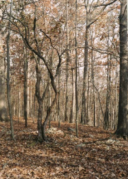
10-28-03 Oak-Hickory Ridge
Anthracnose-killed Flowering Dogwood.
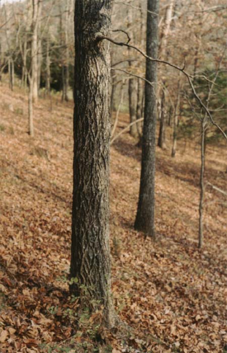
10-28-03 Oak-Hickory Ridge
Carya tomentosa.

10-28-03 Oak-Hickory Ridge. Click to enlarge.
Quercus muehlenbergi. Note characteristic blocky ridges on bark.
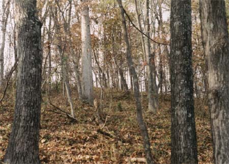
10-28-03 Oak-Hickory Ridge
Black Oak in foreground, large White Oak in middle distance. Click to enlarge.
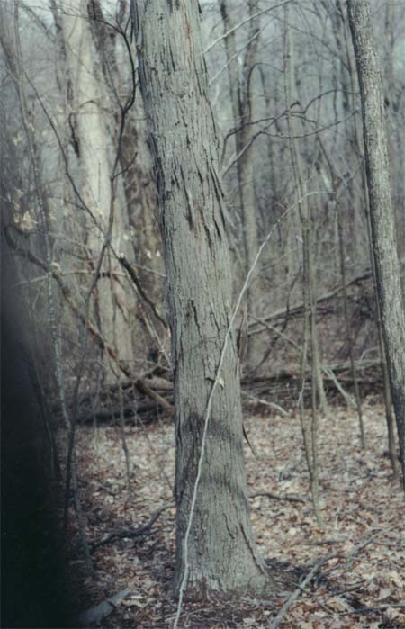
4-8-01 Mesic Slope Forest
Carya ovalis? (Nuts with fully-split husks found at base.)
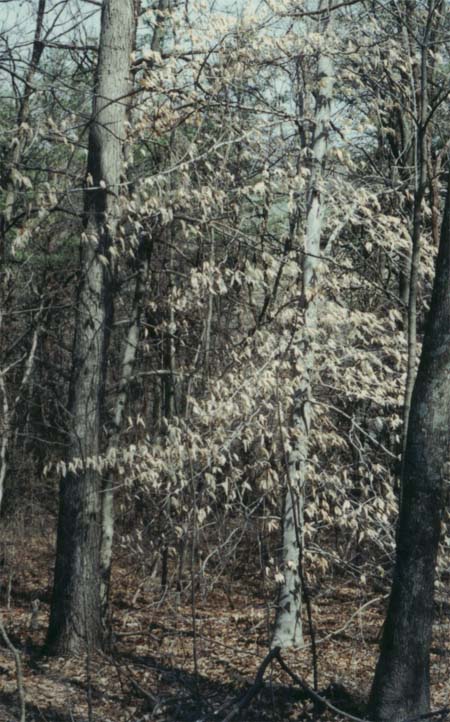
4-8-01 Mesic Slope Forest
Site of soil temperature station No. 2 and soil sample PP-4.
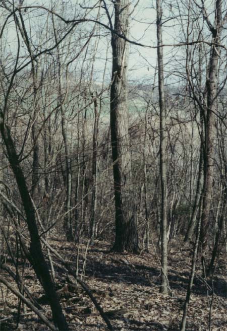
10-4-01 Mesic Slope Forest
Northern Red Oak.
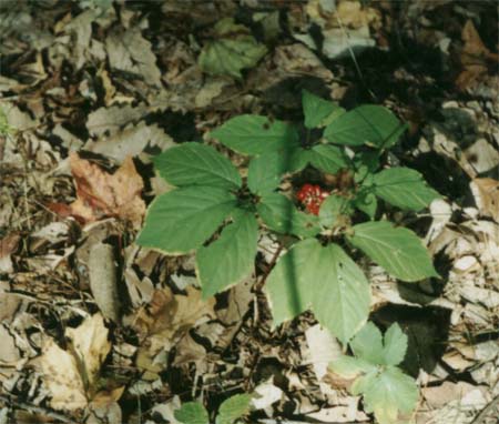
5-6-99 Mesic Slope Forest
Panax quinquefolius. Site of soil sample PP-27.
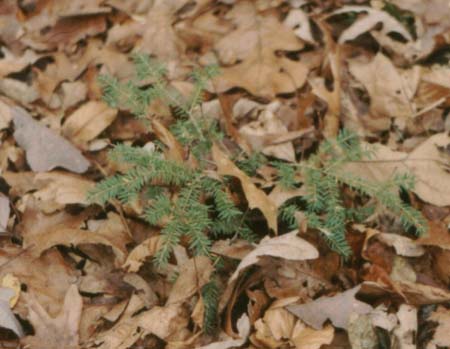
10-25-03 Oak-Hickory Ridge
Hemlock seedling.

6-14-97 Oak-Hickory Ridge
Woodsia obtusa.
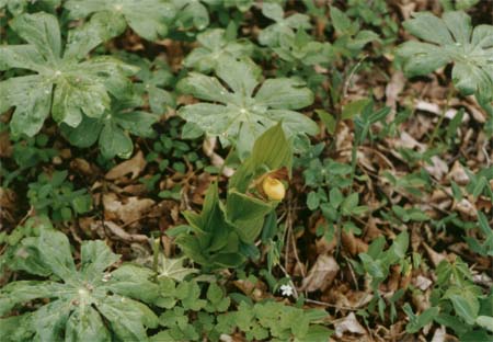
5-6-99 Mesic Slope Forest
Yellow Lady Slipper and associated flora. Click to enlarge.
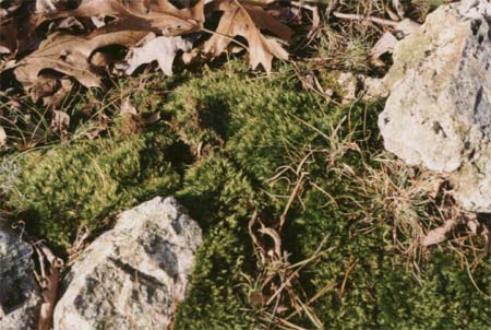
10-28-03 Oak-Hickory Ridge
Dicranum scoparrium and Danthania spirata.
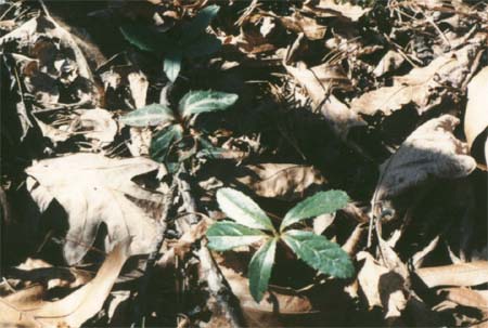
4-94 Oak-Hickory Ridge
Chimaphila umbellata and C. maculata.
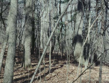
4-8-01 Mesic Slope Forest
Top of ridge with Black Gum, Chestnut Oak, White Pine, and Red Maple.
Acknowledgements
The reporter, is as ever pleased to
acknowledge the assistance in many aspects of this study by Robert.
Hunsucker. He also greatly appreciates the helpful cooperation of
Fred Huber of the US Forest Service in providing documents not only
for this study but for a number of other studies as well.
References.
Braun, E. Lucy (1950) Deciduous
Forests of Eastern North America. Macmillan Publishing Co., New
York. N. Y.
Coulling, Philip P. and Thomas J.
Rawinski (1999) Classification of Vegetation and Ecological
Land Units of the Piney River and Mt. pleasant Area, Pedlar Ranger
District. George Washington and Jefferson National
Forests,Virginia, Technical report 99-03, Department of
Conservation and Recreation, Div. of Natural Heritage, Richmond, Va.
135 pp., plus appendices.
Crum, Howard A. and Lewis E. Anderson (
1981) Mosses of Eastern North America. in two volumes.
Columbia University Press, New York, N. Y.
Fleming, Gary P. (1999) Plant
Communities of Limestone, Dolomite, and Other Calcareous
Substrates in the George Washington and Jefferson National Forests,
Virginia, Technical Report 99-4. Department of Conservation
and Recreation, Div. of Natural Heritage, Richmond, Va. 218 pp., plus
appendices.
Fleming, Gary P. and William H.
Moorhead (1996) Ecological Land Units of the Laurel Fork
Area, Highland County, Virginia. Technical Report 96-08,
Virginia Dept. of Conservation and Recreation, Div. of Natural
Heritage, Richmond, Va. 114 pp., plus appendices.
Fleming, Gary P. and William H.
Moorhead III (2000) Plant Communities and Ecological Land
Units of the Peters Mountain Area, James River Ranger District,
George Washington and Jefferson National Forests, Virginia.
Technical Report 00-07. Virginia Dept. of Conservation and
Recreation, Div, of Natural Heritage. Richmond, Va. 195 pp., plus
appendices.
Fowells, H. A. (1965) Silvics of
Forest Trees of the United States, Agricultural Handbook No. 271,
US Dept. of Agriculture, Forest Service, Washington, DC 20250.
Gleason, Henry A. (1952) The New
Britton and Brown Illustrated Flora of the Northeastern United
States and Adjacent Canada, in three volumes.MacMillan Publishing
Co. Inc., New York.
Hicks, Marie L. (1992) Guide to
the Liverworts of North Carolina. Duke University Press, Durham,
North Carolina.
Hunsucker, Robert and R. F. Mueller (1998) Folly Mills Calcareous Wetland, Augusta County, Virginia.
Forests of the Central Appalachians Project. Virginians for
Wilderness Web Site.
Ludwig, J. Christopher (1999) The
Flora of Dolomite and Limestone Barrens in Southwestern Virginia.
Castanea 64 (3) 209-230.
Mueller, R. F. (2000) Stability
Relations in Forests. Forests of the Central Appalachians Project.
Virginians for Wilderness Web Site.
Mueller, R. F. (2002, 2003) Soil
Temperature and Forest Type and Soil Temperature and Forest Type II.
Forests of the Central Appalachians Project. Virginians for
Wilderness Web Site.
Rader, Eugene K. (1967) Geology of
the Staunton, Churchville, Greenville and Stuarts Draft
Quadrangles, Report of Investigations 12. Virginia Division of
Mineral Resources. Charlottesville, Virginia.
Radford,Albert E., Harry E. Ahles and
C. Ritchie Bell (1968) Manual of the Vascular Flora of
the Carolinas. The University of North Carolina Press, Chapel
Hill, North Carolina.
Strausbaugh, P. D. and Earl L. Core (1977) Flora of West Virginia. Seneca books, Inc.,
Grantsville, West Virginia.
Back to Forests of the Central Appalachians |
Feedback