Locust Springs/ Laurel Fork
Highland County, VirginiaAugust, 2004
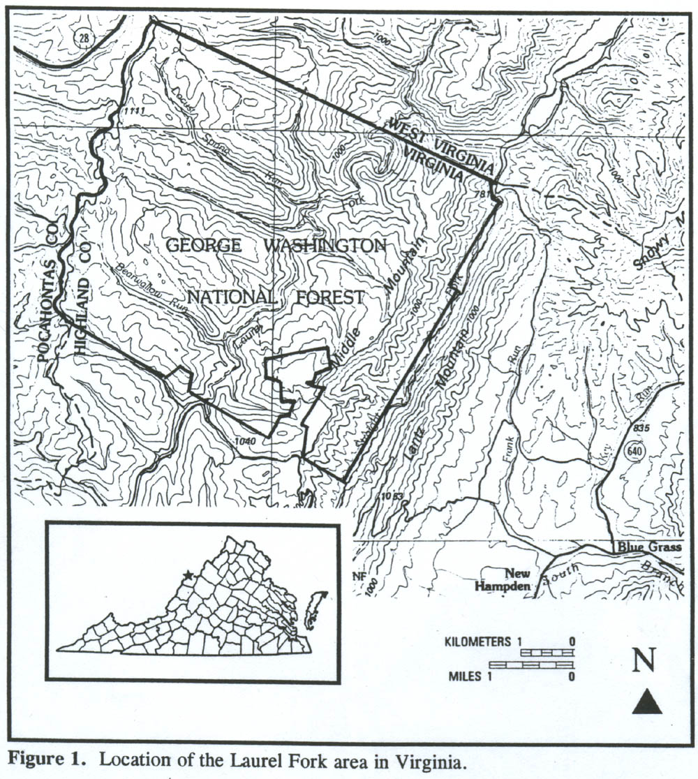
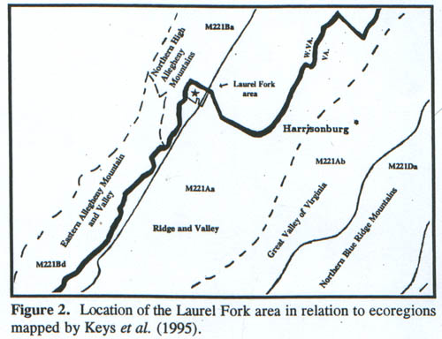
The Locust Springs/Laurel Fork area, outlined in Figure 1, is a part of the George Washington and Jefferson National Forests and lies just east of the West Virginia line in Highland County, Virginia. Locust Springs, also the location of a national forest picnic ground, falls in the extreme northwest corner of the area. This is also the source area for both Locust Spring Run and Buck Run. The outlined area also indicates the Laurel Fork Wilderness Study Area of the George Washington National Forest. The area is bisected by Laurel Fork, a branch of the Potomac River. Elevations range from 2600 feet (793 m) along Laurel Fork to above 4000 ft (1220 m) at several locations on both sides of Laurel Fork Stream. According to Keys et al (1995) the area falls partly in the Northern High Allegheny Mountains Subsection of the Allegheny Mountain Section and partly in the Ridge and Valley Subsection of the Northern Ridge and Valley Section (Figures 1 and 2, after Fleming and Moorhead, 1996). Bedrock geology (Rader and Evans, 1993), from southeast to northwest and decreasing age, consists of bands of the following formations:
Click to enlarge.
Devonian Millboro Shale & underlying Needmore Formation. The Millboro is dark, pyritic shale; gradational to the underlying Needmore, which consists of dark shale, with thin beds of limestone and Tioga metabentonite.
Devonian Brallier Formation consisting of interbedded shale and sandstone
Devonian Chemung Formation, consisting of dark, fine-grained lithic sandstone and interbedded gray shale.
Devonian Hampshire Formation, consisting of fine-grained and conglomeratic and massive sandstone and interbedded mudstone.
Mississippian Pocono Formation, consisting of light, resistant, quartzitic sandstone and interbedded shale.
In terms of landforms, the major northwestern part of the area falls in the Northern High Allegheny Subsection (Keys et al, 1995), while a smaller part, in the extreme southeastern part of the area, falls in the Ridge and Valley Section. It contains the southeast facing scarp slope (Figure 1) that contrasts greatly with the rest of the topography. With reference to Figure 1 and 2, the Ridge and Valley Section occupies an approximately one kilometer-wide band (the scarp slope) of the extreme southeast end of the National Forest tract, and this is underlain by the Millboro, Needmore and and Brallier Formations. A roughly parallel band with a width that extends from the crest of Middle Mountain to Laurel Fork Stream, is underlain by Chemung Formation, while Hampshire Formation underlies a parallel band on Allegheny Mountain to within approximately 1.5 km of the northwest edge of the National Forest tract. Finally, the aforementioned 1.5 km-wide band is underlain by Pocono Formation.
Laurel Fork is one of only a few centers of boreal diversity in Virginia harboring such species as the Northern Flying Squirrel (Glaucomys sabrinus), Snowshoe Hare ( Lepus americanus), Northern Saw-whet Owl (Aegolius funereus) and numerous other birds, insects and plants of northern distribution. Many of these have already been encountered in our West Virginia inventories and will be mentioned only as they appear in our survey here. As is usual in this work, scientific names, with few exceptions, will be given only on first mention.
Source Walks: 9-1-89 and 7-19-90
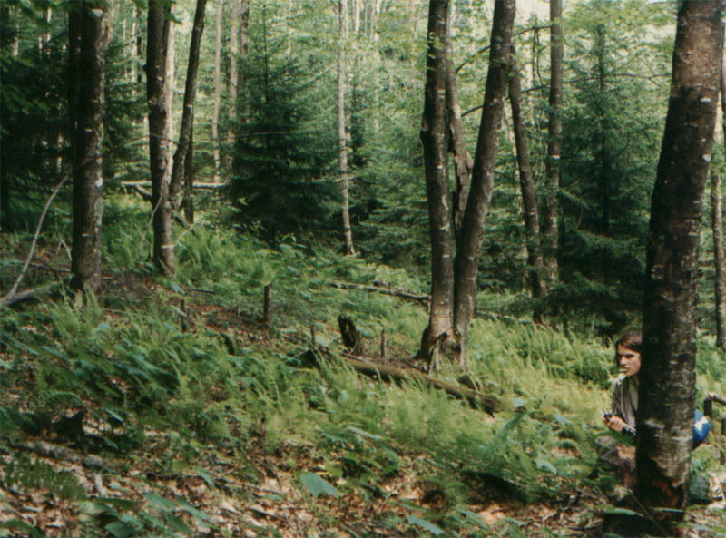
These walks are in the nature of reconnaissances, and we do not here report a number of species noted, but which are covered in greater detail in later inventories. However, they do reveal several species and occurrences of special interest. Reference is made to accompanying photographs from these walks. The 9-1-89 walks were along the heads of Bearwallow and Slabcamp Runs, two of the six major tributaries of Laurel Fork that flow directly southeast to join it. First, as we left our vehicle, we noted a mature Fraser Magnolia (Magnolia fraseri) growing along the access road Route 55. Then entering the scrubby open forest at the head of Slabcamp Run for some distance, we identified a very small sapling of Trembling Aspen ( Populus tremuloides), and this is the only example of the species identified either by us or Fleming and Moorhead (1996) in the entire area. The head of Slabcamp and Bearwallow Runs exhibit good examples of the reclamation of old fields by woody vegetation, such as Red Spruce, Black Locust (Robinia pseudoacacia) and hawthorn, in particular Dotted Thorn (Crataegus punctatus), as shown in the photographs. Also along Slabcamp Run, we observed initially what we took to be a Smooth Green Snake (Liochlorophis vernalis ), based on this boreal habitat. However, the snake, about 16 inches in length, was soon joined by an unidentified Fritillary butterfly which perched on it in one of those peculiar juxtapositions of nature we've come to expect!
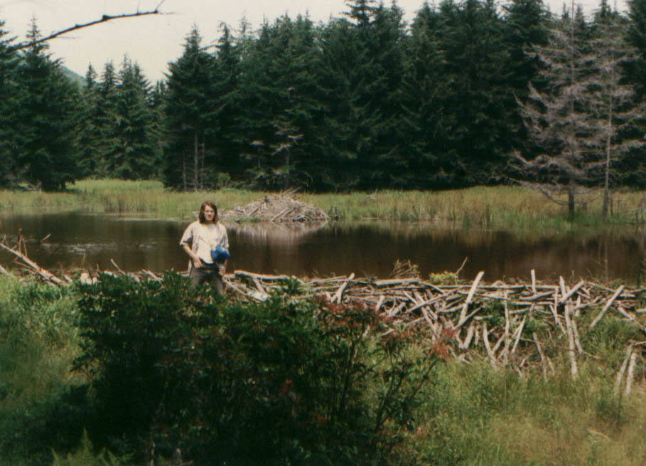
Our 7-19-90 walk was to the beaver ponds at the head of Buck Run. On the way from the picnic ground at Locust Springs we noted Red Elderberry (Sanbucus pubens) and the largest sapling of American Chestnut (Castanea dentata) ever seen by this reporter. This tree, in this area in which the species appears not to have been common, was approximately 6 inches (15 cm) dbh rose to perhaps 35 feet (11 m) in height and appeared healthy..
Source Walks: 8-9-96
Our first inventory was conducted in the vicinity of the Locust Springs picnic ground. Although time was not adequate to determine the true history of the forest at this location, it appeared to consist of a mosaic of immature Red Spruce (Picea rubens) and more mature northern hardwood. Large Northern Red Oak ( Quercus rubra) with spreading crowns, indicating early growth in the open, dominated the latter, but smaller Red Maple (Acer rubrum), Black Locust, Black Cherry (Prunus serotina), American Beech (Fagus grandifolia), Black and Yellow Birches (Betula lenta and B. alleghaniensis) were also common canopy species. White Pine ( Pinus strobus) also occurs, and, like most of the Red Spruce, appears to have been planted.
Macrolichens were conspicuous, especially on Red Maple. Identified by R. Hunsucker, were a species of Pseudevernia, Parmelia rudecta, P. sulcata, P. squarrosa, Pseudoparmelia caperata, Parmotrema stuppeum and Hypogymnia physodes.
Understory species noted were serviceberry ( Amelanchier sp), Striped Maple ( Acer pensylvanicum) and Mountain Holly (Ilex montana ). Shrubs, in order of diminishing size were Mountain Laurel (Kalmia latifolia), Thornless Blackberry (Rubus canadensis ), Mountain Azalea (Rhododendron roseum ), Minnie-bush ( Menziesia pilosa ), Deer Berry (Vaccinium stamineum ) and Early Low Blueberry ( V. angustifolium ). A chokeberry, (likely Aronia melanocarpa ) was present in moist areas. Ground cover consisted of abundant Teaberry ( Gaultheria procumbens ), Trailing Arbutus ( Epigaea repens ), Round-leaf Pyrola (Pyrola rotundifolia), Partridge Berry (Mitchella repens), Canada Mayflower (Maianthemum canadense), Common Speedwell (Veronica officinalis ), Downy Rattlesnake Plantain ( Goodyera pubescens ), Wood Betony (Pedicularis canadensis ), Spotted Jewelweed ( Impatiens capensis), Filmy Angelica (Angelica triquinata ), Woodland Strawberry (Fragaria vesca ), Virginia Strawberry ( F. virginiana), the bullrush Scirpus atrovirens, Tree Clubmoss (Lycopodium obscurum ), Ground Pine (L. flabelliforme ), an unidentified meadowrue (Thalictrum sp) and Millet Grass ( Millium effusum ) with remains of seeds.
Mosses were common and included an unidentified haircap ( Polytrichum sp). A small wetland a little to the east of the picnic area was dominated by Sphagnum with haircap moss (Polytrichum sp), both of unidentified species. Also present in the wetland were tall culms of the bulrush Scirpus pendulus, Carex baileyi, C. gynandra, Cinnamon Fern ( Osmunda cinnamomea ), New York Fern ( Thelypteris noveboracensis ) and the Chokeberry referred to earlier. The wetland was fringed by forest consisting largely of Red Maple and Red Spruce in which Carex debilis occurred. On the Trail to some Beaver (Castor canadensis ) ponds, we encountered in succession the manna grass Glyceria melicaria, Carex digitalis, Fire Cherry (Prunus pensylvanica ), Witch Hazel (Hamamelis virginiana ), the many-leaved bulrush Scirpus polyphyllus, Sugar Maple ( Acer saccharum ), Clearweed (Pilea pumila) in a seep, White Grass (Leersia virginica ); then in a patch of more fertile soil, Wood Nettle ( Laportea canadensis ), Smooth Gooseberry (Ribes rotundifolium), Sweet-scented Bedstraw ( Galium triflorum ) and Tall Agrimony (Agrimonia gryposepala ).
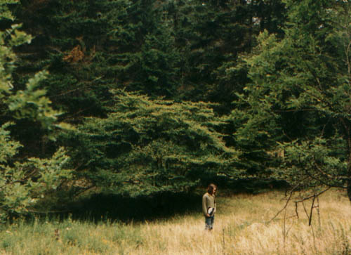
At the beaver pond, in a setting of a heavy stand of immature Red Spruce, we saw Cedar Waxwings (Bombycilla cedrorum ) foraging in the tops of the latter. Also Green Frogs ( Rana clamitans ) were heard, a Mallard (Anas platyrhynchos ) was flushed and the wake of a Beaver was apparent as it swam beneath the surface. Trees, in addition to Red Spruce, included abundant Yellow Birch, Northern Red Oak, Sugar Maple, Beech and various basswoods, some with the characteristics of Tillia americana and some with the characteristics of White Basswood (T. heterophylla or T. americana var heterophylla ). Smaller trees and shrubs seen were Hophornbeam (Ostrya virginiana), Mountain Holly, Mountain Laurel, Early Low Blueberry and one of the tallest bushes of Upland Low Blueberry ( Vaccinium pallidum) ever seen by this observer. Observed ground cover in the acid soil under the Spruce included Intermediate Shield Fern (Dryopteris intermedia ), Common Club Moss (Lycopodium clavatum ), Tree Clubmoss, Ground Pine, Indian Cucumber-root (Medeola virginiana ), Canada Mayflower, Round-leaf Violet (Viola rotundifolia ), Pinesap (Monotropa hypopithys ), Northern Bugleweed (Lycopus uniflorus ), Dotted St. John's-wort ( Hypericum punctatum), patches of the liverwort Bazzania trilobata and some large specimens of the fungus Amanita muscaria.
Fungi identified in the area as a whole by R. Hunsucker were
Amanita muscaria
Amanita parcivoluata
Amanita rubescens
Armilliariella mellea
Boletus badius
Boletus bicolor
Boletus subrehetipas
Clavulina amethystina
Clitocybe clavipes
Collybia confluens
Collybia dryophila
Entoloma salmoneum
Gyroporus cyanescens
Hygrocybe flavescens
Laccaria laccata
Lactarius hygrophoroides
Lactarius lignyotus
Oudemansiella radicata
Tricholoma flavovirens
Tylopilus felleus
Scleroderma citrinum
Source Walks: 8-25-03 and 8-26-03
In the afternoon of 8-25-03, under pleasant weather conditions, a preliminary foray was made to Locust Springs and the beaver ponds at the head of Buck Run. Although no systematic inventory was undertaken, a soaring Black Vulture (Coragyps atratus) and Cedar Waxwings were observed , several plants were noted and some collected for later identification. Identified in place were Hairgrass (Agrostis hyemalis ), Northern Bugleweed (Lycopus uniflorus), Arrow-leaf Tearthumb (Polgonum sagittatum), and later, the rushes Juncus subcaudatus and J. brevicaudatus.
A soil temperature reading (T-707) was also made at the usual depth (5 inches / 13 cm) in needle duff under Red Spruce on a flat aspect not far from the large pond. Obtained was T= 15.5 deg C. To see this temperature in relation to other Central Appalachian soil temperatures refer to Mueller (2004).
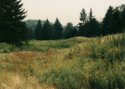
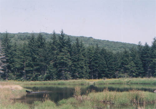
On the morning of 8-26-03, again under pleasant weather conditions, we returned to the larges (lower) Beaver pond area for an inventory of the Spruce-wetland meadow ecotone on the pond's south side, as well as the meadow itself. If a cross section ~30 meters in length perpendicular to the pond meadow edge is considered, the following microhabitats are encountered: young Red Spruce with a shrub layer of chiefly Early Low Blueberry, with abundant Ground Pine, Common Clubmoss, Canada Mayflower, Partridge Berry, with patches of acidiphile bryophytes including unidentified species of Sphagnum moss. Few if any current year Spruce seedlings were seen. Beyond the Spruce there were small drainage swales with exposed cream-colored to tan clay bottoms leading from the Spruce forest to the pond. Sphagnum was common in these swales and on flat seepy areas between them. Higher areas contained clumps and patches of Early Low Blueberry, large shrubs of Mountain Laurel, Common Club Moss, Tree Clubmoss and the haircap moss Polytrichum commune.. New York and Hay-scented (Dennstaedtia punctilobula) Ferns formed patches both within the forest and beyond its edges, and there were also individuals and patches of Cinnamon Fern (Osmunda cinnamomea). In many places the swale acid-flora was bordered on the pond side by extensive, dense growths of grasses, sedges and forbs. On and within the pond's shallow edge waters was a variety of grasses, sedges, rushes and aquatic plants such as species of Potamogeton and Sparganium. This flora has a far more eutrophic appearance than the acidiphile and low flora in and near the Spruce. Our detailed inventory yielded the following:
The fungus Golden Spindles (Clavaria fusiformis) at the forest edge; abundant New York Fern, Mountain Laurel, Common Clubmoss and Ground Pine, also at the forest edge,. abundant Mountain Oat Grass (Danthonia compressa ), Hairgrass, Slender Mannagrass (Glyceria melicaria), Hay-scented Fern, Stonewort (a species of the alga Nitella) in the water, and over a wide area of meadow, numerous blooming Bog Goldenrod (Solidago uliginosa). On near plants of this goldenrod numerous busy bumblebees could be observed, many with their pollen sacks bulging to capacity. However, no Honeybees (Apis mellifera ) were observed, in testimony to the effectiveness of parasites and disease in recent years Also observed again were numerous Cedar Waxwings, in the very tops of trees.
Where the level Beaver meadow was punctuated by elevated areas, Early Low Blueberry and Mountain Laurel held sway. In one place we identified Northern Dewberry (Rubus flagellaris ). Next seen were more Tree Clubmoss, Cinnamon Fern, Soft Rush (Juncus effusus), Hairgrass, Slender St. John's-wort (Hypericum mutilum) in full bloom, Carex lurida, Carex debilis,, Flat-top White Aster (Aster umbellatus) also in full bloom, then small Spruce Saplings, seedlings of Downy Serviceberry (Amelanchier arborea), Blunt Spikerush (Eleocharis obtusa), Small Bur Reed (Sparganium chlorocarpum), Grassy Pondweed ( Potamogeton gramineus), the grass Panicum lanuginosum var fasciculatum , Clayton's Bedstraw (Galium tinctorium), seedlings of Red Maple, the sedge Scirpus cyperinus, Rough-leaf Goldenrod (Solidago rugosa) also in bloom, the alien Velvet Grass (Holcus lanatus), Rice Cutgrass (Leerzia oryzoides ,the main wet-zone grass), Slender Spikerush (Eleocharis tenuis), Autumn Bent Grass (Agrostis perennans ), Arrow-leaf Tearthumb, Marsh St. John's Wort (Triadenum virginicum), Carex gynandra, Carex scoparia, Creeping five-leaf (Potentilla canadensis/simplex) intergrowth with Sphagnum moss, seedlings of Black Birch (identification based on strong taste), a Silver-spotted Skipper (Epargyreus clarus), a small unidentified frog, Bailey's Sedge (Carex baileyi ), the fungus Laccaria laccata, Narrow-leaved Willowherb (Epilobium leptophyllum) in full bloom, the alien Orchard Grass (Dactylis glomerata ), Bracken Fern (Pteridium aquilinum), Carex atlantica var atlantica, Upright Yellow Wood Sorrel ( Oxalis stricta) ; then on an elevation with a Red Spruce sapling, Mountain Laurel and Early Low Blueberry, we encountered the following mosses: Leucobryum glaucum, Pleurozium schreberi, Dicranella heteromalla and Hypnum curvifolium. This elevation is just below the massive old Beaver dam, now overgrown with grasses and forbs, but which a 1990 photo shows to be comprised of relatively fresh appearing sticks, as was also a large lodge in the pond.
Also seen were a Wood Pewee (Contopus virens) and a Ruby-throated Hummingbird (Archilochus colubris) on an unidentified thistle..
The Work of Fleming and Moorhead (1996)
That this important research deserves wider dissemination than is afforded by a Natural Heritage Technical Report is in part the reason for the detailed treatment presented here.
In what follows, text composition is this reporter's, but he has frequently adopted Fleming and Moorhead's phrasing in individual statements without particular attribution, sometimes in altered form, always in the interest of brevity or clarity, In some cases paraphrase is used, and in one case direct quotation. Some scientific names have been changed in the interest of conformity to usage in other sections of our Project. However their common names for a number of sedges and a few other plants were adopted. Finally, much of the material dealing with the classification of forest types in the original document has been omitted. For greater detail and a comprehensive bibliography, the reader is referred to the original document.
Fleming and Moorhead (1996) made a comprehensive and largely successful effort to relate the floras of Laurel Fork to their ecological land units as determined by Harbor (1996). These forests, which are comprised of a number of types, are all secondary and have suffered the devastation of reckless logging and fires. As a result canopy dominance by certain species is often a direct consequence of post logging or fire conditions, which favored these species.
By far the most common type of forest in the area is northern hardwood, which covers more than 50 % of the area and consists of such species as Sugar and Red Maples, American Beech, Yellow and Black Birches, Black Cherry, Northern Red Oak, White Ash (Fraxinus americana) and American Basswood (Tilia americana). Understory and shrub layers are dominated by Hophornbeam, Striped Maple, Mountain Maple (Acer spicatum), Red Elderberry and Hobblebush ( Viburnum alnifolium). Although not mentioned by Fleming and Moorhead, the original forests of this type should also have been prime habitat for the evergreen shrub Canada Yew (Taxus canadensis), a species which was once common in the Central Appalachians and still occurs in trace numbers in similar forests in West Virginia. Most northern hardwood forest types occur in areas that are regarded as having "frigid" soils, or those soils with average annual temperatures less than 47 deg F (8.3 deg C). The area in which they occur is also one of relatively high precipitation compared to the Ridge and Valley Section to the east. As emphasized by Fleming and Moorhead, this characteristic likely protected the original primary forests from wildfires, to which they became vulnerable only after logging produced incendiary conditions.
Fleming and Moorhead distinguished the Landtype Phase of Northern Hardwoods of Fertile Slopes and Hollows (Phase 1) from the Landtype Phase of Moderately Fertile Slopes and Crests (Phase 2) and that of Infertile Slopes and Crests (Phase 3). In addition to the presence of such trees as White Ash and basswood, herbs are good indicators of soil fertility. Those which characterize fertile slopes and hollows, as well as cool soils, include particularly Blue Cohosh (Caulophyllum thalictroides), Wood Nettle, Canada violet (Viola canadensis), Ramps (Allium tricoccum), Carolina Spring Beauty (Claytonia caroliniana), Squirrel Corn (Dicentra canadensis ) and Dwarf Ginseng (Panax trifolius). Of course, these forests also include species of wider distribution such as May Apple (Podophyllum peltatum), Maidenhair Fern ( Adiantum pedatum), Wild Ginger (Asarum canadense) and Black Cohosh (Cimicifuga racemosa ). These fertile soils are generally characterized by higher values of pH, bases such as calcium and magnesium, as well as other nutrients, when compared to less fertile soils. Average values of pH, calcium and magnesium for 12 plots were 4.4, 1,314 ppm and 120 ppm respectively. However, some samples combined high nutrient values with pH values in the range of 3.5-4.0. It will be interesting to compare flora of this forest type with that of the Mixed Hardwood Forests of the Scarp Slope Hollows of the Ridge and Valley Section (see later).
When we consider the forests on somewhat less fertile soils such as those of Moderately Fertile Slopes and Crests (Landtype Phase 2), we note a decrease in critical element values, with pH, calcium and magnesium averaging 3.7, 148 ppm and 28 ppm respectively. Associated with these values is an increase in species tolerant of these conditions. Examples are Hay-scented and New York Ferns, Curtis Goldenrod (Solidago curtisii) ; Sweet White Violet (Viola blanda), a variety of sedges and grasses, and numerous tree seedlings of such species as Black Cherry, largely as influenced by Deer browsing,
In forests of Infertile Slopes and Crests (Landtype Phase 3), average values of key elements were pH = 3.5, calcium = 128 ppm and magnesium = 22 ppm. and forbs, grasses and sedges largely give way to the a sparse distribution of strong acidiphiles such as Stiff Clubmoss (Lycopodium annotinum), Indian Cucumberroot (Medeola virginiana), Indian pipe (Monotropa uniflora), Downy Rattlesnake Plantain (Goodyera pubescens) and Canada Mayflower. An abundance of woody seedlings, particularly of maples, Beech, Cucumbertree, Mountain Holly and Mountain Laurel is also typical, and herbaceous diversity is extremely low in these communities.
The Landtype Phase of Eastern (Canada) Hemlock-Birch Forests of Infertile Slopes and Bouldery Colluvium is a 4th type identified. It is represented by mixed stands of Hemlock-birch and rarely by nearly pure stands of Hemlock. Many of the stands are in an early, strongly stratified stage of development, with even-aged Yellow and Black birches occupying the canopy and dense Hemlock occupying the subcanopy and shrub layers. Also present are scattered Red Maple, Black Cherry, White Pine and Red Spruce. Small tree and shrub species include Striped Maple, Mountain Maple, serviceberry (Amelanchier sp), Mountain Holly, Hobblebush, Mountain Laurel, Witch Hazel, Red Elderberry and Northern Bush Honeysuckle (Diervilla lonicera). Soils are frigid and very acidic, with pH in the vicinity of 3.7 and low base values. The bouldery habitat favors Intermediate Shield Fern (Dryopteris intermedia) in the herb layer, as well as a community similar to forests of Landtype Phase 3. At the time of this survey some Hemlock were already infested by the Hemlock Wooly Adelgid (Adelges tsugae).
, A 5th Landtype Phase of American Beech Forests of South and West Facing Slopes, identified by Fleming and Moorhead, consists largely of American Beech, with some Red Maple, Black Birch, Black Cherry, Northern Red Oak, Cucumbertree and Big-tooth Aspen (Populus grandidentata). As might be expected, soils are acidic and relatively infertile, with pH, calcium and magnesium at 3.5, 120 ppm and 21 ppm respectively. It is inferred that the beech may have resulted from suckering of fire-killed cull trees after logging.
A very minor Landtype Phase, The 6th, is that of Bigtooth Aspen Forests of Severely Burned Slopes. Like many of the foregoing types, soils are highly acidic and this is reflected in the herb layer, which is dominated by such species as Hay-scented Fern and other acidiphiles.
The 7th Landtype Phase is that of Red Spruce Forests of Stream-head Valleys. It occupies broad, unicised valley floors and foot slopes along the upper Buck, Slabcamp, Bearwallow and Newman Runs (see Figure i) Soils are frigid and very acidic, with pH generally less than 4. We have already encountered this forest type in our source walks, particularly at Buck Run and to a lesser degree art Bearwallow and Slabcamp Runs. The most frequent canopy associates of Red Spruce are Red Maple, Hemlock, Yellow and Black Birches, Black Cherry and Northern Red Oak. Spruce is the most important species in the small tree and shrub layers, along with Hemlock and some hardwoods. As found in our source walks, shrubs include Mountain Laurel and blueberries, while a herbaceous ground cover is formed by sparse clubmosses, White Wood Sorrel, Intermediate Shield Fern, Canada Mayflower, Teaberry, Large Round-leaved Orchid (Habenaria orbiculata), Shinleaf (Pyrola elliptica ), Painted Trillium (Trillium undulatum) and other acidiphiles. In more open stands Dotted Thorn is accompanied by the uncommon Purple Oatgrass (Schizachne purpurascens). In some poorly drained stream sides and seeps, in a more eutrophic environment, one may find White Hellebore (Veratrum viride), Marsh Marigold (Caltha palustris), Marsh Blue Violet (Viola cucullata), Drooping Wood Reed Grass (Cinna latifolia), Three-seed Sedge (Carex trisperma) and Leafy Bulrush ( Scirpus polyphyllus).
An example of the 8th Landtype Phase, represented by Wetland Glades and Beaver Meadows, was the subject of our previously reported inventories along the head of Buck Run. According to Fleming and Moorhead, this landtype is restricted to the Allegheny Mountain section of the study area. It occupies narrow zones of the upper, unincised valley floors along Buck Run, Locust Spring Run (north and south branches) and Slabcamp, Bearwallow and Newman Runs. Near the crest of Middle Mountain it occupies a small headwaters swale in one of the truncated valleys, and also occurs in one locality of the alluvial flats along Laurel Fork. It is associated with cold, wet open sites that have been affected by logging and Beavers. The soils of the Allegheny Mountain stream heads are frigid and generally quite acid. Along most of Allegheny Mountain stream-heads, young Spruce reproduction and Early Low Blueberry occupy hummocks in and around the wetlands, as described previously.
Among additional species not recorded in our inventories are Minnie-bush, Crested Shield Fern (Dryopteris cristata), Hairy Willowherb ( Epilobium ciliatum), American Water Pennywort (Hydrocotyle americana), Closed Gentian (Gentiana clausa), Mash fern (Thelypteris palustris) and Three-seeded Sedge.
The 9th Landtype Phase is represented by Northern Hardwood Forests of Valley Floors. This Landtype Phase is confined to the Allegheny Mountain Section of the study area. It is characteristic of the incised stream valleys of deeply dissected terrain on both Allegheny and Middle Mountains, with attenuated occurrences in the high, gently dissected landtype on Allegheny Mountain. Soils are frigid and acid, with pH values in the neighborhood of 3.7.
Valley floor vegetation in the Laurel Fork area is characterized by northern hardwood forest with Yellow Birch as a dominant or co-dominant tree. Due to numerous microhabitats in this Landtype Phase, it was found to have the greatest shrub and herb diversity of any in the study area.
While Yellow Birch generally dominates, Red Maple is commonly a co-dominant, with Sugar Maple, Black Birch, Beech, White Ash, Northern Red Oak, Basswood, Black Cherry, Hemlock and Red Spruce as other canopy species. Most canopy species appear to be 60-75 years in age (in 2004)..Sub-canopy layers contain higher proportions of Sugar Maple and Beech than the canopy, while shrub layers consist of sparse Sugar Maple, Beech, Mountain Maple, Witch Hazel, Hobblebush and Wild Hydrangea (Hydrangea arborescens).
On relatively well-drained areas White Wood Sorrel forms extensive carpets. Accompanying herbs are Stiff Clubmoss, Hay-scented, New York and Intermediate Shield Ferns, Drooping Wood Reed Grass, Sweet White Violet, Canada Mayflower, Finely-nerved Sedge (Carex leptonervia), Slender Wood Sedge (Carex digitalis), Round-leaf Violet, Indian Turnip, Crooked-stem Aster, Rosy Twisted Stalk (Streptopus roseus), Filmy Angelica, Golden Ragwort (Senecio aureus), Hairy Disporum (Disporum lanuginosum), Creeping Phlox ( Phlox stolonifera), Hairy Woodrush (Luzula acuminata), Wide-leaf Joe-pye Weed (Eupatorium purpureum), Hooked Crowfoot (Ranunculus recurvatus ), Clearweed ( Pilea pumila ), Interrupted Fern, Fragile Fern (Cystopteris tenuis), Foamflower, Alpine Enchanter's Nightshade (Circaea alpina),Broad-leaved Sedge (Carex platyphylla ) and the rare species Black Sedge (Carex arctata), Blue Ridge St. Johnswort (Hypericum mitchellianum), Purple Oatgrass, Millet Grass. and White Monkshood (Aconitum reclinatum).
A distinctive wetland suit of this community type is developed in seepage zones and along saturated abandoned meanders. This suit is dominated by Rough Sedge (Carex scabrata), with Lettuce Saxifrage (Saxifraga micrathidfolia), White Hellibore, Marsh Blue Violet, Slender Mannagrass, Mad-dog Skullcap (Scutellaria lateriflora), American Speedwell (Veronica americana), Turtlehead (Chelone glabra), Golden Saxifrage (Chrysosplenium americanum), Drooping Sedge (Carex prasina), Northern White Violet (Viola pallens), Spotted Water Hemlock (Cicuta maculata), Spotted Jewelweed, Miterwort (Mitella diphylla) and Oswego Tea (Monarda didyma) as associates.
The rocky streams and stream banks of this phase are prime habitat for the Water Shrew (Sorex palustris), a northern mammal known in Virginia only from Highland and Bath Counties.
Closely related to the above is the 10th Landtype Phase, that of Forested Alluvial Flood Plains, Terraces and Stream-fronting Slopes. It is confined to the Allegheny Mountain section of the study area. It is the most characteristic and extensively developed phase of the major stream valley landtype. which encompasses the alluvial floor, terraces, fans, meanders and stream-fronting slopes of the Laurel Fork Valley. The unit occupies all topographic positions in the Landtype, with the exception of the active steam channel shelf and is comprised of habitats which are most influenced by dynamic alluvial processes. Soils are frigid, but perhaps less acid and richer in nutrients than those of most of the landtype phases previously described, since they are in part developed on alluvium derived from a greater variety of rock types than the latter. Forests are generally similar to those of Landtype Phase 9 in species composition. However, Great Rhododendron is an important component and covers much of the Valley floor. Also, Tuliptree (Liriodendron tulipifera) occurs at the lowest elevations. Red Spruce has a scattered presence in birch and Hemlock forests down to an elevation of about 3,100 feet (945 m).
Great Rhododendron characterizes the Yellow Birch stands of the Valley floor, but it also ascends steep, stream-fronting slopes of various aspects to form thickets in a variety of community types. Fleming and Moorhead speculate that the presence of Rhododendron may be related to enhanced humidity generated by the large and relatively sheltered stream valley, an opinion also arrived at by this reporter with respect to other occurrences of the species (see our Horseshoe Run/Dorman Ridge Section).
Landtype Phase 11 is represented by Regularly Flooded Bouldery Stream Banks and Cobble Bars. The landtype is confined to the Allegheny Mountain Section of the study area and particularly along Laurel Fork Stream.
The vegetation of this phase is characterized by light-demanding, tough-rooted perennials tolerant of frequent inundation and scouring. Twisted Sedge (Carex torta) is the dominant species., forming extensive colonies. Frequent and locally abundant associates are Silky Willow (Salix sericea), Flat-top White Aster, Deer-tongue Grass ( Panicum clandestinum), Wrinkle=leaf Goldenrod (Solidago rugosa), Soft Rush, Woodland Bulrush, Northern Woolgrass, Field Horsetail ( Equisetum arvense), Sensitive Fern (Onoclea sensibilis), New York Ironweed (Vernonia noveboracensis), Virginia Bugleweed (Lycopus virginicus) and Mad-dog Skullcap.
The next three Landtype Phases, Herbaceous Old Fields, Shrubby old Fields and Coniferous Plantations, are of less interest from an ecological standpoint than the foregoing, and will not be discussed further, although the occurrence of Ground Juniper (Juniperus communis) in Shrubby Old Fields is of some interest.
Landtype Phase 15, Mixed Hardwood Forests of Scarp Slope Hollows, is of considerable interest through comparison with Landtype Phase 1, Northern Hardwood Forests of Fertile Slopes and Hollows. It is however restricted to the study area's Ridge and Valley Section. It occupies numerous hollow heads on the upper portion of the steep, southeast-facing scarp. Soils are very stony silt loams, dark, and apparently quite fertile. They are largely "mesic" with regard to temperature. This habitat often contains low ledges and outcrops. One tested sample from this phase was from the head of a hollow at 3760 feet (1147 m) elevation. Its soil had a pH of 4.5, with 1471 ppm calcium and 127 ppm magnesium. Large trees 130-160 years in age (in 2004) are quite common in the Phase, although the forest as whole has been greatly altered by the Chestnut Blight, fire and windthrow.
The canopy of this Phase is generally dominated by Sugar Maple, Northern Red Oak and hickories, among which Pignut (Carya glabra ) is most common. However Shagbark (C. ovata ) and Mockernut ( C. tomentosa ) are also quite common. Also common in lower slopes of the Phase, particularly in secondary stands, is Tuliptree, a species not present in much of the Laurel Fork area because of climatic restrictions. However, it does not occur in the sample cited above as a consequence of elevation. Other frequent canopy associates are Chestnut Oak (Quercus prinus), White Ash, Black Birch and White Oak (Quercus alba).
Common understory and shrub species are Striped Maple, Hophornbeam, Witch Hazel, Maple-leaf Viburnum (Viburnum acerifolium), Prickly Gooseberry (Ribes cynosbati), as well as saplings of Sugar Maple and the hickories. At lower elevations Flowering Dogwood ( Cornus florida) and vines such as the grapes (Vitis spp.) and Dutchman's Pipe (Aristolochia macrophylla) also occur.
Among herbs, White Snakeroot (Eupatorium rugosum ), Black Cohosh and Canada Brome Grass (Bromus purgans) are frequently dominant. Associates are Hog Peanut (Amphicarpa bracteata), Enchanter's Nightshade (the mesic soil species Circaea quadrisulcata or C. canadensis rather than C. alpina of frigid soils), Virginia Waterleaf, Wide-leaf Joe-pie Weed, Sicklepod (Arabis canadensis), Horse Balm ( Collinsonia canadensis), Tall Bellflower (Campanula americana), Basilbalm (Monarda clinopodia rather than M. didyma of frigid soils), Goatsbeard (Aruncus dioicus), Tall Agrimony (Agrimonia gryposepala), Three-lobed Violet (Viola triloba), Indian Turnip, Hare Figwort (Scrophularia lanceolata), Rattlesnake Fern ( Botrichium virginianum), Sweet-scented Bedstraw (Galium triflorum), Wild Licorice (Galium cicaezans), Purple Bedstraw (Galium latifolium), Carolina Vetch (Vicia caroliniana), Carrion Flower (Smilax herbacea), Spreading Dogbane (Apocynum androsaemifolium), Oxeye ( Heliopsis helianthoides), Cut-leaved Goldenrod (Solidago arguta), Nodding Fescue (Festuca obtusa), Slender-flowered Muhly ( Muhlenbergia tenuiflora), Short-leaved Bluegrass (Poa cuspidata), Slender Wild Rye ( Elymus villosus ), Appalachian Sedge (Carex appalachica ), Oval-leaved Sedge ( Carex cephalophora ), Loose-flowered Sedge ( Carex laxiflora ), Smooth Rockcress (Arabis laevigata), Early Meadowrue ( Thalictrum dioicum ), Early Saxifrage (Saxifraga virginiensis) and Ebony Spleenwort (Asplenium platyneuron).
According to Fleming and Moorhead (1996).
" The forests of this phase tend to have a distinctive physiognomy consisting of more or less regularly spaced, older growth northern red oak amid younger growth comprised of sugar maple, hickories, and other species. In many cases, these young cohorts have grown up to fill canopy gaps created by the death of American chestnut (Castanea dentata ). Numerous, slowly rotting, fallen chestnut boles are present everywhere in this Phase and provide evidence that this species was a co-dominant tree in many pre-blight stands. Apparently, sugar maple, hickories, tuliptree, and others were less abundant in the original forests but were components of a rather rich, mesic, and mixed American Chestnut-northern red oak community. Scars from at least two fire events were observed on a number of older, relict trees."
As seen in the listing of species, there is a fundamental difference between this Landtype Phase and that of Northern Hardwoods of Fertile Slopes and Hollows ( Phase 1), despite the fertile soils that characterize both Phases. Although both Phases have many species in common, there are a number that apparently do not usually cross over. Examples are Blue Cohosh and Ramps, the latter in particular, being a species confined to rich northern hardwoods, and, as indicated above, frigid soils.. Others include the different species of genra such as, Circaea and Monarda. While some of these differences are attributable to differences in substrate as related to bedrock, many reflect differences in soil and air temperatures. Ramps demand the cooler soils as do also Circaea alpina and Monarda didyma. The same is true of the northern forest Hobblebush as distinguished from Maple-leaf Viburnum, which occurs widely in warmer soils. In the example of Landtype Phase 15 cited briefly above, the south-ranging species of Circaea is present rather than the cool soil demanding Circaea alpina, despite an elevation of 3720 feet asl. This indicates that topography and regional climatic variation may trump elevation. The southeast aspects and Ridge and Valley position of Landtype Phase 15 engender warmer soils than many lower valleys of the Allegheny Mountain region. Although ambient air temperatures may be low at times at the high elevation sites on the scarp slope, this cold air readily drains down-slope and cannot accumulate as does that in valley flats.
Landtype Phase 16 represents the Ericad Forests of North and East Facing Slopes. It is restricted to the Ridge and Valley Section, which encompasses the southeast flank (scarp slope) of Middle Mountain. It occupies north to east-facing sideslopes of the hollows. These habitats are steeper, cooler and moister than adjacent crests and south-facing slopes. Soils are mesic and formed in residuum and colluvium from interbedded sandstones and shales. A tested sample had pH of 4.1, with 72 ppm calcium and 20 ppm magnesium.
The canopy is usually dominated by Northern Red Oak, but Chestnut Oak, Red Maple, Shagbark Hickory and Black Birch are common associates. Minor associates are Cucumbertree, which may attain large size, White Oak and White Pine.
Young Hemlock, Northern Red Oak and Red Maple are common in the subcanopy, as are Hophornbeam. and Mountain Maple, while Witch Hazel, Mountain Holly, Maple-leaf Viburnum, Mountain Laurel, Upland Low Blueberry and Mountain Azalea (Rhododendron roseum) form shrub layers.
While the ground cover is frequently dominated by tree seedlings, particularly those of Striped Maple, as a consequence of Deer browsing, steeper slopes may have a variety of herbs, These include the common occurrence of Christmas and New York Ferns, Marginal Shield Fern (Dryopteris marginalis), Intermediate Shield Fern, Indian Cucumber-root, Round-leaf Violet and Big-leaf Aster (Aster macrophyllus). Other less common herbs are Purple Bedstraw (Galium latifolium), Curtis Goldenrod, Tall White Lettuce (Prenanthes altissima), Slender Wood Sedge (Carex digitalis), Starry Campion ( Silene stellata), Lance-leaf Anemone (Anemone quinquefolia var lanceolata ), Calico Aater (Aster lateriflorus), Bellow-beaked Sedge (Carex albicans), Canada Mayflower, Partridge Berry, Black Snakeroot (Sancula canadensis), Great Chickweed (Stellaria pubera ) and Painted Trillium.
Landtype Phase 17, Ericad Forests of Medium to High Elevation Slopes, occurs locally throughout most of the study area, where it is strongly associated with warm infertile sites. On the Middle Mountain southeast-facing scarp slope, it is locally common on interfluve ridges at higher elevations. On the west flank of Middle Mountain it occupies sizable zones on west to southwest slopes, and west of Laurel Fork Stream, it becomes restricted to small zones on south to southwest-facing steep, incised valley sideslopes. In general the Phase is confined to north aspects or higher elevations in the Ridge and Valley Section and to warm aspects or lower elevations in the Allegheny Mountain Section. Soil samples, consisting of stony silt loams, had an average pH value of 4.1, with average calcium at 60 ppm and magnesium at 17 ppm.
The vegetation consists of variable mixtures of Chestnut Oak and Northern Red Oak, with moderately to very dense ericaceous undergrowth. The only common canopy associate is Red Maple, although Bigtooth Aspen and Pitch Pine (Pinus rigida) are found in many stands. On the Middle Mountain scarp slope and locally elsewhere, Chestnut Oak usually dominates and White Oak is frequent. In the Allegheny Mountain portion, and locally on the Middle Mountain scarp slope, Northern Red Oak is most abundant, and Black Birch may occur as well.
Striped Maple is common as trees and seedlings, and associated small trees and shrubs include American Chestnut sprouts, Black Gum (Nyssa sylvatica), Downy Serviceberry, Sassafras (Sassafra albidum), Bear Oak (Quercus ilicifolia) and Witch Hazel. In forest types with Black Birch, Mountain Holly is common and Hemlock saplings may occur.
Mountain Laurel is typically dominant in both the shrub and herb strata. Also common are Upland Low Blueberry, Early Low Blueberry, Mountain Azalea, Minnie-bush, and Teaberry. Great Rhododendron, which is almost confined to the Laurel Fork Valley, occurs anomalously on a steep west-facing slope along Buck Run as a continuous shrub layer.
Herbs are scarce in this Phase, But Gay Wings, Four-leaved Yam, Indian Pipe, Wild Sarsaparilla and Tree Clubmoss have a scattered presence.
Landtype Phase 18, Ericad Forests of Gentle Crests., occurs locally in the eastern half of the study area., where it is strongly associated with gently slopes on warm, infertile, high elevation sites on upper portions of both flanks of Middle Mountain. Soils are deep, stony silt loams. The following average values of soil elements were obtained: pH= 3.9, calcium =54 ppm and magnesium = 19 ppm. Charcoal evidence of fire is common. Scattered trees 130-160 years in age (in 2004) are common in many stands.
This is mixed oak forest, with White Oak usually co-dominant with Northern Red and Chestnut Oaks. Red Maple is also common in the canopy, while Black Birch, Shagbark Hickory and Black Cherry are minor canopy species.
Components of the understory and shrub layers are small Hemlock, Striped Maple, American Chestnut sprouts, Downy Serviceberry, Sassafras, Witch Hazel, Minnie-bush, Upland Low Blueberry, frequently in dense patches, Early Low Blueberry, Mountain and Pinxter (Rhododendron nudiflorum) Azaleas and Teaberry.
Common sedges, where blueberry cover is thin, are Wood's Sedge (Carex woodii ) and Pennsylvania Sedge. Other herbs are Gay Wings, Autumn Bent Grass, Whorled Loosestrife, Four-leaved Yam, Indian Pipe, Arrow-leaved Violet, Plantain-leaved Pusseytoes (Antennaria plantaginifolia), Blue Wood Aster (Aster cordifolius) and Lance-leaved Wild Licorice (Galium lanceolatum).
Landtype 19, Rock Outcrops and Narrow Clifftop Crests occupies small, local areas in and near the Laurel Fork Valley and on the upper portion of the Middle Mountain scarp slope. It is confined to warm, infertile habitats on and around major rock outcrops, usually with a south or west aspect. There is little, if any, true soil in these habitats, and vegetation is supported by crevices and ledges with deep accumulations of humus. A humus sample from a plot representative of this Phase had a pH of 4.4, 60 ppm calcium and 17 ppm magnesium. In this plot a charcoal-rich duff layer up to 11 cm deep was evidence of one or more fires.
The vegetation of this Phase is characterized by a stunted and gnarled overstory of Chestnut Oak, Northern Red Oak, Red Maple and rarely White Oak. Small Black Birch and White Ash are common in crevices. On rasorback crests and clifftops, Mountain Laurel is abundant, and Common Greenbrier forms large climbing and sprawling colonies. In more open spots of the clifftops Hay-scented Fern is common. Small shrubs and herbaceous plants are very scarce in the crest zones dominated by greenbrier, but shelves, crevices and ledges typically support a number of rock or crevice-loving species. Examples are Rock Polypody (Polypodium virginianum), Wild Sarsaparilla, Summer Sedge (Carex aestivalis), Hay Sedge (Carex argyrantha), Ribbed Sedge (Carex virescens), Northern Bush Honeysuckle ( Diervilla lonicera), Round-leaved Gooseberry (Ribes rotundifolia), Marginal Shield Fern, American Alumroot ( Heuchera americana), Wild Hydrangea (Hydrangea arborescens) and Downy Many Knees However, the most abundant and conspicuous plants on these outcrops are often large rock-trype lichens of the genus Umbilicaria.
Of interest also, is that this Phase provides prime hibernacula for the Forest Rattlesnake (Crotalaria horridus horridus).
The final Landtype Phase, number 20, is represented by Oak- Ericad Forests of Medium Elevation, SE to SW- Facing Slopes, and occurs locally in the eastern half of the study area, where it is strongly associated with warm, dry, infertile sites, mostly below 3,400 feet (1,036 m) elevation. It is probably the most widely distributed Phase on the southeast flank of Middle Mountain, and occupies southeast to southwest sideslopes and interfluve spurs. West of the Middle Mountain summit it is increasingly localized on more or less south-facing, convex slopes and rarely occurs west of Laurel Fork Stream. Habitats include steep areas of bouldery colluvium and outcrops as well as residual slopes with well-developed soils. Soil samples from three plots yielded the following average values: pH = 4.1, calcium = 60 ppm and magnesium = 16 ppm.
These are dry forests, typically dominated by Chestnut Oak, in some places, to the exclusion of all other trees. Black Oak is a characteristic, in some cases co-dominant tree, and Scarlet Oak (Quercus coccinea ) is important at lower elevations, usually below 3,200 feet (975 m), while Northern Red Oak is generally confined to high elevations. White Oak, Pignut and Mockernut Hickories, Red Maple and Pitch Pine are occasional canopy associates.
Small tree and shrub layers include Red Maple, Black Gum, American Chestnut sprouts, Downy Serviceberry, Sassafras, various oaks and hickories and Witch Hazel. However ericads such as Mountain Laurel, Upland Low Blueberry, Deer Berry and Pinxter Azalea tent to dominate both the shrub and herbaceous strata. Teaberry is generally present and Black Huckleberry varies from absent to locally abundant. Flowering Dogwood occurs at lower elevations.
While herbs are not common in this community type, they include Whorled Loosestife, Poverty Oat Grass, Canada Cinquefoil (Potentilla canadensis), Four-leaved Yam, Indian Pipe, Purple Bedstraw, Variable Panic Grass (Panicum commutatum), Small-fruited Panic Grass ( Panicum dichotomum), Bracken Fern, Arrow-leaved Violet, Plantain-leaved Pusseytoes, Panicled Hawkweed, Entire-leaved Yellow Foxglove (Aureolaria laevigata), Trailing Arbutus, Rattlesnake Weed, Mountain Bellwort (Uvularia pudica), Sessil-leaved Bellwort (Uvularia sessilifolia), Prairie Wedge Grass (Sphenopholis obtusata), Hairy Angelica ( Angelica venenosa) and Featherbells (Stenanthium gramineum).
Discussion
The floras of the Locust Springs / Laurel Fork Area illustrate beautifully their relations to climate, substrate, topography and not least, regional climatic variation with respect to physiographic province characteristics. An interesting point relates to the stability characteristics (Mueller, 2000) of such species as White Ash, Hispid Greenbrier (Smilax hispida or S. tamnoides ) and Sharplobe Hepatica (Hepatica acutiloba ). In lower elevation, warmer habitats these species appear to be restricted to more alkaline conditions than are typical of the Laurel Fork Landtype Phases. In the previous experience of this reporter, White Ash seldom, if ever, occurred at pH values lower than 4.0 in all habitats examined. Examples are the extensive data from the Peters Mountain Area (Fleming and Moorhead, 2000) as well as his own data. In the Laurel Fork habitats lower values are common, although, as elsewhere, this species is generally associated with the richer soils. Examination of Fleming and Moorhead's (1996) releve forms reveals that in the case of White Ash, in 11 out of 19 plots that contained this species, pH values chosen as representative were less than 4.0, with the lowest at 3.5. Only one plot, at an elevation of 3320 feet asl, with frigid soils, and a pH of 3.7, contained Hispid Greenbrier. Sharp-lobe Hepatica was also restricted to a single plot. In this case the elevation was 3360 feet in northern hardwood, also with frigid soils, and had a representative pH of 4.0. We should bear in mind however, that these single value pHs are not necessarily from soil equilibrated with the plants in question, but are from arbitrarily located sites within the plots. Yet the prevalence of low pH values in plots with White Ash seems to point to a temperature effect. This conclusion is supported by the absence of Tuliptree, a species known to be temperature sensitive, and which is restricted to the lowest elevations of the High Allegheny Sub-section. The same effect is probably operative in the cases of Hispid Greenbrier and Sharplobe Hepatica and was in fact suggested for the former in our section on Reddish Knob and elsewhere. Also, Sharplobe Hepatica occurs in intimate association with such acidiphiles as Canada Mayflower and Partridge Berry in the Fanny Bennett Hemlock Grove and in the Cranberry Glades Area in stands which contain Red Spruce and numerous boreal species (see our sections on these areas).
Acknowledgements
We greatly appreciate the cooperation of Fred Huber of the U S Forest Service in making an important document available for this study. As always, we thank Robert Hunsucker and Dorothy Simkins for their many contributions to this work. The fiscal assistance of Patagonia Corp. and Save America's Forests is also greatly appreciated.
7-19-89 - Buck Run. Gus Mueller, beaver dam, and lodge. Click to enlarge.
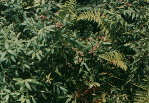
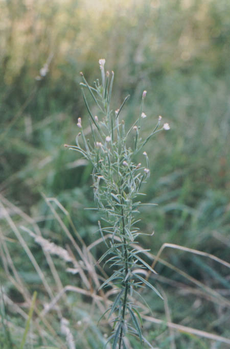
7-19-89 - Buck Run. Vaccinium angustifolium.
7-19-89 - Buck Run. Click to enlarge.
9-1-89 - Bearwallow Run meadow with spruce.
9-1-89 - Slabcamp Run.
8-26-03 - Buck Run.
8-26-03 - Buck Run. Epilobium leptophyllum.
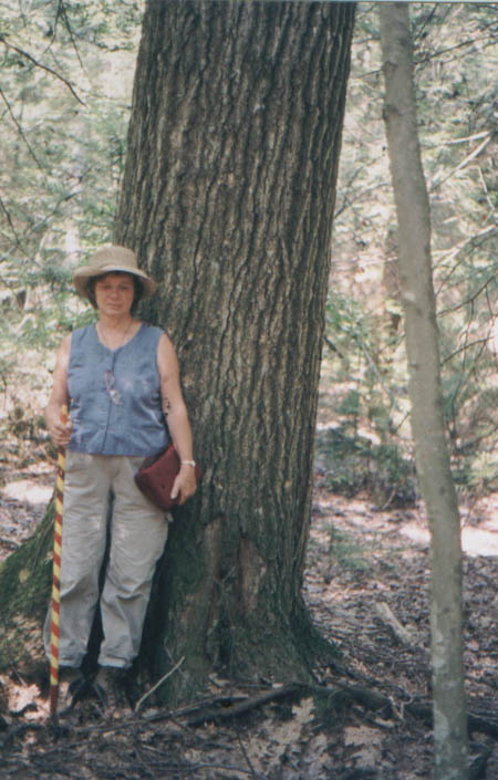
8-26-03 - Locust Springs. Dorothy Simkins and Red Oak.
Reference
Fleming, G.P. and W.H. Moorhead III. (1996) Ecological land units of the Laurel Fork Area, Highland County, VA Natural Heritage Technical Report 96-08. Virginia Dept. of Conservation and Recreation, Div. Of Natural Heritage, Richmond, Va. Unpublished Report submitted to the USDA Forest Service. 114 pp. plus appendices.
Fleming, Gary P. and William H. Moorhead III (2000) Plant Communities and Ecological Land Units of the Peters Mountain Area, James River Ranger District, George Washington and Jefferson National Forests, Virginia. Unpublished Technical report 00-07, Virginia dept. Of Conservation, div. of Natural Heritage. Richmond, Va., 195 pp., plus appendicies.
Harbor, D. J. (1996) Classification and mapping of geomorphology in the Peters Mountain, Laurel Fork and Upper Piney river areas George Washington National Forest. Washington and Lee University, Lexington, Virginia. 25 pp.
Keys, J. E., C. A. Carpenter, S. L. Hooks, F. G. Koenig, W. H. Mc nab, W. E. Russell and M. L. Smith (1995) Ecological units of the eastern united States, First Approximation, USDA Forest Service, Atlanta Ga.
Mueller, R. F. (2000) Stability Relations in Forests. Forests of the Central Appalachians Project, Virginian's for Wilderness Web Site.
Mueller, R. F. (2004) Soil Temperature and Forest Type III. Forests of Central Appalachians Project. Virginians for Wilderness Web Site.
Rader, E. k. and N. H. Evans, editors (1993) Geologic Map of Virginia, Expanded Explanation, Virginia Div. of Mineral Resources, Charlottesville, Va.