General
Mill Hill is a half mile (0.8 km) long, tadpole-shaped hill with a N-S orientation. Elevations range from 1550 to 1850 feet (473 to 564 m) asl. It is cut off from the southwest end of Bolar Mountain by Mill Creek (see our section on Bolar Mountain), and the waters of the Lake Moomaw impoundment abut it on the east. The Hill is along the strike from Blowing Springs (see our section on the latter) and is underlain by the same Upper Silurian/ Lower Devonian lithology (Rader and Evans, 1993) . This lithology is complex and includes shales, which are exposed at the Hill base, limestones and sandstones. It is likely that the latter, as the most erosion resistant type, form the Hill's crest. Of particular interest are calcareous sandstones, in which silica grains are cemented by calcium carbonate, and which may give rise to substrates for plants much like those derived from limestone. Since these rocks are highly deformed the same rock type may appear in different relations to other rock types.
Source Walk: 5-14-01
- Our
inventory traverse began at near 1:00 PM at the Hill's northwest base on a
bordering road. After a short climb to the top of the defining spur, it
extended south along the spur top to the broadened summit. From there it curved
southwest to the bordering road again, and along this road to the point of origin.
The weather was sunny, bright and cool.
After identifying a Parula Warbler (Parula americanus) near the junction with Route 600, we began our ascent of the northwest side of the spur. The forest canopy here consisted or almost pure Canada Hemlock (Tsuga canadensis), with trees mostly in the range of 10 inches (0.25 m) dbh and much defoliated by the Adelgid. Ground flora was sparse, but included Hay-scented Fern (Dennstaedtia punctilobula), Christmas Fern (Polystichum acrostichoides), the forest sedge Carex platyphylla, Spotted Wintergreen (Chimaphila maculata) and the mosses Leucobryum glaucum, Aulocomnium heterostichum and an unidentified Hypnum. Also conspicuous were Deer-browsed sprouts of Black Birch (Betula lenta) .
A soil sample (1) was taken from a depth of 2-3 inches (5-8 cm) under Hemlock on a gentle slope with a west aspect. This sample had an initial pH of 4.3 and 24 hours later one of 4.4. A soil temperature determination (T-60) (1) was also made at the conventional depth of 5 inches (13 cm) . This temperature proved to be quite low at T= 11.0 deg. C. We now began our ascent to the northern part of the spur crest, noting a 9 inch (23 cm) dbh Black Birch and mature Red Maple (Acer rubrum) as minor components of the dominantly Hemlock canopy. The understory consisted almost solely of Flowering Dogwood (Cornus florida), some of which was infected by Anthracnose (Discula destructiva) .
Now, having reached the spur crest, we advanced south along it, noting that the limited exposed rock was indeed sandstone, likely with silica-cemented grains. Soon added to our tally were Tuliptree (Liriodendron tulipifera ), large Northern Red Oak (Quercus rubra), Chestnut Oak (Q. prinus ) and Black Gum (Nyssa sylvatica) which bore on its base the moss Anomodon attenuatus. Here also we heard the song of a Scarlet Tanager (Piranga olivacea) .
Many trees now bore evidence of fire in the form of blackened and scarred bases and were accompanied as well by partially burned dead wood on the forest floor.
Next seen on our ascent along the spur crest were Scarlet Oak (Quercus coccinea) and down wood of the American Chestnut (Castanea dentata) . We also now began to see seedlings of Sugar Maple (Acer saccharum) as well as some identified by R. Hunsucker as those of Black Maple (A. nigrum) . Given the unsuitable habitat for the latter tree on this dry, acidic spur, some skepticism was voiced by this reporter. However the question was soon to be resolved in Dr Hunsucker's favor.
Continuing along the spur, we next saw Sessile-leaved Bellwort (Uvularia sessilifolia), a large Black Locust ( Robinia pseudoacacia), Cancerroot (Conopholis americana), upland Low Blueberry (Vaccinium pallidum), a large Cucumbertree (Magnolia acuminata) ; then Mountain Bellwort (Uvularia pudica), the sedgeCarex pensylvanica , Witch Hazel (Hamamelis virginiana) and a foot (0.3 m) dbh Shagbark Hickory ( Carya ovata) .
Farther along we noted an apparent increase in the number of Black Maple seedlings, then abundant young Hemlock. We now became aware of a much denser ground flora immediately down-slope to the east, perhaps marking an exposed stratum of more nutrient-rich rock there. Here also we began to see, on the forest floor, tunnels of a wood vole, possibly those of the Pine Vole (Pitymys pinetorum) .
Moving onward, we saw isolated clumps of Kentucky Bluegrass (Poa pratensis) and Carex digitalis; then quite abruptly, scattered Wild Comfrey (Cynoglossum virginianum), which is usually an indicator of nutrient-rich soils.
As the spur top now broadened, we saw the first White Oak (Quercus alba), Shagbark Hickory (Carya ovata), a shrub layer of the alien Autumn olive (Elaeagnus umbellata ) with Canada Bluegrass ( Poa compressa ) andCarex rosea in the ground cover.
There was now a relatively sharp transformation in the forest canopy, with Hemlock almost entirely replaced by hardwoods. Also, the ground flora was far denser than under Hemlock. A first appearance was made by May Apple (Podophyllum peltatum) in association with White Snakeroot (Eupatorium rugosum), Whorled Loosestrife (Lysimachia quadrifolia) andCarex amphibola ñ all under White and Black Oak (Quercus velutina), Tuliptree and an unidentified species of Pignut Hickory. Also present were some large and apparently healthy flowering Dogwood.
The soil at this point, on a very gentle north slope, appeared sandy, rich in organic matter and quite moist, but appeared to be a semi-mor. A sample (2), taken from a depth of 2-3 inches, had an initial pH value 4.6, and 24 hours later it was still 4.5. A soil temperature reading at a 5 inch depth (T-61) yielded T=13.5 deg. C.
Now moving over the gently-sloping, greatly broadened summit area, we observed in succession the hawthorn Crataegus macrsperma, Carex hirtifolia, blooming Upright Yellow Wood Sorrel (Oxalis stricta), abundant Wild Comfrey, Nodding fescue (Festuca obtusa), Indian Tobacco (Lobelia inflata), Canada Brome Grass ( Bromus pubescens), a wedge grass (Sphenopholis sp), Scarlet Oak., a fungus of the genus Peziza, Northern Red Oak, the first Black Cohosh (Cimicifuga racemosa) and Clasping- leaved Dogbane (Apocynum sibericum) . These were followed by the forest grass Brachyelytrum erectum, Sweet-scented Bedstraw (Galium triflorum), a 5 inch (0.13 m) dbh sapling of Mockernut Hickory (Carya tomentosa) and a foot (0.3 m) dbh Red Hickory (Carya ovalis) . In association were large, thick grape vines, some of which were Summer Grape ( Vitis aestivalis) .Next seen was the rich-soil indicator Cut-leaf Toothwort (Dentaria laciniata), here with Hog Peanut (Amphicarpa bracteata ), Palmate-leaf Violet (Viola palmata) and Rattlesnake Fern (Botrychium virginianum) . Curiously also, we here found Marsh Blue Violet (Viola cucullata), by any means an indicator of moist growing conditions. We then also began to see Slender-flowered Muhly (Muhlenbergia tenuiflora) and noted that the largest trees were near 20 inches (0.5 m) dbh. A faunal element here was a Spring Peeper (Pseudacris crucifer) among leaves of the forest floor. Following this frog were the forest bluegrass Poa alsodes, Stickseed (Hackelia virginiana), Enchanter's Nightshade (Circaea quadrisulcata), a false buckwheat ( likely Polygonum scandens), Virginia Spring Beauty (Claytonia virginica) in bloom, Nimblewill (Muhlenbergia schreberi), Christmas Fern,Carex laxiflora, Bottlebrush Grass (Elymus hystrix) and Black Walnut (Juglans nigra) with more Spring Beauty at its base. A little up-slope were Carex blanda, abundant Autumn Olive, Black oak, Carex amphibola and Ebony Spleenwort (Asplenium platyneuron) .
We had now reached the highest point of the Hill, where, among a few outcrops of sandstone, stood magnificent White Ash (Fraxinus americana), Pignut Hickory (Carya glabra) and Black Oak (Quercus velutina), with a ground cover that included Indian Turnip (Arisaema triphyllum), Maidenhair Fern (Adiantum pedatum) and Marginal Shield Fern (Dryopteris marginalis) .
Soils here appear to be generally moist. A sample (3) was taken from a 2-3 inch depth at the highest point on a nearly flat aspect. This soil had a low density as a result of a high percentage of organic matter, was moist and almost black in color. However, it contained many small rock fragments. An initial pH value of 5.2 was obtained for this soil, but after 24 hours this had increased to 6.2, perhaps as a result of included carbonate fragments. The soil temperature ( T-62) taken at a 5 inch depth was T=12.5 deg C. Immediately down- slope to the southeast of the highest point we saw a large (20 inch / 0.5 m) dbh multistemmed White Basswood (Tilia heterophylla), Black Oak and Black Maple, with the latter the likely source of the seedlings first identified by R. Hunsucker along the spur to the north. Also present down ñslope were young Tuliptree and a dense ground cover dominated by sedges that includedCarex canoidea, C. digitalis, C laxiflora, C.. communis, C. platyphylla, C. pensylvanica and C. cephalophora. Other species noted on this slope were Redbud (Cercis canadensis), Cleavers (Galium aperine), Carrion Flower (Smilax herbacea), a little Intermediate Shield Fern (Dryopteris intermedia), Smooth Sweet Cicely (Osmorhiza longistylis), Wild Liquorice (Galium circaezans), the grass Brchyelytrum erectum, abundant Black Cohosh and the edible fungus Tricholomopsis platyphylla ("Platterfull") . Both seedlings and saplings, as well as large trees of Black Maple were common. In one case a large Black Maple extended its roots into an ash gray "rotten" sandstone which effervesced to acid, and thus proved to be calcareous. The base of this tree, as well as others, showed evidence of fire in the form of blackening and scarring, and were accompanied by partially burned down wood. It should also be mentioned that the leaves of some Maples here bore resemblances to those of both Sugar and Black Maples.
Somewhat farther down-slope than our survey extended, the Virginia Natural Heritage Program established a test plot (Fleming, 1999), their number FS42. Some additional Species recorded by them in this plot were Slippery Elm ( Ulmus rubra), Bitternut Hickory (Carya cordiformis), Tall Bellflower (Campnula americana), Hackberry (Celtis occidentalis), Twingrass (Diarrhina americana), Virginia Waterleaf (Hydrophyllum virginianum), Spice Bush (Lindera benzoin) and American Gromwell (Lithospermum latifolium) . However they found neither Black Maple, Basswood, Black Walnut nor many of the herbs recorded by us for the upper slope. An analysis of a composite soil sample for this plot was high in calcium and had pH=6.5.
We now began to circle southwest toward the road, successively noting Hispid greenbrier (Smilax hispida), Starry Campion (Silene stellata) and Virginia Creeper (Parthenocissus quinquefolia) . Then among the leaves of the forest floor we saw a small (1 inch/ 2.5 cm), very dark American Toad (Bufo americanus) . Following this were an unidentified Atrichum moss, Carolina Rose (Rosa carolina) and, on a down bole, the edible Oyster Mushroom (Pleurotus ostreatus) .
Now, descending the Hill and passing through a thicket of Autumn Olive that had top-died but was resprouting, we saw large Poke (Phytolacca americana) . This was followed down-slope by a thicket of Black Haw Viburnum (Viburnum prunifolium) . We then once more entered the Hemlock forest, which showed considerable evidence of fire-as in other areas- in the form of blackened and scarred tree bases and partially burned down wood.
As we returned to our point of origin we heard the calls of Pileated (Dryocopus pileatus) and Hairy (Picoides villosus) Woodpeckers.
Additional
mosses from this traverse identified by R. Hunsucker are as follows:
Anomodon
rostratus ñ on bases of hardwoods, rotting down boles
Anomodon
attenuatus ñ on bases of trees, rocks
Campylium
hispidulum ñ on bases of hardwoods
Dicranum fulvum ñ
on rocks
Entodon cladorrhizans ñ on bases of hardwoods, rotting down boles
Eurhynchium hians
ñ on soil in deciduous forest
Fissidens
subbasilaris ñ onbases of hardwoods
Hypnum sp ñ
on rotting down boles, bases of trees
Mnium cuspidatum ñ on rotting down boles, bases of trees
Plagiothecium
laetum ñ on rotting down boles in Hemlock forest
Platygyrium
repens ñ on rotting down boles
The occurrence of Black Maple here exhibits relations to the substrate which are in harmony with its conditions of inferred stability. The close relation between mature trees as well as seedlings and saplings and the calcareous sandstone is compatible with a stability field in the slightly acid to alkaline range as observed elsewhere. The occurrence of its seedlings, likely dispersed down wind, in the Hemlock forest, home to a number of acidiphiles such as Chestnut Oak and blueberries, is an interesting illustration of the phenomenon of the expanded ñ albeit temporary ñ stability field of seedlings relative to that of mature trees (Mueller, 2000) . Of course, the trees which gave rise to the leaves that appear intermediate between Black and Sugar Maples, may also be expected to have expanded fields of occurrence relative to pure members of these species ñ or varieties, as some believe. The stability relations of other species such as Red Maple, Chestnut Oak, White Ash and a number of the herbs should also be kept in mind when interpreting the communities observed here. Finally, the observed relatively moist conditions on the summit of this ridge pose a caution to the blanket application of so-called " moisture indexes ", which automatically attribute low moisture values to ridge tops, and fail to take account of the common intersection of moisture bearing rock units such as porous sandstone or limestone on slopes.
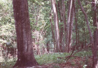
Mill Hill 5-14-01 Colluvial slope.
Note multistemmed Basswood.
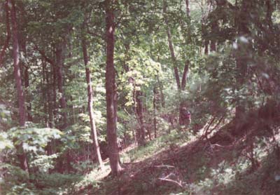
Mill Hill 5-14-01
Colluvial slope.
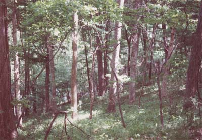
Mill Hill 5-14-01
Colluvial slope.
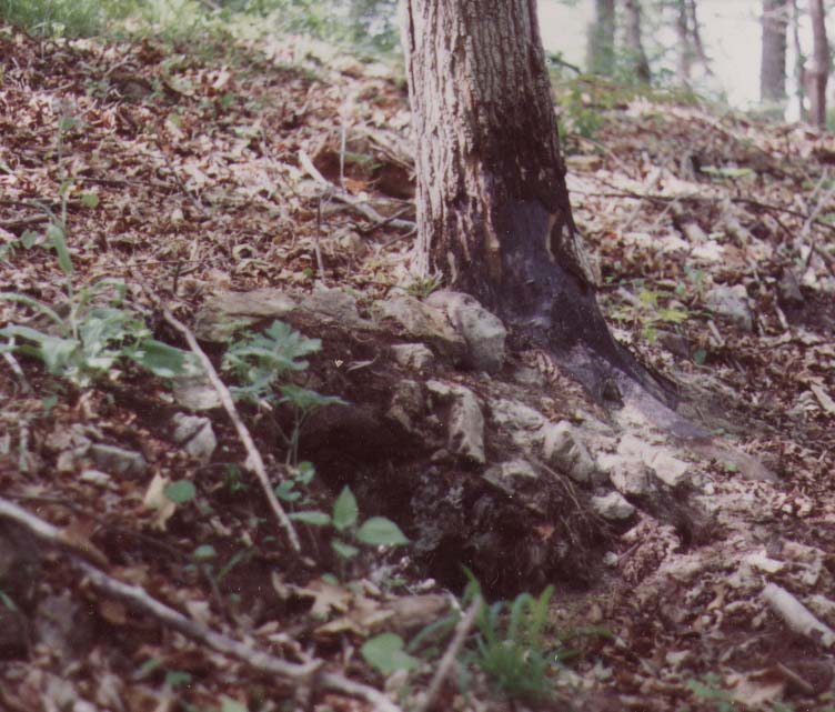
Mill Hill 5-14-01
Black Maple rooted in calcareous sandstone
note fire damage. (Click to enlarge)
Mill Hill and vicinity after Virginia Division of Natural Heritage
Note:
(1) This is the first published soil temperature determination of an extensive study intended to characterize growing conditions and initiate a baseline program in the Central Appalachian Forests.
References
Fleming, Gary P., 1999, Plant Communities of Limestone, Dolomite, and Other Calcareous Substrates in the George Washington and Jefferson National Forests, Virginia .Virginia Natural Heritage Technical Report 99-4. Virginia Dept. of Conservation and Recreation, Div. of Natural Heritage, Richmond, Va.
Mueller, R.F., 2000, Stability Relations in Forests. Forests of the Central Appalachians Project. Virginians for Wilderness Web Site.
Rader, E. K. and N. h. Evans, editors, 1993, Geologic Map of Virginia, Expanded Explanation. Virginia Division of Mineral Resources. Charlottesville, Va.