|
|
|
Hood River
Monday, June 14 2010
location: Timberline Lodge on Mount Hood, Oregon
[REDACTED]
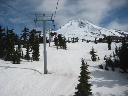
This morning we checked out of our room, Gretchen got me a cup of coffee from the breakfast area (it appeared to be free, though nobody was asking if we'd actually been staying at the lodge), and then we rode the Magic Mile ski lift to a point a thousand feet higher on the mountain. We'd spent the night at about six thousand feet above sea level, and this took us to little over 7000. The slopes were crowded with people, nearly all of them skiing or snow boarding. Some of the skiiers were paraplegics with special equipment. One of these skiers was serious-looking gentleman who appeared to be missing everything beneath his navel. For Gretchen and me, who do not ski, the lift itself was something of a novelty. I'd never been on a ski lift before in my life, and it was a little scary because it doesn't stop. The lift seats come in and seem to detach from the cable they ride on, but they're still moving slowly forward. Then you sit down, the cable re-engages, and zing! You're moving up the mountain. At the other end you have to get off and get out of the way before the next seat shows up. I'm sure this is all incredibly prosaic to an avid skier, but all I could think about was the interactions in the various mechanisms that allowed the seats to slow down on either end of the lift.
If one doesn't have skis, there's not a whole lot to do at the top of the lift. One can stand around and watch the skiers and snow boarders come and go, marveling at the effortlessness with which they move at high speeds even on crowded slopes. Or one can gaze across a murky layer of clouds and denser atmosphere that partially-obscure the terrain below like the surface of a pool. There's not much rising from that surface except Mt. Jefferson to the south (and the Three Sisters beyond). Gretchen asked if we could continue on another set of lifts to the 8540 feet elevation on the Palmer Glacier, but unfortunately only skiers are allowed to do that.
For awhile Gretchen and I sat on a large boulder of lava watching the skiers and a lone raven who had made this his habitat. He'd land on the snow and walk around or do the same on the roof of the lift house, and then he'd soar for a bit overhead. Perhaps occasionally the skiers break out sandwiches and then he can eat the scraps. By this point there were a few other non-skiers who had come up on the lift. They walked around awkwardly like the dateless at a sock hop.
Eventually Gretchen and I decided to try walking further up the mountain despite the fact that we'd have to walk on snow. All I had for footwear was Crocs without socksTM, but these proved perfectly capable as snow shoes. The snow was well-packed and not too slippery despite the balmy temperatures (it was maybe in the 50s, though the sun made it seem warmer), so if I stepped with care I didn't get much snow in my shoe. Occasionally we'd make it to a ridgelike patch of exposed soil, a granola-like material made of crumbled lava spotted here and there with rosettes of various plants. In this way I managed to make it a good quarter to a half mile up the mountain beyond where the ski lift had let us off. Gretchen didn't make it nearly as far, choosing to sit by herself on a remote boulder and looking out over the world instead. Eventually I heard her tiny voice off in the distance telling me we should get going. Coming down the mountain, it was much harder to keep snow out of my shoes. Occasionally I'd have to decelerate my descent on a patch of crumbled lava so I could dump them out.
After returning to Timberline and getting me another cup of coffee, we started driving down the mountain. We'd last bought gas down near Cave Junction, and by this point the digital read out on our Ford Fusion was telling us that we only had about forty miles left of gas in our tank. But what the Ford Fusion didn't know was that we were on top of a very tall mountain. I was able to drive nearly all of the way from Timberline down to the village of Hood River with the car in neutral, using little more gasoline than what it required in order to idle.
Our next destination was the residence of one of Gretchen's friends from high school. Her name was Carrie and she lived in Hood River near the Columbia River. She'd sent Gretchen extremely-detailed directions via email, and we were depending on those directions to find our way. But the email had come via Yahoo Mail, depending on us having left a webpage open on the laptop. But I'd accidentally loaded something else into that tab, and now our directions were lost. Fortunately, though, when we were filling up our tank just outside of Hood River, I managed to find an open WiFi hotspot right there at the gas station. I reloaded the directions and we found our way.
Carrie lived in an orchard, surrounded by beautiful orchard-covered hills. Given the dry air, the bright sun, and the intensely agricultural nature of the vegetation, it was as if she was living in a Cezanne painting. The one thing she had that Cezanne's paintings lack was Mount Hood, an enormous snow-covered peak to the south. Carrie told us that she still hasn't stopped snapping pictures of it.
We sat out in the grass and Gretchen and Carrie mostly talked about the old days and whatever happened to their various classmates. Conversation was kind of dull until Carrie's husband Aaron showed up. The two have been together since high school, and Gretchen remembered him as being extremely shy. These days he's pursuing some sort of University degree, though in the meantime he works for a company that makes tiny brass bookmarks, the kind that cannot be used on an e-reader. Upon hearing that Gretchen works with students inside a prison, he gave her some in a little metal tin. But it's doubtful they'd be allowed through security. As for Carrie, she works over in Washington State at a factory that produces blue-green algæ. They rent their house from the people who own the orchard, and they're good landlords in that they keep themselves scarce.
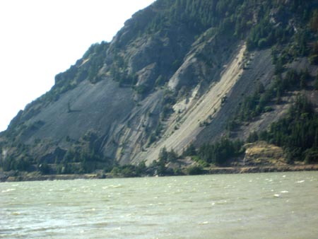
At some point Aaron took the four of us on a drive, first down into the Hood River Gorge (it descends from the north slopes of Mt. Hood), and then into the Columbia Gorge. Every landform is dramatic and beautiful there, a consequence of rivers working their hardest to undo the work of volcanos. By the standards of geologic time, all the rocks and mountains in this region are infants, though the rivers tend to be much older. The Columbia itself has probably flowed in roughly its present location for tens of millions of years. But in that last few million years a line of volcanos has repeatedly tried to arrest its massive flow. Occasionally Mt. Hood or Mt. Adams has been successful in damming up the Columbia, but it doesn't take long for such a dam to be topped by the rising water behind it. And then it's just a matter of time (days or weeks) before the dam collapses and massive wall of water and depris surges out into the Pacific. This has happened many times, and Portland is built on some of that debris. The sides of the Columbia gorge show the remains of these dams. In cross-section they usually appear as steeply-sloping strata whose higher sides point in the directions of the volcanos that created them.
We ended up having a light lunch at a little hippie place in Mosier. We sat outside on the front porch and I drank a 22 ounce Total Domination IPA with my hummus wrap. It was delicious, tasting almost exactly like grapefruit juice (which is how I like my IPAs). At some point I jokingly made a creationist explanation for the landforms I could see from where I was sitting, so Aaron told us about a geology class he'd taken that was taught by a guy who turned out to be a creationist. Despite his wacky ideas, the teacher had actually been a good one.
We continued up the Columbia Gorge a couple miles to a place (45.682693N, 121.299641W) with dramatic overlooks of the terrain, which was reminiscent of Scotland (complete with an unpleasantly relentless chill-inducing wind).
On the way back to Hood River, my bladder couldn't ran out of space for processing that IPA, so we had to pull over at a rest stop. In downtown Hood River, we went into a coffee shop for a little bit of that sort of experience. By this point I'd had entirely too much of Hood River and wanted to hit the road. But I didn't say anything, so we all went down to the banks of the Columbia to watch people kite surf. It amazed us that all those kites could be in the air simultaneously yet nothing was getting tangled.
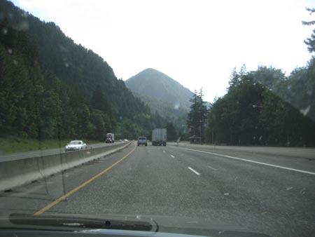
After we left Hood River, we headed west on I-80 to Portland. It's a beautiful drive, with plenty of steep densely-forested landforms on either side of the river. The lowest dam on the Columbia is the Bonneville Dam, which didn't seem all that spectacular as we drove past, though it generates over a gigawatt of power. Further downstream, though, we were tempted onto US Route 30 to see various waterfalls cascading from the relatively-recently-built volcanic highland south of the gorge. There are several waterfalls that drop over a hundred feet, though most of these are little creeks, so the volume isn't impressive. (Some of the streams are nearly completely ærosolized on their way down.) Then there is Multonomah Falls, a cascade large enough to justify a tourist trap. It falls in two cascades, the higher of these being 542 feet and the lower being 69 feet. I find the lushly green beauty around such a waterfall far more compelling than the sterile serenity at a place like Crater Lake. Multonomah as a fairyland of mosses continually nourished by droplets of mist. Appropriately enough, it's accented by an elfin bridge over the pool connecting the two cascades. The only downside is its popularity. We were dressed a little too lightly for the mist-cooled conditions, so we were in a hurry to get in, see the falls, and then get out. In so doing, we had to hustle past the slow-moving throngs and their (generally) oversized posteriors. There were crazy Christians outfitted in 19th Century garb, at least two retarded children, and someone's anorexic girlfriend (equipped with dangerously-pointy shoulder blades).
Once back in Portland, we drove immediately to Gilley's House, and we ended up going out for dinner with her and Alan at the Bye and Bye (our favorite vegan bar and grill).
Looking at Hood's summit from the ski lift.

Looking at Hood's summit from the ski lift, further up.
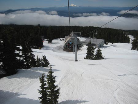
Riding the ski lift upward, looking backwards.
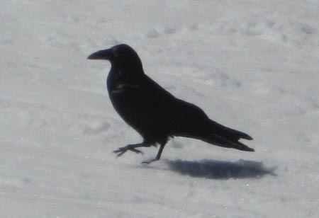
Our friend the raven.
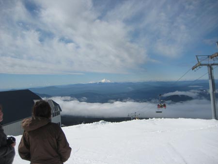
Distant Mt. Jefferson.
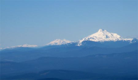
Mount Jefferson (foreground) and the Three Sisters beyond, from high on Mt. Hood.
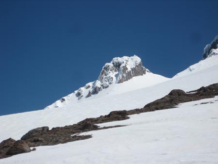
A lesser peak on the soutwest flank of Mt. Hood.
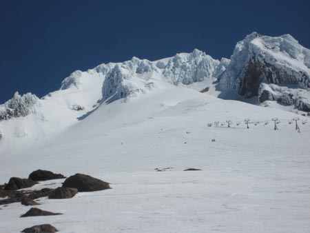
The peak of Mount Hood from as high as I hiked today.
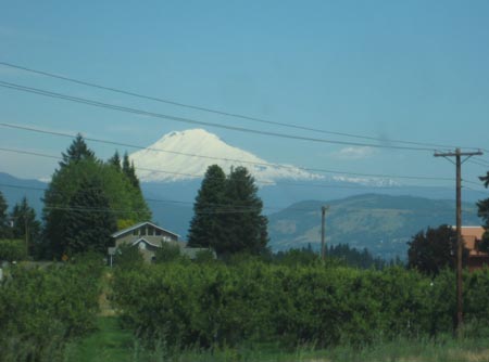
Mt. Adams (in Washington) on the drive into Hood River.
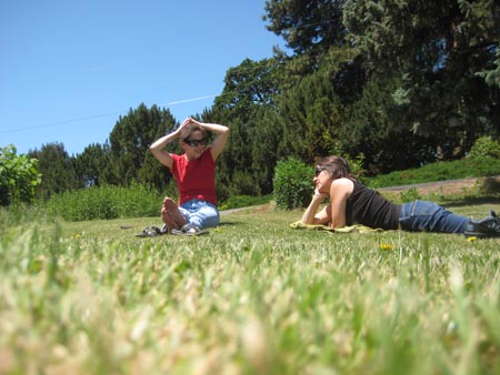
From left: Carrie and Gretchen outside Carrie's house in Hood River.
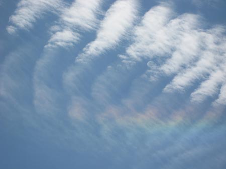
A rainbow in the clouds above Carrie and Aaron's house.
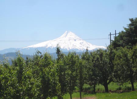
Mt. Hood, viewed from the orchards of Hood River to the north.
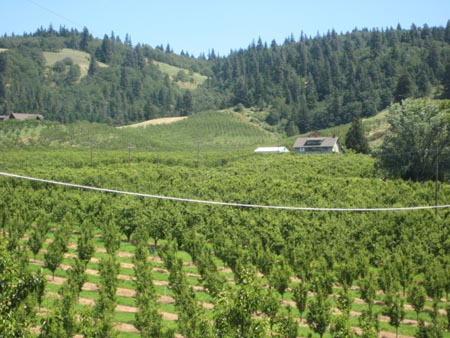
The Cezannesque landscape of the orchards of Hood River.
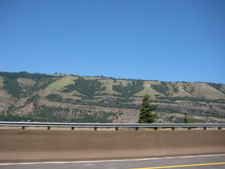
The lava layers on the Washington shore in the Columbia Gorge.
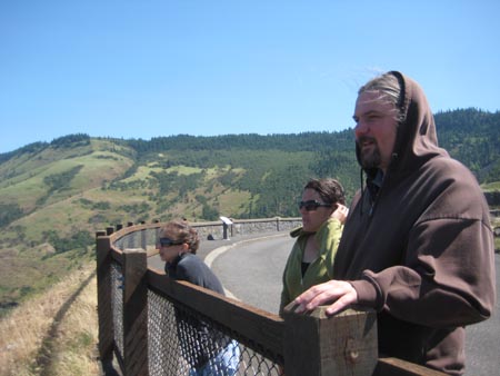
At that pretty but uncomfortably-windy spot. From left: Carrie, Gretchen, and Aaron.
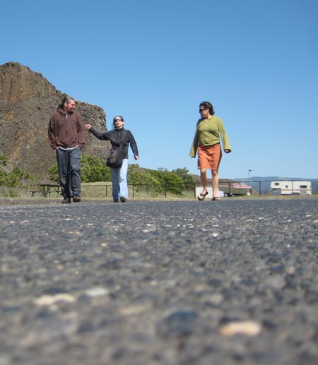
At the rest stop where we stopped on I-80. From left: Aaron, Carrie, Gretchen.
Beautiful landforms along I-80 in the Columbia Gorge east of Portland, Oregon.
Crazy steep volcanic landforms in the Columbia Gorge east of Portland, Oregon.
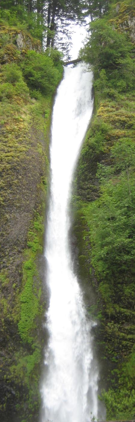
Multonomah Falls.
For linking purposes this article's URL is:
http://asecular.com/blog.php?100614 feedback
previous | next |